Kunashir Island
This article needs additional citations for verification. (December 2018) |
| Disputed island Native name: Ainu: クナシㇼ Other names: Russian: Кунаши́р; Japanese: 国後島 | |
|---|---|
 Cape Stolbchaty on the western side of the island | |
| Geography | |
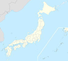
 Location of Kunashir Island 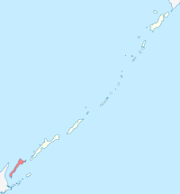 Location of Kunashir Island | |
| Location | Sea of Okhotsk |
| Coordinates | 44°07′N 145°51′E / 44.117°N 145.850°ECoordinates: 44°07′N 145°51′E / 44.117°N 145.850°E |
| Archipelago | Kuril Islands |
| Area | 1,490 square kilometres (580 sq mi) |
| Length | 123 kilometres (76 mi) |
| Width | from 4 kilometres (2.5 mi) to 30 kilometres (19 mi) |
| Highest point |
|
| Administered by | |
| Federal subject | Sakhalin Oblast |
| District | Yuzhno-Kurilsky |
| Claimed by | |
| Prefecture | Hokkaido |
| Subprefecture | Nemuro |
| Demographics | |
| Population | approx. 7000 (as of 2007) |

Kunashir Island (Russian: Кунаши́р, romanized: Kunashír; Japanese: 国後島, romanized: Kunashiri-tō; Ainu: クナシㇼ, romanized: Kuna=sir), possibly meaning Black Island or Grass Island in Ainu, is the southernmost island of the Kuril Islands archipelago. The island is currently under Russian control, though Japan also claims the island (see Kuril Islands dispute).
Geography[]
Kunashir lies between the straits of Kunashir Island, Catherine, Izmena, and South Kuril. Kunashir Island is visible from the nearby Japanese island of Hokkaido, from which it is separated by the Nemuro Strait.
Kunashir Island is formed by four volcanoes which were separate islands but have since joined together by low-lying areas with lakes and hot springs. All these volcanoes are still active: Tyatya (1,819 m (5,968 ft)), Smirnov, Mendeleev (Rausu-yama), and Golovnin (Tomari-yama).[1] The island is made up of volcanic and crystalline rocks.
Environment[]
The climate is humid continental with very heavy precipitation especially in the autumn and a strong seasonal lag with maximum temperatures in August and September. The vegetation mostly consists of spruce, pine, fir, and mixed deciduous forests with lianas and Kuril bamboo underbrush. The mountains are covered with birch and Siberian Dwarf Pine scrub, herbaceous flowers or bare rocks. Tree cores of century-old oaks (Quercus crispula) were found in July 2001 on Kunashiri Island.[2]
Important Bird Area[]
Kunashir, along with the neighbouring Lesser Kuril Chain of smaller islands, has been recognised as an Important Bird Area (IBA) by BirdLife International because they support populations of various threatened bird species, including many waterbirds, seabirds and waders.[3]
History[]
Matsumae Domain established Kunashir fishery and trading site (国後場所,Kunashiri-basho) in 1754.[4] Administration office of the fishery and trading site located in Tomari (now Golovnino). Area of Kunashir fishery and trading site was consisted of Kunashir, Iturup and Urup islands.
In 1789 Kunashir Island was one of the settings of the Menashi-Kunashiri Battle in which Ainu revolted against Japanese tradespeople and colonists.
Russian navigator Vasily Golovnin attempted to map and explore the island in 1811, but was apprehended by Japanese authorities and spent two years in prison.
On September 1, 1945, or one day before the surrender documents of World War II were signed on September 2, 1945, in accordance with decisions made at the Yalta Conference, the Soviet Union acquired the Kuril Islands. This occurred after the Soviet Union renounced the Soviet–Japanese Neutrality Pact in April 1941 and declared war on Japan on August 9, 1945 (formally, the pact itself remained in effect until April 13, 1946). Although Japan agreed after deliberations to cede its claims on the entire island chain including the Northern Territories as part of the Treaty of San Francisco in 1951, the Japanese government has claimed since the 1960s that the southern islands were not part of the ceded Kuril Islands.
Settlements[]
The largest settlement on Kunashir Island is Yuzhno-Kurilsk, administrative center of Yuzhno-Kurilsky District.
Economy[]
The primary economic activity is the fishing industry. The island has a port next to Yuzhno-Kurilsk. Kunashir Island enjoys a Mendeleevskaya GeoPP geothermal power plant with the capacity of 1.8 MW[5]
Transport[]
The island is served by Mendeleyevo Airport.
Population[]
After the 1994 earthquake, about one-third of Kunashir Island's population left and did not return. By 2002, the island's population was approximately 7,800. The total population of the disputed Kuril islands at that time was approximately 17,000.[6]


See also[]
References[]
Notes[]
- ^ Volcanoes
- ^ Jacoby, G.; Solomina, O.; Frank, D.; Eremenko, N.; D'Arrigo, R. (2004). "Kunashir (Kuriles) Oak 400-year reconstruction of temperature and relation to the Pacific Decadal Oscillation". Palaeogeography, Palaeoclimatology, Palaeoecology. 209 (1–4): 303–311. Bibcode:2004PPP...209..303J. doi:10.1016/j.palaeo.2004.02.015.
- ^ "Lesser Kuril Ridge and Kunashir Island". BirdLife Data Zone. BirdLife International. 2021. Retrieved 7 February 2021.
- ^ 戸祭由美夫『絵図に見る幕末の北辺防備:五稜郭と城郭・陣屋・台場』古今書院、2018年、71頁(Tomatsuri Yumio, Japanese Military Architectures around the Coast of Yezo Province in the Nineteenth Century, (Tokyo: Kokon Shoin Publishers Ltd), p.71. ISBN 9784772220248)
- ^ "2007 Survey of Energy Resources" (PDF). World Energy Council 2007. 2007. Archived from the original (PDF) on 9 April 2011. Retrieved 23 January 2011.
- ^ Yuzhno-Kurilsk Journal; Between Russia and Japan, a Pacific Tug of War — The New York Times, 2002
General references[]
- Geographic data at the Wayback Machine (archived December 23, 2010)
- Flights to Kunashir Island banned
External links[]
| Wikimedia Commons has media related to Kunashir Island. |
| show Authority control |
|---|
- Kunashir Island
- Islands of the Kuril Islands
- Islands of the Pacific Ocean
- Islands of the Russian Far East
- Disputed islands
- Japan–Soviet Union relations
- Southern Kuriles
- Important Bird Areas of the Kurile Islands
- Seabird colonies