Léglise
Léglise
Leglijhe (Walloon) | |
|---|---|
 Léglise: the village and its small church | |
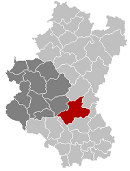
 Léglise Location in Belgium
show Location of Léglise in Luxembourg province | |
| Coordinates: 49°48′N 05°32′E / 49.800°N 5.533°ECoordinates: 49°48′N 05°32′E / 49.800°N 5.533°E | |
| Country | Belgium |
| Community | French Community |
| Region | |
| Province | Luxembourg |
| Arrondissement | Neufchâteau |
| Government | |
| • Mayor | André Lecomte |
| • Governing party/ies | H2000+ |
| Area | |
| • Total | 172.92 km2 (66.76 sq mi) |
| Population (2018-01-01)[1] | |
| • Total | 5,366 |
| • Density | 31/km2 (80/sq mi) |
| Postal codes | 6860 |
| Area codes | 063 |
| Website | www.communeleglise.be |

Léglise(Walloon: Leglijhe) is a municipality of Wallonia, located in the province of Luxembourg, Belgium.
Population[]
On 1 January 2007 the municipality, had 4,178 inhabitants, giving a population density of 24.2 inhabitants per km².
Area[]
The municipality covers 172.92 km².
Sub-Municipalities[]
The municipality consists of the following districts :
Assenois, Ébly, Léglise, Mellier, and Witry.
Other population centers include :
- Behême
- Bernimont
- Bombois
- Burnaimont
- Chêne
- Chevaudos
- Gennevaux
- Habaru
- Lavaux
- Les Fossés
- Louftémont
- Maisoncelle
- Narcimont
- Naleumont
- Nivelet
- Rancimont
- Thibessart
- Traimont
- Vaux-lez-Chêne
- Vlessart
- Volaiville
- Winville
- Witimont
See also[]
References[]
- ^ "Wettelijke Bevolking per gemeente op 1 januari 2018". Statbel. Retrieved 9 March 2019.
External links[]
 Media related to Léglise at Wikimedia Commons
| show Places adjacent to Léglise |
|---|
| show Municipalities of Luxembourg Province, Wallonia |
|---|

| Authority control |
|
|---|
This Belgian Luxembourg location article is a stub. You can help Wikipedia by . |
Categories:
- Léglise
- Municipalities of Luxembourg (Belgium)
- Belgian Luxembourg geography stubs