La Habra, California
La Habra | |
|---|---|
City | |
| City of La Habra | |
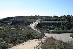 Bridge over Idaho Street | |
 Seal Logo | |
| Motto(s): "A Caring Community"[1] | |
 Location of La Habra in Orange County, California | |
 La Habra Location in the United States | |
| Coordinates: 33°55′55″N 117°56′46″W / 33.93194°N 117.94611°WCoordinates: 33°55′55″N 117°56′46″W / 33.93194°N 117.94611°W | |
| Country | United States |
| State | California |
| County | Orange |
| Incorporated | January 20, 1925[2] |
| Named for | Rancho La Habra |
| Area | |
| • Total | 7.56 sq mi (19.58 km2) |
| • Land | 7.55 sq mi (19.57 km2) |
| • Water | 0.01 sq mi (0.02 km2) 0.08% |
| Elevation | 299 ft (91 m) |
| Population (2010) | |
| • Total | 60,239 |
| • Estimate (2019)[5] | 60,513 |
| • Density | 8,010.72/sq mi (3,092.78/km2) |
| Time zone | UTC-8 (Pacific) |
| • Summer (DST) | UTC-7 (PDT) |
| ZIP codes | 90631–90633 |
| Area code | 562[6] |
| FIPS code | 06-39290 |
| GNIS feature IDs | 1652735, 2411571 |
| Website | www |

La Habra is a city in the northwestern corner of Orange County, California, United States. In the 2010 census, the city had a population of 60,239. A related city, La Habra Heights, is located to the north of La Habra, and is in Los Angeles County.
History[]
Origin of name[]
The name referred to the “Pass Through the Hills,”[7] the natural pass through the hills to the north first discovered and used by Spanish explorers of the Portola expedition on July 30, 1769.
In 1839, when the area was part of Alta California, vast herds of cattle and horses grazed over the hills and valleys of Southern California. Mariano Reyes Roldan was granted 6,698 acres (27 km2) in that year and named his land Rancho Cañada de La Habra. In the 1860s, Abel Stearns purchased Rancho La Habra.
Historical information[]
La Habra was founded in 1896.[8] The first post office in the town was established in 1898 in a corner of Coy's Store at Central (now La Habra Boulevard) and Euclid Street.
The city was incorporated under general law on January 20, 1925, with a population of 3,000. The police force was organized in 1926 and employed a chief, traffic officer and patrolman. By 1928, the city was the largest avocado center in Southern California. In 1930, the first fire department building was constructed followed by the original City Hall in 1935. By 1950, the population reached nearly 5,000. The Civic Center took shape when the existing County Library was dedicated in 1966, followed by the present administration building in 1969.
For more than 70 years, La Habra was known as the city just south of La Habra Heights where the Hass avocado, of the , was planted by Rudolph Hass in the 1920s.[9] The fruit from this tree has since become one of the most popular avocado cultivars worldwide. The Hass Mother Tree succumbed to root rot in 2002.
The La Habra Stakes, run since 1973 at the Santa Anita Park Thoroughbred race track, is named for La Habra. Although La Habra lies within Orange County, the city contracts with the Los Angeles County Fire Department for EMS and fire protection.
Law enforcement is provided by the La Habra Police Department, which in 2008 employed about 70 officers. From 2004 to 2008, they ranked third in the number of officer-involved shootings among twenty Orange County municipal police departments. One case among these, the 2007 death of Michael Cho, resulted in a wrongful death lawsuit against the city which was settled in September 2010 for $250,000.[10][11]
Geography[]
According to the United States Census Bureau, the city has a total area of 7.4 square miles (19 km2), 99.92% of it land and 0.08% of it water.
It is bordered by La Habra Heights on the north, Brea on the east, Fullerton on the south and southeast, La Mirada on the west and southwest and East Whittier on the west, Whittier on the northwest and a small unnamed section of unincorporated Los Angeles County on the northeast.
| show Places adjacent to La Habra, California |
|---|
Climate[]
According to the Köppen Climate Classification system, La Habra has a Hot-summer Mediterranean climate, abbreviated "Csa" on climate maps.[12]
Demographics[]
| Historical population | |||
|---|---|---|---|
| Census | Pop. | %± | |
| 1930 | 2,273 | — | |
| 1940 | 2,499 | 9.9% | |
| 1950 | 4,961 | 98.5% | |
| 1960 | 25,136 | 406.7% | |
| 1970 | 41,350 | 64.5% | |
| 1980 | 45,232 | 9.4% | |
| 1990 | 51,266 | 13.3% | |
| 2000 | 58,974 | 15.0% | |
| 2010 | 60,239 | 2.1% | |
| 2019 (est.) | 60,513 | [5] | 0.5% |
| U.S. Decennial Census[13] | |||
2010[]
At the 2010 census La Habra had a population of 60,239. The population density was 8,166.8 people per square mile (3,153.2/km2). The racial makeup of La Habra was 35,147 (58.3%) White (30.2% Non-Hispanic White),[14] 1,025 (1.7%) African American, 531 (0.9%) Native American, 5,653 (9.4%) Asian, 103 (0.2%) Pacific Islander, 15,224 (25.3%) from other races, and 2,556 (4.2%) from two or more races. Hispanic or Latino of any race were 34,449 persons (57.2%).[15]
The census reported that 59,899 people (99.4% of the population) lived in households, 169 (0.3%) lived in non-institutionalized group quarters, and 171 (0.3%) were institutionalized.
There were 18,977 households, 7,937 (41.8%) had children under the age of 18 living in them, 10,078 (53.1%) were opposite-sex married couples living together, 2,905 (15.3%) had a female householder with no husband present, 1,327 (7.0%) had a male householder with no wife present. There were 1,158 (6.1%) unmarried opposite-sex partnerships, and 119 (0.6%) same-sex married couples or partnerships. 3,651 households (19.2%) were one person and 1,440 (7.6%) had someone living alone who was 65 or older. The average household size was 3.16. There were 14,310 families (75.4% of households); the average family size was 3.58.
The age distribution was 16,062 people (26.7%) under the age of 18, 6,353 people (10.5%) aged 18 to 24, 17,349 people (28.8%) aged 25 to 44, 13,926 people (23.1%) aged 45 to 64, and 6,549 people (10.9%) who were 65 or older. The median age was 33.6 years. For every 100 females, there were 97.0 males. For every 100 females age 18 and over, there were 94.0 males.
There were 19,924 housing units at an average density of 2,701.2 per square mile, of the occupied units 10,941 (57.7%) were owner-occupied and 8,036 (42.3%) were rented. The homeowner vacancy rate was 1.5%; the rental vacancy rate was 6.2%. 33,609 people (55.8% of the population) lived in owner-occupied housing units and 26,290 people (43.6%) lived in rental housing units.
According to the 2010 United States Census, La Habra had a median household income of $60,954, with 14.0% of the population living below the federal poverty line.[14]
2000[]
At the 2000 census there were 58,974 people in 18,947 households, including 14,020 families, in the city. The population density was 8,045.8 inhabitants per square mile (3,106.4/km2). There were 19,441 housing units at an average density of 2,652.3 per square mile (1,024.0/km2). The racial makeup of the city was 41.40% White, 1.40% Black or African American, 0.96% Native American, 6.00% Asian, 0.22% Pacific Islander, 2.20% from other races, and 4.67% from two or more races. 49.00% of the population were Hispanic or Latino of any race.[16] There are 19,042 households, 39.3% had children under the age of 18 living with them, 54.5% were married couples living together, 13.5% had a female householder with no husband present, and 26.0% were non-families. 21.0% of households were one person and 8.0% were one person aged 65 or older. The average household size was 3.08 and the average family size was 3.56.
The age distribution was 29.1% under the age of 18, 10.3% from 18 to 24, 31.7% from 25 to 44, 18.2% from 45 to 64, and 10.8% 65 or older. The median age was 31 years. For every 100 females, there were 97.1 males. For every 100 females age 18 and over, there were 94.7 males.
The median household income was $47,652 and the median family income was $51,971. Males had a median income of $36,813 versus $30,466 for females. The per capita income for the city was $18,923. About 19.1% of families and 22.9% of the population were below the poverty line.
Economy[]
Top employers[]
According to the city's 2009 Comprehensive Annual Financial Report,[17] the top employers in the city are:
| # | Employer | # of employees |
|---|---|---|
| 1 | CVS/pharmacy | 1,056 |
| 2 | Wal-Mart | 492 |
| 3 | City of La Habra | 435 |
| 4 | Target | 254 |
| 5 | Costco | 249 |
| 6 | La Habra Bakery | 242 |
| 7 | Kohl's | 150 |
| 8 | The Home Depot | 140 |
| 9 | La Habra Convalescent Hospital | 140 |
| 10 | Lowe's | 129 |
| 11 | VIP Rubber | 118 |
Retail[]
The site of the former La Habra Fashion Square is now a retail power center, La Habra Market Place.[citation needed] Since 1962 Whittier Boulevard has been home to the second El Cholo Spanish Cafe.[18]
Government[]
La Habra's mayor is rotated among current city council members. The current Mayor is Rose Espinoza as of 2021.[19] Current council members include Tim Shaw, Jose Medrano, James Gomez, and Steve Simonian. Though he has previously served as mayor several times, Gomez is often mistaken as the incumbent mayor of La Habra because of his nickname "Mr. La Habra" and community fame.
In the California State Legislature, La Habra is in the 29th Senate District, represented by Democrat Josh Newman, and in the 55th Assembly District, represented by Republican Phillip Chen.[20]
In the United States House of Representatives, La Habra is in California's 39th congressional district, which has a Cook PVI of EVEN[21] and is currently represented by Republican Young Kim.[22]
Politics[]
According to the California Secretary of State, as of October 22, 2018, La Habra has 27,439 registered voters. Of those, 10,369 (37.79%) were registered Democrats, 8,745 (31.87%) were registered Republicans, and 7,150 (26.06%) have declined to state a political party/are independents.[23]
| Year | Democratic | Republican | Third Parties |
|---|---|---|---|
| 2020[24] | 56.33% 15,409 | 41.47% 11,343 | 2.20% 602 |
| 2016[25] | 53.40% 10,865 | 39.56% 8,048 | 7.04% 1,433 |
| 2012[26] | 49.43% 9,149 | 48.23% 8,926 | 2.34% 433 |
| 2008[27] | 49.38% 9,503 | 48.60% 9,353 | 2.02% 389 |
| 2004[28] | 41.10% 7,254 | 57.81% 10,204 | 1.09% 193 |
| 2000[29] | 43.25% 7,312 | 53.03% 8,964 | 3.72% 629 |
| 1996[30] | 40.30% 6,284 | 49.08% 7,654 | 10.63% 1,657 |
| 1992[31] | 33.25% 6,178 | 43.78% 8,135 | 22.98% 4,270 |
| 1988[32] | 33.17% 5,664 | 65.86% 11,247 | 0.97% 165 |
| 1984[33] | 25.54% 4,594 | 73.56% 13,232 | 0.90% 161 |
| 1980[34] | 25.38% 4,357 | 66.41% 11,399 | 8.21% 1,409 |
| 1976[35] | 37.83% 5,959 | 60.79% 9,575 | 1.38% 218 |
Education[]
The city of La Habra is mainly served by the La Habra City School District for elementary and middle school students and the Fullerton Joint Union High School District for high school students, but portions of La Habra are also redirected to other school districts closer to homes of some residents.
Public schools:
- La Habra City School District
- Brea Olinda Unified School District
- Fullerton School District
- Lowell Joint School District
- Fullerton Joint Union High School District
- Sonora High School
- La Habra High School
Private schools:
- Whittier Christian High School
Transportation[]
Though La Habra has no freeways, three California State Highways SR 39 (covers Whittier and Beach Boulevards), SR 90 (Imperial Highway), and SR 72 (Whittier Boulevard) serve the city. The four major thoroughfares include Whittier Boulevard, Beach Boulevard, Imperial Highway, and Harbor Boulevard. Idaho Street, Euclid Street, and Palm Street are local north–south arterials and La Habra Boulevard and Lambert Road are local west–east arterials.
Notable people[]
This article needs additional citations for verification. (January 2015) |
- Rusty Anderson - guitarist, singer, songwriter and music producer; born and raised in La Habra.
- Librado Andrade - Mexican boxer in the Super Middleweight division and older brother of Enrique; raised in La Habra
- Brent Boyd - graduate of Lowell HS 1975, Rancho Canada Jr High, Olita Elementary- played football and Honors grad UCLA, Minnesota Vikings 1980–86, considered to be the "father of concussion awareness" due to three US Congressional hearing and placing issue in media. Founder of DIGNITY AFTER FOOTBALL
- Boyd Coddington - Famous Hot Rod builder
- Cathy Cooper - Stylist, artist, model
- Jack Cooper - composer, arranger, woodwind player
- Jeanette Dimech - Spanish singer
- Jesse Sandoval Flores - Major League Baseball Pitcher (1942–50). Played for the Chicago Cubs, Philadelphia Athletics, and the Cleveland Indians.
- The Funeral Pyre - Blackened death metal band
- Greg Gaines- Football player
- Natalie Golda - Water polo player, Olympian
- Jennifer Hanson - Country music singer
- Jenna Haze - Adult film actress
- Ronnie Hillman - NFL running back
- William Hodgman - lawyer and prosecutor known for his work in the O. J. Simpson murder case
- Mark Kostabi - Modern artist and composer
- John N. Lotz - Air National Guard Brigadier general
- Ann Meyers - Basketball player, Olympian. First player to be part of the U.S. National team while still in high school.
- Dave Meyers - Basketball player, 2x NCAA Champion teams at UCLA, playing for Milwaukee Bucks 1975-1980
- Margarita McCoy - urban planner
- Alan Newman - Major League Baseball Player
- Richard Nixon - American president; opened a law office in La Habra in 1938[36]
- Enrique Ornelas - Mexican boxer in the Middleweight division and younger brother of Librado; raised in La Habra.
- Anne Ramsay - Actress
- Cruz Reynoso - First Latino Justice on California Supreme Court
- Nadya Suleman - Mother of the longest living octuplets, also known as the "Octomom"
- Diane Wakoski - Poet and essayist. Winner of the prestigious William Carlos Williams award for her book Emerald Ice
- Jonwayne - Rapper and producer, previously signed to Stones Throw Records, more recently releasing music via his Authors Recording Company imprint
- Zebrahead - Punk rock/pop punk band
- Norma Zimmer - Honorary Mayor of the City of La Habra in 1975 and featured singer and "Champagne Lady" of the Lawrence Welk Show.
- Josh Staumont Professional Baseball Pitcher for the Kansas City Royals
References[]
- ^ "City of La Habra California". City of La Habra California. Archived from the original on January 27, 2010. Retrieved September 12, 2012.
- ^ "California Cities by Incorporation Date". California Association of Local Agency Formation Commissions. Archived from the original (Word) on November 3, 2014. Retrieved August 25, 2014.
- ^ "2019 U.S. Gazetteer Files". United States Census Bureau. Retrieved July 1, 2020.
- ^ "La Habra". Geographic Names Information System. United States Geological Survey. Retrieved November 5, 2014.
- ^ Jump up to: a b "Population and Housing Unit Estimates". United States Census Bureau. May 24, 2020. Retrieved May 27, 2020.
- ^ "NPA City Report". North American Numbering Plan Administration. Archived from the original on November 4, 2014. Retrieved November 5, 2014.
- ^ "Profile for La Habra, California, CA". ePodunk. Archived from the original on January 31, 2013. Retrieved September 12, 2012.
- ^ Haire, Chris (August 31, 2013). "Blurred Boundary". The Orange County Register. p. News 35.
- ^ "The Hass Mother Tree: 1926–2002". Irvine, CA: California Avocado Society. 2008. pp. "Mother Hass Tree" section. Archived from the original on May 13, 2008. Retrieved September 27, 2008.
- ^ Kim, Kenneth; Kim, Sangjin (February 24, 2008), "Gone in 41 Seconds — Police Quick to Kill Korean Artist", New America Media, archived from the original on May 25, 2011, retrieved February 26, 2008
- ^ Ponsi, Lou (September 15, 2010), "Lawsuit in deadly La Habra police shooting is settled", The Orange Country Register, archived from the original on July 7, 2012, retrieved May 8, 2011
- ^ "La Habra, California Köppen Climate Classification (Weatherbase)". Weatherbase.
- ^ "Census of Population and Housing". Census.gov. Retrieved June 4, 2015.
- ^ Jump up to: a b "{title}". Archived from the original on November 20, 2013. Retrieved December 16, 2013.
- ^ "2010 Census Interactive Population Search: CA - La Habra city". U.S. Census Bureau. Archived from the original on July 15, 2014. Retrieved July 12, 2014.
- ^ "U.S. Census website". United States Census Bureau. Retrieved January 31, 2008.
- ^ "City of La Habra CAFR" (PDF). Archived from the original (PDF) on July 18, 2011.
- ^ "60s: Adapting". El Cholo Restaurant.
- ^ "City Council". City of La Habra, California. Retrieved April 5, 2021.
- ^ "Statewide Database". UC Regents. Archived from the original on February 1, 2015. Retrieved January 18, 2015.
- ^ "Partisan Voting Index: Districts of the 113th Congress" (PDF). The Cook Political Report. Retrieved January 18, 2015.
- ^ "California's 39th Congressional District - Representatives & District Map". Civic Impulse, LLC.
- ^ "CA Secretary of State – Report of Registration – October 22, 2018" (PDF). ca.gov. Retrieved February 16, 2019.
- ^ "Votes cast" (PDF). www.ocvote.com. Retrieved January 18, 2021.
- ^ "Election data" (PDF). www.ocvote.com. Retrieved August 10, 2020.
- ^ "Election data" (PDF). www.ocvote.com. Retrieved August 10, 2020.
- ^ "Election data" (PDF). www.ocvote.com. Retrieved August 10, 2020.
- ^ "Election data" (PDF). www.ocvote.com. Retrieved August 10, 2020.
- ^ "Election data" (PDF). www.ocvote.com. Retrieved August 10, 2020.
- ^ "Statement of vote : California. Secretary of State : Free Download, Borrow, and Streaming". Internet Archive.
- ^ "Statement of vote : California. Secretary of State : Free Download, Borrow, and Streaming". Internet Archive.
- ^ Statement of the Vote. Sacramento, Calif. : The Secretary. 1968.
- ^ Statement of the Vote. Sacramento, Calif. : The Secretary. 1968.
- ^ Statement of the Vote. Sacramento, Calif. : The Secretary. 1968.
- ^ Statement of the Vote. Sacramento, Calif. : The Secretary. 1968.
- ^ Black, Conrad (2007). Richard M. Nixon: A Life in Full. New York: PublicAffairs Books. p. 44. ISBN 978-1-58648-519-1.
External links[]
| Wikimedia Commons has media related to La Habra, California. |
| show Municipalities and communities of Orange County, California, United States |
|---|

| show Greater Los Angeles Area |
|---|

| show |
|---|

| show Authority control |
|---|
- La Habra, California
- Cities in Orange County, California
- Incorporated cities and towns in California
- Populated places established in 1898
- 1898 establishments in California