Labbé Point
 Location of Greenwich Island in the South Shetland Islands | |
 Labbé Point Location of Labbé Point | |
| Geography | |
|---|---|
| Location | Antarctica |
| Coordinates | 62°29′49.5″S 59°43′52.3″W / 62.497083°S 59.731194°WCoordinates: 62°29′49.5″S 59°43′52.3″W / 62.497083°S 59.731194°W |
| Archipelago | South Shetland Islands |
| Length | 0.6 km (0.37 mi) |
| Administration | |
| Administered under the Antarctic Treaty System | |
| Demographics | |
| Population | Uninhabited |


Labbé Point is a point projecting 600 m (660 yd) into the southwest part of Discovery Bay from Parvomay Neck, Greenwich Island in the South Shetland Islands, Antarctica with an adjacent ice-free area of 11 hectares (27 acres).[1] The point forms the northwest side of the entrance to Basullo Cove and the east side of the entrance to Vinett Cove (62°29′42″S 59°44′55″W / 62.49500°S 59.74861°W). The small Basso Island (62°29′38.9″S 59°44′02″W / 62.494139°S 59.73389°W) is linked by a mainly submerged spit to the north side of Labbé Point.
The features were charted and named by the 1947 Chilean Antarctic Expedition after members of the expedition: Lieutenant Custodio Labbé, navigation officer of the transport ship Angamos; Vinett, the boatswain of the expedition; and Juan Basso, chief storekeeper on the frigate Iquique.
Location[]
The point is located at 62°29′49.5″S 59°43′52.3″W / 62.497083°S 59.731194°W which is 5.08 km (3.16 mi) southwest of Ash Point, 1.79 km (1.11 mi) west by north of Ferrer Point, 1.3 km (0.81 mi) east-southeast of Riquelme Point, 3 km (1.9 mi) south-southeast of Ortiz Point and 5.97 km (3.71 mi) south of Spark Point (Chilean mapping in 1951, British in 1968, and Bulgarian in 2005 and 2009).
Maps[]
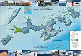
- L.L. Ivanov et al. Antarctica: Livingston Island and Greenwich Island, South Shetland Islands. Scale 1:100000 topographic map. Sofia: Antarctic Place-names Commission of Bulgaria, 2005.
See also[]
- Composite Antarctic Gazetteer
- List of Antarctic islands south of 60° S
- SCAR
- Territorial claims in Antarctica
References[]
- ^ L.L. Ivanov. Antarctica: Livingston Island and Greenwich, Robert, Snow and Smith Islands. Scale 1:120000 topographic map. Troyan: Manfred Wörner Foundation, 2009. ISBN 978-954-92032-6-4
External links[]
Antarctica | ||
|---|---|---|
| General |
|  |
| Regions |
| |
| Waterways |
| |
| Famous explorers |
| |
This Greenwich Island location article is a stub. You can help Wikipedia by . |
- Headlands of Greenwich Island
- Greenwich Island geography stubs