Libertyville Township, Lake County, Illinois
Libertyville Township | |
|---|---|
 Location in Lake County | |
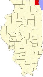 Lake County's location in Illinois | |
| Coordinates: 42°17′03″N 87°56′42″W / 42.28417°N 87.94500°WCoordinates: 42°17′03″N 87°56′42″W / 42.28417°N 87.94500°W | |
| Country | United States |
| State | Illinois |
| County | Lake |
| Established | November 6, 1849 |
| Government | |
| • Supervisor | Kathleen M. O'Connor |
| Area | |
| • Total | 36.5 sq mi (94.6 km2) |
| • Land | 35.4 sq mi (91.7 km2) |
| • Water | 1.1 sq mi (2.9 km2) |
| Elevation | 659 ft (201 m) |
| Population (2010) | |
| • Estimate (2016)[1] | 53,803 |
| Time zone | UTC-6 (CST) |
| • Summer (DST) | UTC-5 (CDT) |
| FIPS code | 17-097-43263 |
| Website | www |

Libertyville Township is a township in Lake County, Illinois, USA. As of the 2010 census, its population was 53,139.[2] The village of Libertyville is part of the township, as are parts of Green Oaks, Lake Bluff, Lake Forest, Mettawa, Mundelein, North Chicago, Rondout, Vernon Hills and Waukegan.
Geography[]
Libertyville Township covers an area of 36.5 square miles (94.6 km2); of this, 1.1 square miles (2.9 km2) or 3.02 percent is water.[2] Lakes in this township include Big Bear Lake,[3] Butler Lake,[4] Harvey Lake, Liberty Lake, Little Bear Lake,[5] Minear Lake and West Lake. The stream of Bull Creek runs through this township, before depositing into the Des Plaines River.[6]
Open space[]
In 1985, Libertyville Township established the first Township Open Space District in Illinois. This innovative land protection program was funded by a 22.6 million-dollar bond referendum approved by the residents of Libertyville Township. The Open Space Bond was retired fully paid in October 2003. Since land acquisition began in 1986, over 1,500 acres (6.1 km2) of irreplaceable open space have been protected with these funds. Two of these sites, Oak Openings and Liberty Prairie, have also received the state's highest protection status as Illinois Nature Preserves.
Cities and towns[]
- Green Oaks
- Lake Forest (western edge)
- Libertyville
- Mettawa (northwest portion)
- Mundelein (eastern edge)
- North Chicago (western edge)
- Vernon Hills (northern half)
- Waukegan (western edge)
Unincorporated towns[]
Adjacent townships[]
- Warren Township (north)
- Waukegan Township (northeast)
- Shields Township (east)
- West Deerfield Township (southeast)
- Vernon Township (south)
- Ela Township (southwest)
- Fremont Township (west)
- Avon Township (northwest)
Cemeteries[]
The township contains four cemeteries: Ascension,[7] Lake County Poor Farm, Lakeside[8] and the Serbian Monastery Cemetery.[9][10]
Major highways[]
- Interstate 94
- U.S. Route 45
- Illinois State Route 21
- Illinois State Route 43
- Illinois State Route 60
- Illinois State Route 137
- Illinois State Route 176
Airports and landing strips[]
- Condell Memorial Hospital Heliport
Demographics[]
| Historical population | |||
|---|---|---|---|
| Census | Pop. | %± | |
| 2016 (est.) | 53,803 | [1] | |
| U.S. Decennial Census[11] | |||
Notable people[]
- Phil Collins, presidential nominee of the Prohibition Party
References[]
- ^ a b "Population and Housing Unit Estimates". Retrieved June 9, 2017.
- ^ a b "Geographic Identifiers: 2010 Demographic Profile Data (G001): Libertyville township, Lake County, Illinois". U.S. Census Bureau, American Factfinder. Archived from the original on February 12, 2020. Retrieved December 19, 2012.
- ^ "2012 Big and Little Bear Lake Summary Report".
{{cite web}}: CS1 maint: url-status (link) - ^ "2015 Butler Lake Summary Report".
{{cite web}}: CS1 maint: url-status (link) - ^ "2012 Big and Little Bear Lake Summary Report".
{{cite web}}: CS1 maint: url-status (link) - ^ "Bull Creek | Lake County, IL". www.lakecountyil.gov. Retrieved 2021-02-10.
- ^ "Cemetery Location Details". www.catholiccemeterieschicago.org. Retrieved 2021-02-10.
- ^ "Lakeside Cemetery Association – Libertyville, Illinois". Retrieved 2021-02-10.
- ^ "The Cemetery". Saint Sava Monastery.
{{cite web}}: CS1 maint: url-status (link) - ^ "About". Saint Sava Monastery.
{{cite web}}: CS1 maint: url-status (link) - ^ "Census of Population and Housing". Census.gov. Retrieved June 4, 2016.
External links[]
- Libertyville Township official website
- US-Counties.com
- City-Data.com
- US Census
- Illinois State Archives
Municipalities and communities of Lake County, Illinois, United States | ||
|---|---|---|
| Cities | ||
| Villages |
| |
| Townships | ||
| CDPs | ||
| Other unincorporated communities | ||
| Former settlements | ||
| Footnotes | ‡This populated place also has portions in an adjacent county or counties | |
| ||
- Townships in Lake County, Illinois
- Townships in Illinois