Shields Township, Lake County, Illinois
Shields Township | |
|---|---|
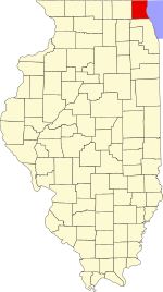
 Location in Lake County | |
 Lake County's location in Illinois | |
| Coordinates: 42°16′44″N 87°51′21″W / 42.27889°N 87.85583°WCoordinates: 42°16′44″N 87°51′21″W / 42.27889°N 87.85583°W | |
| Country | United States |
| State | Illinois |
| County | Lake |
| Established | November 6, 1849 |
| Government | |
| • Supervisor | Gayle Stringer |
| Area | |
| • Total | 17.69 sq mi (45.82 km2) |
| • Land | 17.68 sq mi (45.79 km2) |
| • Water | 0.01 sq mi (0.03 km2) |
| Elevation | 709 ft (216 m) |
| Population (2010) | |
| • Estimate (2016)[1] | 36,612 |
| Time zone | UTC-6 (CST) |
| • Summer (DST) | UTC-5 (CDT) |
| FIPS code | 17-097-69485 |
| Website | www |

Shields Township is a township in Lake County, Illinois, USA. As of the 2010 census, its population was 39,062.[2] The Naval Station Great Lakes is located in this township.
Geography[]
Shields Township covers an area of 17.7 square miles (45.8 km2).[2]
Cities and towns[]
- Lake Bluff
- Lake Forest (north half)
- North Chicago (Great Lakes Naval Base)
Adjacent townships[]
- Waukegan Township (north)
- Moraine Township (southeast)
- West Deerfield Township (south)
- Vernon Township (southwest)
- Libertyville Township (west)
- Warren Township (northwest)
Cemeteries[]
The township contains two cemeteries: Lake Forest and Saint Marys.
Major highways[]
- U.S. Route 41
- Illinois State Route 43
- Illinois State Route 60
- Illinois State Route 131
- Illinois State Route 137
- Illinois State Route 176
Airports and landing strips[]
- Lake Forest Hospital Heliport
Railroad lines[]
- Union Pacific/North Line
Demographics[]
| Historical population | |||
|---|---|---|---|
| Census | Pop. | %± | |
| 2016 (est.) | 36,612 | [1] | |
| U.S. Decennial Census[3] | |||
References[]
- ^ a b "Population and Housing Unit Estimates". Retrieved June 9, 2017.
- ^ a b "Geographic Identifiers: 2010 Demographic Profile Data (G001): Shields township, Lake County, Illinois". U.S. Census Bureau, American Factfinder. Archived from the original on February 12, 2020. Retrieved December 19, 2012.
- ^ "Census of Population and Housing". Census.gov. Retrieved June 4, 2016.
External links[]
Municipalities and communities of Lake County, Illinois, United States | ||
|---|---|---|
| Cities | ||
| Villages |
| |
| Townships | ||
| CDPs | ||
| Other unincorporated communities | ||
| Former settlements | ||
| Footnotes | ‡This populated place also has portions in an adjacent county or counties | |
| ||
Categories:
- Townships in Lake County, Illinois
- Townships in Illinois