Wauconda, Illinois
This article needs additional citations for verification. (June 2016) |
Wauconda, Illinois | |
|---|---|
 Wauconda Area Library | |
| Motto(s): "Water. Spirit. Wonder." | |
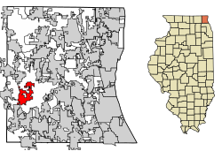 Location of Wauconda in Lake County, Illinois. | |
 Location of Illinois in the United States | |
| Coordinates: 42°16′1″N 88°8′34″W / 42.26694°N 88.14278°WCoordinates: 42°16′1″N 88°8′34″W / 42.26694°N 88.14278°W | |
| Country | United States |
| State | Illinois |
| County | Lake |
| Government | |
| • Mayor | Lincoln F. Knight[1] |
| Area | |
| • Total | 5.76 sq mi (14.93 km2) |
| • Land | 5.07 sq mi (13.14 km2) |
| • Water | 0.69 sq mi (1.79 km2) |
| Population (2010) | |
| • Total | 13,603 |
| • Estimate (2019)[3] | 13,504 |
| • Density | 2,662.46/sq mi (1,027.93/km2) |
| Time zone | UTC-6 (CST) |
| • Summer (DST) | UTC-5 (CDT) |
| ZIP Code(s) | 60084 |
| Area code(s) | 847 and 224 |
| FIPS code | 17-79267 |
| Wikimedia Commons | Wauconda, Illinois |
| Website | wauconda-il |

Wauconda (/ˌwɔːˈkɒndə/ or /wəˈkɒndə/) is a village in Lake County, Illinois, United States. The population was 13,603 at the 2010 census.[4] It is the site of the Wauconda Bog Nature Preserve, a National Natural Landmark. Wauconda Community Unit School District 118 serves students from kindergarten through 12th grade who live in Wauconda and surrounding communities (Island Lake, Lakemoor, Volo, and unincorporated sections of McHenry County). Fremont School District 79 also serves students from communities from northern part of Wauconda.
Government[]
Wauconda's local government consists of a Mayor, Clerk, and six-member Board of Trustees who are elected to four-year overlapping terms of office. Village Board meetings are held on the first and third Tuesday of the month. Committee of the Whole meetings are held the second, fourth and sometimes fifth Tuesday of the month.
The Village Administrator oversees all village departments and serves as a liaison between the village residents and the Board. The Administrator supervises the daily operations of the village with the assistance of staff, including the Chief of Police and the directors of Public Works, Finance, Human Resources/Risk Management, Information Technology, Environmental Quality, Building and Zoning, and Economic Development.
Fire/Rescue is provided by the Wauconda Fire Protection District, an independent taxing body covering the entire Village and all or parts of nine different communities including unincorporated areas of Lake and McHenry Counties.
There is a library on Main Street, called Wauconda Area Library, which serves the village.
History[]
According to local legend, Wauconda was supposedly named after an indigenous chief whose name translated to "spirit water".
“Waconda,” it says in the Otoe language, Great Mystery, meaning that vital thing or phenomenon in life that cannot ever be entirely comprehensible to us. What is understood though, through the spoken word, is that silence is also Waconda, as is the universe and everything that exists, tangible and intangible, because none of these things are separate from that life force. It is all Waconda. . . .” [Anna Lee Walters, Talking Indian: Reflections on Survival and Writing (Ithaca, N.Y.: Firebrand Books, 1992), 19–20.]
Many indigenous people had already been victims to the ongoing genocide that began the moment Columbus arrived. Those who survived the genocide, were forcefully pushed out of their homes to the west or to northern states. Many early “settlers” of Wauconda came from New England and New York by covered wagon or through the Erie Canal and the Great Lakes.[5]
Elihu Hubbard built the first log cabin on the bank of Bangs Lake in 1836. Justus Bangs, the first settler in Wauconda, built a house next to the lake in 1848 and the lake was later named after him. In 1840, members of the Winnebago tribe who did not leave the shores of the Fox River often went to the area to trade. In 1849, Wauconda was formally organized and the first town meeting was held in April 1850 on the first Tuesday.[5]
Wauconda's first school was built in 1839 and the area's post office was moved to Wauconda on June 27, 1849, with Hazard Green becoming its first postmaster.[5]
Elder Joel Wheeler of McHenry built the first Baptist church in Wauconda in the autumn of 1838. A Methodist church was organized on September 3, 1852 by Reverend C. French, and built in 1856 on the Commons. Both Methodists and Baptists attended prayer at the church until February 1870, when the Baptists reorganized and built a new church on October 30, 1870. A Roman Catholic church was built in 1877 and its first trustees were James Murray, Charles Davlin, Felix Givens, Hugh Davlin, and Owen McMahon. Its first priest was Father O'Neil.[5]
In 1850, Wauconda had a population of around 200 residents, and the town had three goods stores, two public houses and various mechanics.[5]
Geography[]
Wauconda is located at 42°16′1″N 88°8′34″W / 42.26694°N 88.14278°W (42.266910, -88.142657).[6]
According to the 2010 census, Wauconda has a total area of 5.732 square miles (14.85 km2), of which 5.05 square miles (13.08 km2) (or 88.1%) is land and 0.682 square miles (1.77 km2) (or 11.9%) is water.[7]
Transportation[]
A small private airport, Air Estates Airport, is located northeast of Mundelein.
Demographics[]
| Historical population | |||
|---|---|---|---|
| Census | Pop. | %± | |
| 1880 | 298 | — | |
| 1890 | 368 | 23.5% | |
| 1900 | 397 | 7.9% | |
| 1910 | 368 | −7.3% | |
| 1920 | 399 | 8.4% | |
| 1930 | 554 | 38.8% | |
| 1940 | 639 | 15.3% | |
| 1950 | 1,173 | 83.6% | |
| 1960 | 3,227 | 175.1% | |
| 1970 | 5,460 | 69.2% | |
| 1980 | 5,688 | 4.2% | |
| 1990 | 6,294 | 10.7% | |
| 2000 | 9,448 | 50.1% | |
| 2010 | 13,603 | 44.0% | |
| 2019 (est.) | 13,504 | [3] | −0.7% |
| U.S. Decennial Census[8] | |||
As of the census[9] of 2000, there were 9,448 people, 3,611 households, and 2,404 families residing in the village. The population density was 2,445.0 people per square mile (945.1/km2). There were 3,822 housing units at an average density of 989.1 per square mile (382.3/km2). The racial makeup of the village was 90.2% White, 0.4% African American, 0.3% Native American, 1.8% Asian, 0.0% Pacific Islander, 6.4% from other races, and 0.9% from two or more races. 11.9% of the population reported being Latino of any race.
There were 3,611 households, out of which 100% had children under the age of 18 living with them, 54.2% were married couples living together, 8.3% had a female householder with no husband present, and 33.4% were non-families. 27.4% of all households were made up of individuals, and 9.4% had someone living alone who was 65 years of age or older. The average household size was 2.58 and the average family size was 3.16.
In the village, the population was spread out, with 25.1% under the age of 18, 7.2% from 18 to 24, 35.8% from 25 to 44, 20.5% from 45 to 64, and 11.4% who were 65 years of age or older. The median age was 36 years. For every 100 females, there were 101.9 males. For every 100 females age 18 and over, there were 98.1 males.
The median income for a household in the village was $65,805, and the median income for a family was $56,576. Males had a median income of $64,027 versus $43,125 for females. The per capita income for the village was $40,355. About 2.1% of families and 4.0% of the population were below the poverty line, including 2.1% of those under age 18 and 4.0% of those age 65 or over.
Events[]
On January 28, 2005, over 3,000 people participated in a snowball fight for ten minutes, setting a new world record for most participants in such an event.[10]
In popular culture[]
- The Blues Brothers was partially filmed in the village. A segment of the chase scene during the final third of the film featured the US-12 highway overpass over IL-176 (Liberty St.),[11] as was a scene with the Blues Brothers driving onto Phil's Beach on North Main Street.[12]
- In 2018, the village began to receive prank phone calls with the release of the film Black Panther. This was because, in the movie, the homophonous fictional country Wakanda is where the narrative is mostly set.[13]
References[]
- ^ "Village Board of Wauconda, IL". Retrieved 7 April 2020.
- ^ "2019 U.S. Gazetteer Files". United States Census Bureau. Retrieved July 14, 2020.
- ^ Jump up to: a b "Population and Housing Unit Estimates". United States Census Bureau. May 24, 2020. Retrieved May 27, 2020.
- ^ "Geographic Identifiers: 2010 Demographic Profile Data (G001): Wauconda village, Illinois". U.S. Census Bureau, American Factfinder. Archived from the original on February 12, 2020. Retrieved December 18, 2012.
- ^ Jump up to: a b c d e "History of Wauconda | Wauconda, IL". wauconda-il.gov. Retrieved 9 May 2018.
- ^ "US Gazetteer files: 2010, 2000, and 1990". United States Census Bureau. 2011-02-12. Retrieved 2011-04-23.
- ^ "G001 - Geographic Identifiers - 2010 Census Summary File 1". United States Census Bureau. Archived from the original on 2020-02-13. Retrieved 2015-12-25.
- ^ "Census of Population and Housing". Census.gov. Retrieved June 4, 2015.
- ^ "U.S. Census website". United States Census Bureau. Retrieved 2008-01-31.
- ^ Record Snow Ball Fight
- ^ "Police Crash Site :: Blues Brothers Central". Archived from the original on 2012-03-15. Retrieved 2011-07-30.
- ^ "Crowded Beach :: Blues Brothers Central". Archived from the original on 2012-03-15. Retrieved 2011-07-30.
- ^ Moran, Dan (February 23, 2018). "Wauconda, not to be confused with Wakanda, has an accidental association with 'Black Panther'". Chicago Tribune. Retrieved March 18, 2018.
Sources[]
External links[]
| show Municipalities and communities of Lake County, Illinois, United States |
|---|
| show Authority control |
|---|
- Villages in Illinois
- Villages in Lake County, Illinois
- Populated places established in 1849
- 1849 establishments in Illinois