Lindsay, California
Lindsay, California | |
|---|---|
City | |
 Butterfield Overland Mail Stage Route plaque | |
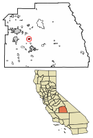 Location of Lindsay in Tulare County, California. | |
 Lindsay, California Location in the United States | |
| Coordinates: 36°12′N 119°5′W / 36.200°N 119.083°WCoordinates: 36°12′N 119°5′W / 36.200°N 119.083°W | |
| Country | |
| State | |
| County | Tulare |
| Incorporated | February 28, 1910[1] |
| Area | |
| • Total | 2.72 sq mi (7.05 km2) |
| • Land | 2.72 sq mi (7.05 km2) |
| • Water | 0.00 sq mi (0.00 km2) 0% |
| Elevation | 387 ft (118 m) |
| Population (2010) | |
| • Total | 11,768 |
| • Estimate (2019)[4] | 13,463 |
| • Density | 4,944.18/sq mi (1,908.64/km2) |
| Time zone | UTC-8 (Pacific (PST)) |
| • Summer (DST) | UTC-7 (PDT) |
| ZIP code | 93247 |
| Area code(s) | 559 |
| FIPS code | 06-41712 |
| GNIS feature ID | 1652744 |
| Website | www |

Lindsay is a city in Tulare County, California, United States. The population was 11,768 at the 2010 census. Lindsay is located southeast of Visalia and north of Porterville and is considered part of the Visalia-Porterville Metropolitan Area and the Porterville Urban Area by the United States Census Bureau.
History[]
The Yandanchei tribe of Native Americans came to hunt and fish at the future site of Lindsay for centuries.[5] Future Military Governor of California John C. Fremont passed through twice by way of the Stockton - Los Angeles Road and the later Butterfield Overland Mail route on two of his four exploration trips. Julius Orton, a seventh generation descendant of Thomas, served as security for a pack train headed for Placerville, a booming California gold mining town, motivated by his futile search for gold. In 1859, with his wife and two small daughters, and driving a small herd of cattle, walked more than 200 miles (320 km) from the coast near Sacramento, to a homestead along the Tule River, southwest of Lindsay. In the 1880s, Julius Orton homesteaded another (160 acres (0.65 km2)) piece of land bordering on the property of pioneers Lewis and John Keeley, brothers who had taken on a homestead just a few miles southwest of Lindsay in the mid-1870s.[5]
In 1889, the founder of the City of Lindsay, Captain Arthur Hutchinson, moved to California because of his ill health. He moved to the Lindsay area and bought 2,000 acres (8.1 km2) to found the Lindsay Land Company. When the Southern Pacific Railroad came through the area in 1889, development of the Lindsay townsite was begun. Hutchinson laid out the plan for the township, and named the community for his wife, Sadie Lindsay Patton Hutchinson.[5]
Government[]
Local government[]
Its Mayor is Pamela Kimball (last elected 11/2012, appointed, not elected since), Mayor Pro Tempore is Laura Cortes (appointed, not elected). The remaining city council members are Yolanda Flores (elected 11/2018), Rosaena Sanchez (elected 11/2018), Brian Watson (appointed, not elected).[6]
State and federal representation[]
In the California State Legislature, Lindsay is in the 14th Senate District, represented by Democrat Melissa Hurtado, and in the 26th Assembly District, represented by Republican Devon Mathis.[7]
In the United States House of Representatives, Lindsay is in California's 22nd congressional district, represented by Republican Devin Nunes[8]
Geography[]
Lindsay is located at 36°12′N 119°5′W / 36.200°N 119.083°W (36.207, -119.089).[9]
According to the United States Census Bureau, the city has a total area of 2.6 square miles (6.8 km2), all of it land.
Climate[]
According to the Köppen Climate Classification system, Lindsay has a semi-arid climate(BSk) with hot, dry summers and cool, wet winters.
| hideClimate data for Lindsay, California (normals 1981-2010, 1913-2020 extremes) | |||||||||||||
|---|---|---|---|---|---|---|---|---|---|---|---|---|---|
| Month | Jan | Feb | Mar | Apr | May | Jun | Jul | Aug | Sep | Oct | Nov | Dec | Year |
| Record high °F (°C) | 81.0 (27.2) |
87.0 (30.6) |
91.0 (32.8) |
100.0 (37.8) |
107.0 (41.7) |
114.0 (45.6) |
115.0 (46.1) |
113.0 (45.0) |
109.0 (42.8) |
102.0 (38.9) |
91.0 (32.8) |
82.0 (27.8) |
115.0 (46.1) |
| Mean maximum °F (°C) | 72.0 (22.2) |
76.0 (24.4) |
83.0 (28.3) |
92.0 (33.3) |
99.0 (37.2) |
103.0 (39.4) |
105.0 (40.6) |
105.0 (40.6) |
102.0 (38.9) |
94.0 (34.4) |
80.0 (26.7) |
71.0 (21.7) |
107.0 (41.7) |
| Average high °F (°C) | 58.1 (14.5) |
64.3 (17.9) |
70.4 (21.3) |
76.8 (24.9) |
84.9 (29.4) |
91.9 (33.3) |
97.2 (36.2) |
96.3 (35.7) |
91.3 (32.9) |
80.4 (26.9) |
66.9 (19.4) |
57.9 (14.4) |
78.0 (25.6) |
| Daily mean °F (°C) | 47.6 (8.7) |
52.0 (11.1) |
56.8 (13.8) |
61.6 (16.4) |
68.6 (20.3) |
75.1 (23.9) |
80.3 (26.8) |
78.8 (26.0) |
73.8 (23.2) |
64.4 (18.0) |
53.9 (12.2) |
46.8 (8.2) |
63.3 (17.4) |
| Average low °F (°C) | 37.1 (2.8) |
39.7 (4.3) |
43.1 (6.2) |
46.3 (7.9) |
52.3 (11.3) |
58.2 (14.6) |
63.5 (17.5) |
61.4 (16.3) |
56.3 (13.5) |
48.4 (9.1) |
40.8 (4.9) |
35.7 (2.1) |
48.6 (9.2) |
| Mean minimum °F (°C) | 27.0 (−2.8) |
29.0 (−1.7) |
33.0 (0.6) |
36.0 (2.2) |
41.0 (5.0) |
47.0 (8.3) |
54.0 (12.2) |
53.0 (11.7) |
47.0 (8.3) |
39.0 (3.9) |
30.0 (−1.1) |
26.0 (−3.3) |
25.0 (−3.9) |
| Record low °F (°C) | 18.0 (−7.8) |
22.0 (−5.6) |
25.0 (−3.9) |
26.0 (−3.3) |
33.0 (0.6) |
39.0 (3.9) |
46.0 (7.8) |
44.0 (6.7) |
35.0 (1.7) |
28.0 (−2.2) |
23.0 (−5.0) |
17.0 (−8.3) |
17.0 (−8.3) |
| Average precipitation inches (mm) | 2.40 (61) |
2.15 (55) |
2.22 (56) |
1.14 (29) |
0.40 (10) |
0.13 (3.3) |
0.01 (0.25) |
0.01 (0.25) |
0.19 (4.8) |
0.64 (16) |
1.34 (34) |
1.83 (46) |
12.46 (316) |
| Source: NOAA[10] | |||||||||||||
Demographics[]
| Historical population | |||
|---|---|---|---|
| Census | Pop. | %± | |
| 1910 | 1,814 | — | |
| 1920 | 2,576 | 42.0% | |
| 1930 | 3,878 | 50.5% | |
| 1940 | 4,397 | 13.4% | |
| 1950 | 5,060 | 15.1% | |
| 1960 | 5,397 | 6.7% | |
| 1970 | 5,206 | −3.5% | |
| 1980 | 6,936 | 33.2% | |
| 1990 | 8,338 | 20.2% | |
| 2000 | 10,297 | 23.5% | |
| 2010 | 11,768 | 14.3% | |
| 2019 (est.) | 13,463 | [4] | 14.4% |
| U.S. Decennial Census[11] | |||
2010[]
At the 2010 census Lindsay had a population of 11,768. The population density was 4,509.4 people per square mile (1,741.1/km2). The racial makeup of Lindsay was 6,480 (55.1%) White, 85 (0.7%) African American, 128 (1.1%) Native American, 267 (2.3%) Asian, 4 (0.0%) Pacific Islander, 4,367 (37.1%) from other races, and 437 (3.7%) from two or more races. Hispanic or Latino of any race were 10,056 persons (85.5%).[12]
The census reported that 11,672 people (99.2% of the population) lived in households, no one lived in non-institutionalized group quarters and 96 (0.8%) were institutionalized.
There were 3,014 households, 1,890 (62.7%) had children under the age of 18 living in them, 1,719 (57.0%) were opposite-sex married couples living together, 578 (19.2%) had a female householder with no husband present, 233 (7.7%) had a male householder with no wife present. There were 242 (8.0%) unmarried opposite-sex partnerships, and 19 (0.6%) same-sex married couples or partnerships. 401 households (13.3%) were one person and 210 (7.0%) had someone living alone who was 65 or older. The average household size was 3.87. There were 2,530 families (83.9% of households); the average family size was 4.21.
The age distribution was 4,523 people (38.4%) under the age of 18, 1,439 people (12.2%) aged 18 to 24, 3,079 people (26.2%) aged 25 to 44, 1,848 people (15.7%) aged 45 to 64, and 879 people (7.5%) who were 65 or older. The median age was 24.6 years. For every 100 females, there were 101.3 males. For every 100 females age 18 and over, there were 96.8 males.
There were 3,193 housing units at an average density of 1,223.5 per square mile, of the occupied units 1,526 (50.6%) were owner-occupied and 1,488 (49.4%) were rented. The homeowner vacancy rate was 2.0%; the rental vacancy rate was 6.2%. 5,909 people (50.2% of the population) lived in owner-occupied housing units and 5,763 people (49.0%) lived in rental housing units.
2000[]
At the 2000 census there were 10,297 people in 2,717 households, including 2,208 families, in the city. The population density was 1,649.7/km2 (4,264.4/mi2). There were 2,865 housing units at an average density of 459.0/km2 (1,186.5/mi2). The racial makeup of the city was 44.83% White, 0.57% African American, 1.51% Native American, 1.06% Asian, 0.15% Pacific Islander, 48.27% from other races, and 3.62% from two or more races. Hispanic or Latino of any race were 77.97%.[13]
Of the 2,717 households 53.4% had children under the age of 18 living with them, 57.2% were married couples living together, 17.1% had a female householder with no husband present, and 18.7% were non-families. 15.9% of households were one person and 8.6% were one person aged 65 or older. The average household size was 3.74 and the average family size was 4.16.
The age distribution was 38.0% under the age of 18, 11.4% from 18 to 24, 27.3% from 25 to 44, 14.2% from 45 to 64, and 9.1% 65 or older. The median age was 25 years. For every 100 females, there were 102.6 males. For every 100 females age 18 and over, there were 101.0 males.
The median income for a household in the city was $24,305, and the median family income was $24,934. Males had a median income of $23,645 versus $18,992 for females. The per capita income for the city was $8,230. About 33.3% of families and 39.9% of the population were below the poverty line, including 49.3% of those under age 18 and 12.3% of those age 65 or over.
Sister cities[]
See also[]
References[]
- ^ "California Cities by Incorporation Date". California Association of Local Agency Formation Commissions. Archived from the original (Word) on February 21, 2013. Retrieved August 25, 2014.
- ^ "2019 U.S. Gazetteer Files". United States Census Bureau. Retrieved July 1, 2020.
- ^ "Lindsay". Geographic Names Information System. United States Geological Survey. Retrieved March 11, 2015.
- ^ Jump up to: a b "Population and Housing Unit Estimates". United States Census Bureau. May 24, 2020. Retrieved May 27, 2020.
- ^ Jump up to: a b c http://www.lindsay.ca.us/aacity/history.cfm
- ^ "Meet the Lindsay City Council". City of Lindsay California. City of Lindsay. Retrieved 28 March 2017.
- ^ "Statewide Database". Regents of the University of California. Archived from the original on February 1, 2015. Retrieved March 11, 2015.
- ^ "California's 22nd Congressional District - Representatives & District Map". Civic Impulse, LLC. Retrieved October 5, 2014.
- ^ "US Gazetteer files: 2010, 2000, and 1990". United States Census Bureau. 2011-02-12. Retrieved 2011-04-23.
- ^ "Lindsay - NWS Hanford CA NOAA Online Weather Data". Retrieved February 9, 2021.
- ^ "Census of Population and Housing". Census.gov. Retrieved June 4, 2015.
- ^ "2010 Census Interactive Population Search: CA - Lindsay city". U.S. Census Bureau. Archived from the original on July 15, 2014. Retrieved July 12, 2014.
- ^ "U.S. Census website". United States Census Bureau. Retrieved 2008-01-31.
External links[]
| show Municipalities and communities of Tulare County, California, United States |
|---|

| show Authority control |
|---|
- Incorporated cities and towns in California
- Cities in Tulare County, California
- 1910 establishments in California