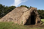
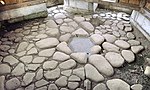
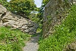
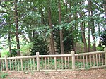
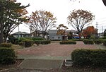
Isehara Hachimandai Stone Age Dwelling Site 伊勢原八幡台石器時代住居跡 Isehara Hachimandai sekki-jidai jūkyo ato Isehara
Jomon period settlement trace
35°23′20″N 139°18′31″E / 35.38893842°N 139.30849847°E / 35.38893842; 139.30849847 (Isehara Hachimandai Stone Age Dwelling Site ) 1
792
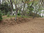
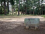
Isshōmasu Site 一升桝遺跡 Isshōmasu iseki Kamakura
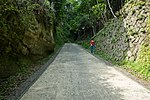
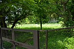
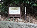
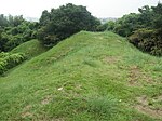
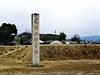
Kamakura period earthworks beside the road, half a kilometre from Gokuraku-ji [5]
35°18′53″N 139°31′39″E / 35.3146051°N 139.52758283°E / 35.3146051; 139.52758283 (Isshōmasu Site ) 2, 6
00003514
Inamuragasaki 稲村ヶ崎 (新田義貞徒渉伝説地) Inamuragasaki Kamakura
Kamakura period site where Nitta Yoshisada entered Kamakura during the Siege of Kamakura (1333)
35°18′07″N 139°31′32″E / 35.30199813°N 139.52549508°E / 35.30199813; 139.52549508 (Inamuragasaki ) 8
790
Egara Tenjin Shrine Precinct荏柄天神社境内 Egara Tenjin-sha keidai Kamakura
Shinto shrine submitted for inscription on the UNESCO World Heritage List as one of the Temples, Shrines and other structures of Ancient Kamakura ;[6] [7] ICP honden dates to 1316[8]
35°19′33″N 139°33′52″E / 35.32592137°N 139.56436886°E / 35.32592137; 139.56436886 (Egara Tenjin Shrine Precinct ) 3
00003454
Yōfuku-ji ruins永福寺跡 Yōfukuji ato Kamakura
Buddhist temple ruins submitted for inscription on the UNESCO World Heritage List as one of the Temples, Shrines and other structures of Ancient Kamakura [6] [7]
35°19′38″N 139°34′08″E / 35.32731805°N 139.56881901°E / 35.32731805; 139.56881901 (Yōfukuji ruins ) 3
804
Engaku-ji Precinct円覚寺境内 Engakuji keidai Kamakura
Buddhist temple submitted for inscription on the UNESCO World Heritage List as one of the Temples, Shrines and other structures of Ancient Kamakura [6] [7]
35°20′16″N 139°32′52″E / 35.33790762°N 139.5478108°E / 35.33790762; 139.5478108 (Engakuji Precinct ) 3
808
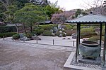
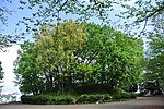
Engaku-ji Gardens円覚寺庭園 Engakuji teien Kamakura
Buddhist temple garden; also a Place of Scenic Beauty ; submitted for inscription on the UNESCO World Heritage List as one of the Temples, Shrines and other structures of Ancient Kamakura [6] [7]
35°20′12″N 139°32′43″E / 35.33677183°N 139.54539308°E / 35.33677183; 139.54539308 (Engakuji Gardens ) 8
788
Shimoterao Kanga site 下寺尾官衙遺跡群 Shimoterao kanga iseki-gun Chigasaki
Nara / Heian period local administration complex ruins
35°21′46″N 139°23′48″E / 35.362666°N 139.396538°E / 35.362666; 139.396538 (Shimoterao Kanga ruins ) 2
00003890
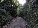
Kewaizaka Pass 仮粧坂 Kehaizaka Kamakura
Kamakura period sites submitted for inscription on the UNESCO World Heritage List as one of the Temples, Shrines and other structures of Ancient Kamakura [6] [7]
35°19′37″N 139°32′44″E / 35.32695051°N 139.54566391°E / 35.32695051; 139.54566391 (Kewaizaka Pass ) 6
814
Natsushima Shell Mound 夏島貝塚 Natsushima kaizuka Yokosuka
Jomon period shell midden
35°19′21″N 139°38′58″E / 35.32236445°N 139.64956105°E / 35.32236445; 139.64956105 (Natsushima Shell Mound ) 1
817
Precinct 覚園寺 境内Kakuonji keidai Kamakura
Buddhist temple submitted for inscription on the UNESCO World Heritage List as one of the Temples, Shrines and other structures of Ancient Kamakura [6] [7]
35°19′59″N 139°33′49″E / 35.33298577°N 139.56353313°E / 35.33298577; 139.56353313 (Kakuonji Precinct ) 3
809
Kamakura Daibutsuden 鎌倉大仏殿跡 Kamakura daibutsuden ato Kamakura
Buddhist temple submitted for inscription on the UNESCO World Heritage List as one of the Temples, Shrines and other structures of Ancient Kamakura [6] [7]
35°19′00″N 139°32′09″E / 35.31673435°N 139.53571041°E / 35.31673435; 139.53571041 (Kamakura Daibutsuden ruins ) 3
3385
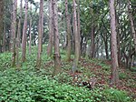
Kamegayatsuzaka Pass 亀ヶ谷坂 Kamegayatsuzaka Kamakura
Kamakura period site submitted for inscription on the UNESCO World Heritage List as one of the Temples, Shrines and other structures of Ancient Kamakura [6] [7]
35°19′51″N 139°33′01″E / 35.33076405°N 139.55038805°E / 35.33076405; 139.55038805 (Kamegayatsuzaka Pass ) 6
812
Tachibana Kanga site 橘樹官衙遺跡群 Tachibana kanga iseki-gun Kawasaki
Nara / Heian period local administration complex ruins
35°34′42″N 139°37′09″E / 35.578452°N 139.619204°E / 35.578452; 139.619204 (Tachibana Kanga ruins ) 2
00003889
Former Yokohama Specie Bank Head Office 旧横浜正金銀行本店 kyū-Yokohama Shōkin Ginkō honten kaizuka Yokohama
established in 1880, the ICP honkan (main building) dates to 1904 and is used for the Kanagawa Prefectural Museum of Cultural History [9]
35°26′57″N 139°38′11″E / 35.449059°N 139.636307°E / 35.449059; 139.636307 (Former Yokohama Specie Bank Head Office ) 6
824
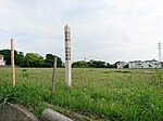
Sagami River Bridge ruins 旧相模川橋脚 kyū-Sagami-gawa kyōkyaku Chigasaki
also a Natural Monument
35°19′55″N 139°23′04″E / 35.33198299°N 139.38441004°E / 35.33198299; 139.38441004 (Sagami River Bridge ruins ) 6
777
Kobukurozaka Pass 巨福呂坂 Kobukurozaka Kamakura
Kamakura period
35°19′39″N 139°33′16″E / 35.32739418°N 139.55455648°E / 35.32739418; 139.55455648 (Kobukurozaka Pass ) 6
813
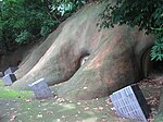
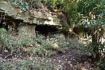
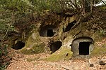
Gokuraku-ji Precinct - Tomb of Ninshō 極楽寺境内・忍性墓 Gokurakuji keidai・Ninshō no haka Kamakura
Buddhist temple submitted for inscription on the UNESCO World Heritage List as one of the Temples, Shrines and other structures of Ancient Kamakura [6] [7]
35°18′36″N 139°31′44″E / 35.3100966°N 139.52880202°E / 35.3100966; 139.52880202 (Gokurakuji Precinct - Tomb of Ninshō ) 7
781
Kenchō-ji Precinct建長寺境内 Kenchōji keidai Kamakura
Buddhist temple submitted for inscription on the UNESCO World Heritage List as one of the Temples, Shrines and other structures of Ancient Kamakura [6] [7]
35°19′54″N 139°33′17″E / 35.33160435°N 139.55467388°E / 35.33160435; 139.55467388 (Kenchōji Precinct ) 3
805
Kenchō-ji Gardens建長寺庭園 Kenchōji teien Kamakura
Buddhist temple gardens; also a Place of Scenic Beauty ; submitted for inscription on the UNESCO World Heritage List as one of the Temples, Shrines and other structures of Ancient Kamakura [6] [7]
35°19′56″N 139°33′20″E / 35.33218681°N 139.55554868°E / 35.33218681; 139.55554868 (Kenchōji Gardens ) 8
787
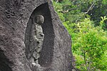
Moto-Hakone Stone Buddhas 元箱根石仏群 Moto-Hakone sekibutsu Hakone
Kamakura period monuments; designation includes three gorintō , one dating to 1295, and a hōkyōintō of 1296; the ICP sculptures date from the late C13/early C14[10] [11] [12]
35°13′02″N 139°02′19″E / 35.21714185°N 139.03863773°E / 35.21714185; 139.03863773 (Moto-Hakone Stone Buddhas ) 3
797
Goryōgaidai Shell Mound 五領ヶ台貝塚 Goryōgaidai kaizuka Hiratsuka
Jomon period shell midden
35°21′16″N 139°18′02″E / 35.35437008°N 139.300568°E / 35.35437008; 139.300568 (Goryōgaidai Shell Mound ) 1
818
Grave of William Adams 三浦安針墓 Miura Anjin no haka Yokosuka
Edo Period personage
35°16′45″N 139°38′27″E / 35.27911496°N 139.64084299°E / 35.27911496; 139.64084299 (Grave of William Adams ) 7
774
Santonodai Site 三殿台遺跡 Santonodai iseki Yokohama
Yayoi period settlement trace
35°25′14″N 139°36′39″E / 35.42065195°N 139.61075656°E / 35.42065195; 139.61075656 (Santonodai Site ) 1
802
Wakamiya Ōji 若宮大路 Wakamiya Ōji Kamakura
Kamakura period site submitted for inscription on the UNESCO World Heritage List as one of the Temples, Shrines and other structures of Ancient Kamakura [6] [7]
35°18′58″N 139°33′01″E / 35.31612247°N 139.55027298°E / 35.31612247; 139.55027298 (Wakamiya Ōji ) 3, 6
793
Jufuku-ji Precinct寿福寺境内 Jufukuji keidai Kamakura
Buddhist temple submitted for inscription on the UNESCO World Heritage List as one of the Temples, Shrines and other structures of Ancient Kamakura [6] [7]
35°19′27″N 139°32′57″E / 35.32417515°N 139.54924252°E / 35.32417515; 139.54924252 (Jufukuji Precinct ) 3
801
Akibayama Kofun Cluster 秋葉山古墳群 Akibayama kofun-gun Ebina
Konfun period tumuli
35°28′12″N 139°24′15″E / 35.47004387°N 139.4041932°E / 35.47004387; 139.4041932 (Akibayama Kofun Cluster ) 1
00003453
Katsusaka Site 勝坂遺跡 Katsusaka iseki Sagamihara
Jomon period settlement trace
35°30′32″N 139°23′18″E / 35.50889722°N 139.38826591°E / 35.50889722; 139.38826591 (Katsusaka Site ) 1
819
Odawara Castle ruins小田原城跡 Odawara-jō ato Odawara
Sengoku / Edo period castle
35°15′03″N 139°09′13″E / 35.25069544°N 139.1535599°E / 35.25069544; 139.1535599 (Odawara Castle ruins ) 2
794
Precinct 称名寺 境内Shōmyōji keidai Yokohama
Buddhist temple submitted for inscription on the UNESCO World Heritage List as one of the Temples, Shrines and other structures of Ancient Kamakura [6] [7]
35°20′38″N 139°37′49″E / 35.34401438°N 139.63033998°E / 35.34401438; 139.63033998 (Shōmyōji Precinct ) 3
773
Precinct - Grave of 浄光明寺 境内・冷泉為相 墓Jōkōmyōji keidai・Reizei Tamesuke haka Kamakura
Buddhist temple submitted for inscription on the UNESCO World Heritage List as one of the Temples, Shrines and other structures of Ancient Kamakura [6] [7]
35°19′37″N 139°33′05″E / 35.32698816°N 139.55137061°E / 35.32698816; 139.55137061 (Jōkōmyōji Precinct ) 3, 7
780
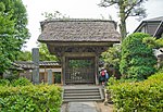
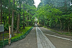
Jōchi-ji Precinct浄智寺境内 Jōchiji keidai Kamakura
Buddhist temple founded in Kamakura period
35°20′00″N 139°32′48″E / 35.33345466°N 139.54661145°E / 35.33345466; 139.54661145 (Jōchiji Precinct ) 3
800
Jōmyō-ji Precinct浄妙寺境内 Jōmyōji keidai Kamakura
Buddhist temple founded in Kamakura period
35°19′21″N 139°34′16″E / 35.32257345°N 139.57111023°E / 35.32257345; 139.57111023 (Jōmyōji Precinct ) 3
806
Kanzaki Site 神崎遺跡 Kanzaki iseki Ayase
Yayoi period settlement trace
35°24′37″N 139°24′26″E / 35.41024387°N 139.40715118°E / 35.41024387; 139.40715118 (Kanzaki Site ) 1
00003699
Zuisen-ji Precinct瑞泉寺境内 Zuisenji keidai Kamakura
Buddhist temple, submitted for inscription on the UNESCO World Heritage List as one of the Temples, Shrines and other structures of Ancient Kamakura [6] [7]
35°19′21″N 139°34′16″E / 35.32257345°N 139.57111023°E / 35.32257345; 139.57111023 (Zuisenji Precinct ) 3
815
Suara Stone Age Site 寸沢嵐石器時代遺跡 Suara shisekki-jidai iseki Sagamihara
Jomon period settlement trace
35°36′00″N 139°13′24″E / 35.59995902°N 139.22343084°E / 35.59995902; 139.22343084 (Suara Stone Age Site ) 1
785
Mount Ishigaki 石垣山 Ishigaki-yama Odawara
site of Sengoku period Ishigakiyama Ichiya Castle
35°14′08″N 139°07′39″E / 35.23545028°N 139.12745228°E / 35.23545028; 139.12745228 (Mount Ishigaki ) 2
799
Kawajiri Stone Age Site 川尻石器時代遺跡 Kawajiri shisekki-jidai iseki Sagamihara
Jomon period settlement trace
35°35′30″N 139°18′01″E / 35.5915723°N 139.30018766°E / 35.5915723; 139.30018766 (Kawajiri Stone Age Site ) 1
786
Sagami Kokubun-ji ruins相模国分寺 跡Sagami Kokubunji ato Ebina
Nara period provincial temple of Sagami Province
35°27′16″N 139°23′52″E / 35.45443278°N 139.39780691°E / 35.45443278; 139.39780691 (Sagami Kokubunji ruins ) 3
771
Sagami Kokubun-niji ruins相模国分尼寺 跡Sagami Kokubunniji ato Ebina
Nara period provincial nunnery of Sagami Province
35°27′38″N 139°23′53″E / 35.46047584°N 139.39806854°E / 35.46047584; 139.39806854 (Sagami Kokubunniji ruins ) 3
825
Ōmachi Shakadō Pass Site大町釈迦堂口遺跡 Ōmachi Shakado-guchi iseki Kamakura
Kamakura period
35°19′02″N 139°33′54″E / 35.31725805°N 139.56498735°E / 35.31725805; 139.56498735 (Ōmachi Shakadō Pass Site ) 3
00003681
Ōtsuka-Saikachido Site 大塚・歳勝土遺跡 Ōtsuka-Saikachido iseki Yokohama
Yayoi period settlement trace
35°33′02″N 139°34′50″E / 35.55066428°N 139.58062308°E / 35.55066428; 139.58062308 (Ōtsuka-Saikachido Site ) 1
823
Daibutsu Pass 大仏切通 Daibutsu kiridōshi Kamakura
Kamakura period site submitted for inscription on the UNESCO World Heritage List as one of the Temples, Shrines and other structures of Ancient Kamakura [6] [7]
35°19′38″N 139°31′59″E / 35.32709408°N 139.53318115°E / 35.32709408; 139.53318115 (Daibutsu Pass ) 6
820
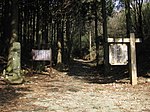
Asaina Pass 朝夷奈切通 Asaina kiridōshi Kamakura
Kamakura period site submitted for inscription on the UNESCO World Heritage List as one of the Temples, Shrines and other structures of Ancient Kamakura [6] [7]
35°19′51″N 139°35′28″E / 35.33076405°N 139.59105875°E / 35.33076405; 139.59105875 (Asaina Pass ) 6
811
Nagae-Sakurayama Kofun Cluster 長柄桜山古墳群 Nagae-Sakurayama kofun-gun Zushi , Hayama
Kofun period tumuli cluster
35°17′14″N 139°35′05″E / 35.28711559°N 139.58482271°E / 35.28711559; 139.58482271 (Nagae-Sakurayama Kofun Cluster ) 1
3351
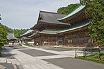
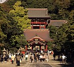
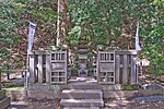
Tsurugaoka Hachiman-gū Precinct鶴岡八幡宮境内 Tsurugaoka Hachimangū keidai Kamakura
Shinto shrine submitted for inscription on the UNESCO World Heritage List as one of the Temples, Shrines and other structures of Ancient Kamakura [6] [7]
35°19′31″N 139°33′21″E / 35.32529159°N 139.5559293°E / 35.32529159; 139.5559293 (Tsurugaoka Hachimangū Precinct ) 3
807
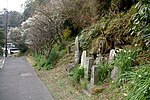
Grave of 伝上杉憲方 墓 den-Uesugi Norikata no haka Kamakura
Kamakura period tomb
35°18′34″N 139°31′47″E / 35.30952262°N 139.52962639°E / 35.30952262; 139.52962639 (Grave of Uesugi Norikata ) 7
782
Tanamukaihara Site 田名向原遺跡 Tanamukaihara iseki Sagamihara
Japanese Paleolithic Site
35°31′46″N 139°21′18″E / 35.52930989°N 139.35507767°E / 35.52930989; 139.35507767 (Tanamukaihara Site ) 1
3244
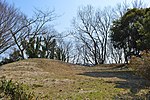
Tōshō-ji Site東勝寺跡 Tōshōji ato Kamakura
Buddhist temple ruins submitted for inscription on the UNESCO World Heritage List as one of the Temples, Shrines and other structures of Ancient Kamakura [6] [7]
35°19′14″N 139°33′35″E / 35.32065359°N 139.55969649°E / 35.32065359; 139.55969649 (Tōshōji Site ) 2, 3
3213
藤沢敵御方供養塔 Fujisawa tekimikata kuyōtō Fujisawa
Sengoku period monument erected to commemorate those who fell in the Uesugi Zenshū Rebellion (上杉禅秀の乱 of Ōei 23 (1416); on the grounds of Shōjōkō-ji (清浄光寺 [13]
35°20′51″N 139°29′19″E / 35.34760627°N 139.48867362°E / 35.34760627; 139.48867362 (Fujisawa Memorial Tower to Friends and Foe ) 3
776
Grave of 日野俊基 墓Hino Toshimoto no haka Kamakura
Kamakura period
35°19′41″N 139°32′35″E / 35.32816406°N 139.54303228°E / 35.32816406; 139.54303228 (Grave of Hino Toshimoto ) 7
779
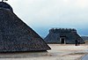
Hakone Barrier Site箱根関 跡Hakone no seki ato Hakone
Edo Period
35°11′33″N 139°01′34″E / 35.1923674°N 139.02617866°E / 35.1923674; 139.02617866 (Hakone Barrier Site ) 6
772
Site 仏法寺跡 Buppōji ato Kamakura
Buddhist temple submitted for inscription on the UNESCO World Heritage List as one of the Temples, Shrines and other structures of Ancient Kamakura [6] [7]
35°18′26″N 139°31′52″E / 35.30735767°N 139.53098513°E / 35.30735767; 139.53098513 (Buppōji Site ) 3
00003501
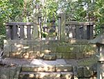
Hokkedō Site法華堂跡 (源頼朝墓・北条義時墓) Hokkedō ato (Minamoto Yoritomo no haka・Hōjō Yoshitoki no haka) Kamakura
designation includes the tomb of Minamoto no Yoritomo and the tomb of Hōjō Yoshitoki
35°19′33″N 139°33′40″E / 35.32591733°N 139.56099667°E / 35.32591733; 139.56099667 (Hokkedō Site ) 3, 7
778
Hōjō Clan Site北条氏常盤亭跡 Hōjō-shi Tokiwa-tei ato Kamakura
submitted for inscription on the UNESCO World Heritage List as one of the Temples, Shrines and other structures of Ancient Kamakura [6] [7]
35°19′24″N 139°31′55″E / 35.32340499°N 139.53200341°E / 35.32340499; 139.53200341 (Hōjō Clan Tokiwa Residence Site ) 2
821
Nagoe Pass 名越切通 Nagoe kiridōshi Kamakura
Kamakura period site submitted for inscription on the UNESCO World Heritage List as one of the Temples, Shrines and other structures of Ancient Kamakura [6] [7]
35°18′27″N 139°33′53″E / 35.30738381°N 139.56470343°E / 35.30738381; 139.56470343 (Nagoe Pass ) 6
803
Meigetsu-in Precinct明月院境内 Meigetsuin keidai Kamakura
Buddhist temple
35°20′06″N 139°33′05″E / 35.33504347°N 139.55130101°E / 35.33504347; 139.55130101 (Meigetsuin Precinct ) 3
822
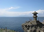
Wakae Island 和賀江嶋 Wakaejima Kamakura , Zushi
Kamakura period site submitted for inscription on the UNESCO World Heritage List as one of the Temples, Shrines and other structures of Ancient Kamakura [6] [7]
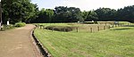
35°18′01″N 139°33′05″E / 35.30028254°N 139.55142955°E / 35.30028254; 139.55142955 (Wakae Island ) 3, 5, 6
810
Akasaka Site 赤坂遺跡 Akasaka iseki Miura
Yayoi period settlement trace
35°10′28″N 139°38′03″E / 35.174421°N 139.634081°E / 35.174421; 139.634081 (Akasaka Site ) 1
00003779
箱根旧街道 Hakone kyū-kaidō Hakone
stretch of the old Tōkaidō ; the designation includes areas of Mishima and Kannami in Shizuoka Prefecture
35°11′36″N 139°01′35″E / 35.19331254°N 139.02647902°E / 35.19331254; 139.02647902 (Old Hakone Road ) 6
798
Tokyo Bay Fortress Sites東京湾要塞 跡Tōkyō-wan yōsai ato Yokosuka
designation includes the sites of Sarushima Battery (猿島砲台跡 ) and Chiyogasaki Battery (千代ヶ崎砲台跡 )
35°17′10″N 139°41′38″E / 35.286020°N 139.693995°E / 35.286020; 139.693995 (Tokyo Bay Fortress ) 2
00003891
Stone Quarries for Edo Castle Site江戸城石垣石丁場跡 Edo-jō ishigaki ishi-chōba ato Odawara
designation includes areas of Atami and Itō in Shizuoka Prefecture
35°14′08″N 139°07′40″E / 35.235421°N 139.127692°E / 35.235421; 139.127692 (Stone Quarries for Edo Castle ) 6
00003930
Shimoterao Nishikata Site 下寺尾西方遺跡 Shimoterao Nishikata iseki Chigasaki
Yayoi period settlement trace
35°21′49″N 139°24′01″E / 35.363607°N 139.400166°E / 35.363607; 139.400166 (Shimoterao Nishikata Site ) 1
00003890