List of Pennsylvania state historical markers in Lancaster County
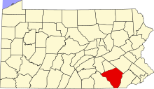
Location of Lancaster County in Pennsylvania
This is a list of the Pennsylvania state historical markers in Lancaster County.
This is intended to be a complete list of the official state historical markers placed in Lancaster County, Pennsylvania by the Pennsylvania Historical and Museum Commission (PHMC). The locations of the historical markers, as well as the latitude and longitude coordinates as provided by the PHMC's database, are included below when available. There are 81 historical markers located in Lancaster County.[1]
Historical markers[]
| Marker title | Image | Date dedicated | Location | Marker type | Topics |
|---|---|---|---|---|---|
| Andrew Ellicott | 
|
December 10, 1999 | 123 N. Prince Street, Lancaster 40°02′24″N 76°18′30″W / 40.04°N 76.30837°W |
City | Exploration, Government & Politics 19th Century, Medicine & Science, Navigation, Professions & Vocations |

|
May 14, 1971 | 14 W. King St., Lancaster 40°02′17″N 76°18′23″W / 40.03813°N 76.30632°W |
City | Business & Industry, Professions & Vocations | |
| Baron Stiegel |
|
March 19, 1947 | Pa. 72 at Square in Manheim 40°09′50″N 76°25′42″W / 40.1638°N 76.42842°W |
Roadside | Business & Industry, Glass, Iron, Professions & Vocations, Religion |
| Boehm's Chapel |  |
April 29, 1980 | Pa. 272 northbound at Boehm's Rd., .1 mile S of Willow Street 39°57′44″N 76°16′06″W / 39.96228°N 76.26825°W |
Roadside | Religion |
| Charles Demuth | 
|
November 8, 1983 | 118 E. King St., Lancaster 40°02′18″N 76°18′11″W / 40.03827°N 76.30292°W |
City | Artists |
| Christiana Riot, The | 
|
April 25, 1998 | Lower Valley Rd. near Orchard Buck Rd., Sadsbury Twp., SW of Christiana 39°56′11″N 76°00′44″W / 39.93633°N 76.0122°W |
Roadside | African American, Government & Politics, Government & Politics 19th Century, Underground Railroad |

|
April 14, 1950 | NW corner, Orange & Shippen Sts., Lancaster 40°02′25″N 76°17′59″W / 40.04023°N 76.2997°W |
City | Buildings, Mansions & Manors | |
| Columbia | 
|
March 19, 1947 | Pa. 462 (old U.S. 30) at E end of Columbia 40°01′58″N 76°30′22″W / 40.03277°N 76.50602°W |
Roadside | Cities & Towns, Transportation |
|
|
n/a | Pa. 999 between Washington Boro & Millersville, 200 ft. W of SR 3017 (Missing) | Roadside | Cities & Towns, Early Settlement, Native American, William Penn | |
| - PLAQUE |
|
September 1, 1924 | SR 3017 (Safe Harbor Rd.) at Indian Marker Rd. near Letort, 4 miles SW of Millersville 39°57′36″N 76°24′01″W / 39.9599°N 76.40032°W |
Plaque | Cities & Towns, Early Settlement, Native American |
|
|
May 20, 2001 | Rte. 324 at New Danville Pike, Lancaster Twp. 40°00′37″N 76°18′13″W / 40.01017°N 76.30357°W |
Roadside | Canals, Navigation, Transportation | |
| Conestoga Wagon | 
|
March 17, 1947 | Pa. 462 (old US 30), .8 mile E of Lancaster (Missing) | Roadside | Transportation |
|
|
n/a | Pa. 441, 1 mile S of Bainbridge 40°05′09″N 76°39′09″W / 40.08592°N 76.65253°W |
Roadside | Cities & Towns, Early Settlement, Native American | |
|
|
March 18, 1947 | Pa. 230, 3.5 miles SE of Elizabethtown | Roadside | Religion | |
| - PLAQUE |
|
September 1921 | US 222 (E side) at Unicorn S of Quarryville | Plaque | Military, Professions & Vocations |
|
|
n/a | 28 N. Water St., Lancaster 40°02′18″N 76°18′31″W / 40.0384°N 76.3087°W |
City | Buildings, Houses & Homesteads | |
| Early Telegraph |
|
March 18, 1947 | Pa. 230, 3.1 miles SE of Elizabethtown 40°07′20″N 76°32′34″W / 40.12218°N 76.5428°W |
Roadside | Business & Industry, Invention |
| Ephrata Cloister | 
|
n/a | At the site on U.S. 322, Ephrata 40°11′09″N 76°11′14″W / 40.18593°N 76.18736°W |
Roadside | Religion |
| Ephrata Cloister | 
|
March 18, 1947 | Pa. 272 N & S of U.S. 322, Ephrata 40°11′02″N 76°11′25″W / 40.18401°N 76.19024°W |
Roadside | Religion |
|
|
June 17, 1984 | 140 E. Orange St., Lancaster 40°02′24″N 76°18′09″W / 40.03987°N 76.3026°W |
City | Religion | |

|
May 3, 1992 | 40 E. Orange St., Lancaster 40°02′23″N 76°18′17″W / 40.03975°N 76.3046°W |
City | Ethnic & Immigration, Religion | |
| - PLAQUE |
|
1918 | US 30 at the Bethany Ave., E end of Paradise | Plaque | Early Settlement, Ethnic & Immigration, Religion, William Penn |
| Franklin and Marshall College | 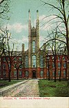
|
November 28, 1950 | Harrisburg Ave. at entrance to college, Lancaster (Missing) | Roadside | Education |
| Fulton Opera House | 
|
October 11, 1952 | N. Prince St. between King & Orange Sts., Lancaster | City | Buildings, Music & Theater |
| George Ross |
|
March 13, 1950 | SW corner, King & Lime Sts., Lancaster 40°02′18″N 76°18′05″W / 40.0384°N 76.30148°W |
City | American Revolution, Government & Politics, Houses & Homesteads, Military, Professions & Vocations |
|
|
June 26, 1951 | NE section of Square; at Jacobs' Store; approx. 15 ' north of fire alarm box, Lancaster | City | Buildings, Early Settlement, Inns & Taverns | |
|
|
August 23, 1951 | River Rd., just S of Washington Boro | Roadside | Early Settlement, Native American, Paths & Trails, Transportation | |
| Great Minquas Path |
|
August 23, 1951 | U.S. 30 just N of Gap 39°59′31″N 76°01′13″W / 39.99197°N 76.02032°W |
Roadside | Native American, Paths & Trails, Transportation |
|
|
May 13, 1962 | 24 S. Main St. (Pa. 72), Manheim 40°09′47″N 76°23′40″W / 40.16313°N 76.39458°W |
City | Civil War, Military | |
|
|
May 14, 1971 | U.S. 222 at Hans Herr Dr., West Lampeter Twp., Lancaster 39°59′23″N 76°16′01″W / 39.9897°N 76.26707°W |
Roadside | Houses & Homesteads, Religion | |
| Holy Trinity | 
|
June 15, 1975 | 31 S. Duke St., Lancaster 40°02′16″N 76°18′12″W / 40.0377°N 76.30337°W |
Roadside | Native American, Religion |

|
July 11, 1959 | U.S. 322, 2 miles W of Brickerville 40°14′10″N 76°19′58″W / 40.2361°N 76.3328°W |
Roadside | Business & Industry, Iron | |
|
|
June 16, 1960 | Off Pa. 272 (Oregon Pike) at Landis Valley Museum, Lancaster 40°05′27″N 76°16′49″W / 40.09082°N 76.28025°W |
Roadside | Buildings, Ethnic & Immigration, Religion | |
| James Buchanan | 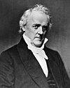
|
June 11, 1951 | SE section of Square, Lancaster 40°02′14″N 76°18′20″W / 40.03715°N 76.30565°W |
City | Government & Politics, Government & Politics 19th Century |
| James Buchanan | 
|
March 24, 1950 | S. Queen St. at Woodward Hill Cemetery, Lancaster 40°01′46″N 76°18′16″W / 40.02933°N 76.30433°W |
City | Government & Politics, Government & Politics 19th Century |
| John A. Sutter | 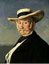
|
March 5, 1948 | Pa. 501 (S. Broad St.) at Lemon St., Lititz 40°09′12″N 76°18′26″W / 40.15328°N 76.30718°W |
Roadside | Business & Industry, Professions & Vocations |
| John Durang (1768-1822) | 
|
September 23, 2007 | 126 N Water St., Lancaster | City | Music & Theater, Performers, Professions & Vocations |
| John F. Reynolds (1820-1863) | 
|
December 17, 1949 | 42 W. King St., between Queen & Prince Sts., Lancaster 40°02′16″N 76°18′26″W / 40.03777°N 76.30717°W |
City | Civil War, Military |
| Joseph Simon (1712–1804) |
|
May 12, 2006 | W Orange & N Queen Sts., Lancaster 40°02′22″N 76°18′22″W / 40.03949°N 76.30601°W |
Roadside | American Revolution, Early Settlement, Ethnic & Immigration, Exploration, Religion |
| Lancaster |
|
March 17, 1947 | U.S. 30 E at Lancaster (Missing) | Roadside | Business & Industry, Cities & Towns, Early Settlement, Government & Politics |
| Lancaster |
|
March 17, 1947 | U.S. 230 W at Lancaster (Missing) | Roadside | Business & Industry, Cities & Towns, Early Settlement, Government & Politics |
| Lancaster |
|
March 17, 1947 | U.S. 30 W at Lancaster (Missing) | Roadside | Business & Industry, Cities & Towns, Early Settlement, Government & Politics |
| Lancaster |
|
March 17, 1947 | Pa. 72 N of Lancaster (Missing) | Roadside | Business & Industry, Cities & Towns, Early Settlement, Government & Politics |
| Lancaster |
|
March 17, 1947 | U.S. 222 S at Lancaster | Roadside | Business & Industry, Cities & Towns, Early Settlement, Government & Politics |
| Lancaster |
|
March 17, 1947 | Pa. 501 N of Lancaster | Roadside | Business & Industry, Cities & Towns, Early Settlement, Government & Politics |
| Lancaster |
|
July 9, 1946 | On main highways leading into city (Missing) | Roadside | Cities & Towns, Government & Politics |
| Lancaster County |
|
June 12, 1982 | Old Courthouse, N. Duke St., Lancaster | City | Government & Politics, Government & Politics 18th Century |
| Lancaster County Courthouse | 
|
June 11, 1951 | SW section of Square, Lancaster (Missing) | City | Government & Politics, Government & Politics 18th Century |
| Lincoln Highway | 
|
October 7, 2003 | Rte. 462, east end of Veterans Memorial/Columbia–Wrightsville Bridge, Columbia 40°01′59″N 76°30′22″W / 40.03297°N 76.50623°W |
Roadside | Business & Industry, Roads, Transportation |

|
April 9, 1980 | Pa. 772 (E. Main St.) at school in Lititz 40°09′23″N 76°18′06″W / 40.1564°N 76.30157°W |
City | Education, Religion, Women | |
| Lititz | 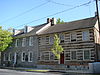
|
n/a | PA 501 near Rt. 772 intersection, at Lititz Spring Park, Lititz 40°09′29″N 76°18′27″W / 40.15807°N 76.30747°W |
City | Cities & Towns, Ethnic & Immigration, Religion |
| Martin Chartier - PLAQUE |
|
September 1, 1925 | PA 441 (River Rd.) at Charlestown Rd., Washington Boro 39°59′53″N 76°28′24″W / 39.99817°N 76.4733°W |
Plaque | Early Settlement, Exploration, Native American |
|
|
November 21, 1959 | U.S. 222 at junction Pa. 272 northbound near Willow Street 39°59′14″N 76°16′54″W / 39.98722°N 76.28173°W |
Roadside | Buildings, Business & Industry | |
|
|
September 16, 2000 | 315 West King St., Lancaster 40°02′14″N 76°22′54″W / 40.03727°N 76.38173°W |
City | American Revolution, Military | |

|
March 24, 1950 | 307 N. Duke St., Lancaster 40°02′36″N 76°18′17″W / 40.04327°N 76.30465°W |
City | American Revolution, Buildings, Military | |
| Millersville University | 
|
March 8, 1968 | U.S. 30, 1 mile W of Lancaster | Roadside | Education |
| Millersville University |
|
1989 | On N. George St. at campus, Millersville | Roadside | Education |
|
|
March 1, 1953 | NE corner, Main (Pa. 772) & Elm Sts., Lititz 40°09′19″N 76°17′42″W / 40.15528°N 76.29495°W |
City | Education, Houses & Homesteads, Religion | |
|
|
December 20, 1949 | W. King St. between Prince & Water Sts., Lancaster (Missing) | City | Government & Politics, Government & Politics 18th Century | |
| Pennsylvania Farm Museum | 
|
1957 | Landis Valley Museum, 2451 Kissel Hill Rd., Lancaster | Roadside | Agriculture |
| Pennsylvania Medical Society |
|
October 16, 1998 | North Duke & Walnut Streets, Lancaster 40°02′34″N 76°18′18″W / 40.0429°N 76.30512°W |
Roadside | Education, Medicine & Science, Professions & Vocations, Religion |
|
|
March 19, 1947 | Pa. 462 (old U.S. 30), .8 mile E of Lancaster (MISSING) | Roadside | Business & Industry | |
|
|
March 19, 1947 | Marietta Pike (PA 23), near Oakwood Ln., west end of Lancaster 40°02′54″N 76°20′35″W / 40.0482°N 76.34305°W |
Roadside | Business & Industry | |
| Robert Fulton Birthplace | 
|
1978 | At site, U.S. 222 N of | Roadside | Artists, Canals, Professions & Vocations, Transportation |
| Rock Ford Plantation |
|
June 29, 1951 | S. Duke St. ext., Lancaster, at Conestoga River 40°01′25″N 76°23′00″W / 40.02355°N 76.38321°W |
Roadside | American Revolution, George Washington, Mansions & Manors, Medicine & Science, Military, Professions & Vocations |
| Samuel S. Haldeman (1812-1880) | 
|
September 7, 1991 | River Rd. (PA 441) S of Bainbridge at Locust Grove Rd. 40°04′47″N 76°39′20″W / 40.0798°N 76.65567°W |
Roadside | Medicine & Science, Professions & Vocations, Writers |
| Shippen House |
|
March 30, 1950 | NW corner, Orange & Lime Sts., Lancaster 40°02′24″N 76°22′49″W / 40.04007°N 76.38018°W |
City | Buildings, Government & Politics 18th Century, Houses & Homesteads, Professions & Vocations |
| Simon Cameron | 
|
June 9, 1951 | W. High St. near Square, Maytown | City | Abraham Lincoln, Government & Politics, Government & Politics 19th Century |
| Simon Snyder | 
|
March 24, 1950 | N. Queen St. between Chestnut & Walnut Sts., Lancaster 40°02′34″N 76°18′24″W / 40.0427°N 76.30668°W |
City | Government & Politics, Government & Politics 19th Century, Governors, Military, War of 1812 |

|
August 21, 1968 | U.S. 30 between Gap & at "White Chimneys" (Missing) | Roadside | Buildings, Cities & Towns, Government & Politics, Government & Politics 19th Century, Roads | |
|
|
June 15, 1980 | 119 N. Duke St., Lancaster 40°02′23″N 76°18′13″W / 40.03982°N 76.30367°W |
City | Buildings, Government & Politics 18th Century, Religion | |
|
|
May 13, 1962 | 102 W. Stiegel St., Manheim | City | Buildings, Business & Industry, Glass | |
|
|
May 13, 1962 | 1 N. Main St. (Pa. 72), Manheim (destroyed by passing vehicle 3/04) (Missing) | City | Buildings, Mansions & Manors | |
| Thaddeus Stevens | 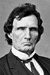
|
March 24, 1950 | W. Chestnut St. at Shreiners Cemetery, near N Mulberry St., Lancaster 40°02′26″N 76°18′40″W / 40.04055°N 76.311°W |
City | African American, Business & Industry, Education, Government & Politics, Government & Politics 19th Century, Professions & Vocations |
|
|
October 20, 2007 | Intersection of Rts. 999 & 441, at community park, Washington Boro | Roadside | Native American | |
| Wheatland | 
|
March 17, 1947 | Pa. 462 (Columbia Ave.) near President Ave. just W of Lancaster 40°02′18″N 76°20′05″W / 40.03838°N 76.33485°W |
Roadside | Government & Politics, Government & Politics 19th Century |
| Wheatland |
|
May 14, 1971 | N. President Ave. near Harrisburg Pike, Lancaster 40°03′10″N 76°19′28″W / 40.05275°N 76.32448°W |
Roadside | Government & Politics, Government & Politics 19th Century |
| William C. Sproul | 
|
January 3, 1951 | Georgetown Rd. / Newark Rd. (PA 896) at Octoraro Creek, just W. of county line, Lancaster 39°52′15″N 76°00′16″W / 39.87095°N 76.00455°W |
Roadside | Education, Government & Politics, Government & Politics 20th Century, Governors, Roads |
| (1882-1971) |
|
October 2, 2006 | 5369 Lincoln Hwy. East, Rt. 30, Gap 39°59′31″N 76°01′08″W / 39.9919°N 76.01885°W |
Roadside | African American, Agriculture, Invention, Religion |
| William Henry |
|
November 15, 1950 | NW section of Square, Lancaster (Missing) | City | Invention, Navigation, Professions & Vocations, Transportation |
| Witmer's Tavern | 
|
September 26, 1988 | 2014 Old Philadelphia Pk. (PA 340) just E of US 30, at E end of Lancaster 40°02′25″N 76°14′29″W / 40.04023°N 76.24152°W |
Roadside | Buildings, Business & Industry, Inns & Taverns |

See also[]
- List of Pennsylvania state historical markers
- National Register of Historic Places listings in Lancaster County, Pennsylvania Listings outside the city of Lancaster
- National Register of Historic Places listings in Lancaster, Pennsylvania Lancaster city only
References[]
- ^ "PHMC Historical Markers Search" (Searchable database). Pennsylvania Historical and Museum Commission. Commonwealth of Pennsylvania. Retrieved 2010-07-19.
External links[]
Municipalities and communities of Lancaster County, Pennsylvania, United States | ||
|---|---|---|
County seat: Lancaster | ||
| City |
|  |
| Boroughs |
| |
| Townships |
| |
| CDPs |
| |
| Unincorporated communities |
| |
| Footnotes | ‡This populated place also has portions in an adjacent county or counties | |
| ||
Harrisburg (capital) | ||
| Topics |
| |
| Society | ||
| Metro areas |
| |
| Largest cities |
| |
| Largest municipalities |
| |
| Regions |
| |
| Counties |
| |

Pennsylvania Historical and Museum Commission | ||
|---|---|---|
| Museums and Archives |
|  |
Categories:
- History of Lancaster County, Pennsylvania
- Pennsylvania state historical markers
- Tourist attractions in Lancaster County, Pennsylvania