List of Pennsylvania state historical markers in Mercer County
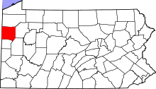
Location of Mercer County in Pennsylvania
This is a list of the Pennsylvania state historical markers in Mercer County.
This is intended to be a complete list of the official state historical markers placed in Mercer County, Pennsylvania by the Pennsylvania Historical and Museum Commission (PHMC). The locations of the historical markers, as well as the latitude and longitude coordinates as provided by the PHMC's database, are included below when available. There are 19 historical markers located in Mercer County.[1]
Historical markers[]
| Marker title | Image | Date dedicated | Location | Marker type | Topics |
|---|---|---|---|---|---|
| Albert Bushnell Hart | 
|
April 30, 1948 | S side PA 258 at PA 18, across from Tara restaurant, just N of Sharpsville 41°17′00″N 80°25′43″W / 41.28335°N 80.42853°W |
Roadside | Education, Professions & Vocations |

|
November 12, 1946 | PA 58 (628 Mercer Rd.) at Salem Rd., SE of Greenville 41°21′47″N 80°21′18″W / 41.36298°N 80.35499°W |
Roadside | Government & Politics, Government & Politics 19th Century, Governors | |
|
|
November 12, 1946 | Pa. 58 SE of Greenville (MISSING) |
Roadside | Government & Politics, Government & Politics 19th Century, Governors | |
| Camp Reynolds |
|
September 1, 1994 | Rte. 18 S of Greenville (MISSING) |
Roadside | Military, Military Post-Civil War |
|
|
January 20, 1949 | N side of US 62 at Clay Furnace Rd., W of Charleston 41°14′15″N 80°23′05″W / 41.23742°N 80.38486°W |
Roadside | Business & Industry, Coal, Furnaces, Iron | |
| Erie Extension Canal |
|
April 30, 1948 | Wasser Bridge Rd. (SR 4003) just E of Pa. 18, S of Greenville (Missing) |
Roadside | Canals, Environment, Navigation, Transportation |
| Erie Extension Canal |
|
November 12, 1946 | PA 18 & 518 (Lamar Rd.), Lamonts Corners, east of Sharpsville 41°15′26″N 80°27′10″W / 41.25722°N 80.45276°W |
Roadside | Canals, Navigation, Transportation |
| Erie Extension Canal |
|
November 12, 1947 | Wasser Bridge Road, .3 mile E of Pa. 18, S of Greenville (Missing) |
Roadside | Canals, Environment, Navigation, Transportation |
| Freedom Road |
|
August 23, 1948 | US 62, across from Great Stoneboro Fair, SW of Sandy Lake 41°20′07″N 80°05′50″W / 41.33535°N 80.09734°W |
Roadside | African American, Underground Railroad, Women |
|
|
n/a | N Diamond St., N side of Co. courthouse, right column support, Mercer 41°13′38″N 80°14′21″W / 41.22717°N 80.23911°W |
Plaque | American Revolution, Forts, French & Indian War, Military | |
| James Sheakley |
|
March 6, 1967 | E side of US 19, across from church, N end of Sheakleyville 40°26′43″N 79°59′08″W / 40.44521°N 79.98542°W |
Roadside | Government & Politics, Government & Politics 19th Century |
|
|
August 24, 1948 | US 19 (across from 1561 Perry Hwy.), near Dydek's Lane, N of Leesburg 41°09′00″N 80°13′24″W / 41.14998°N 80.22333°W |
Roadside | Buildings, Business & Industry, Inns & Taverns | |
|
|
July 15, 1995 | SR 4012 at Kidd's Mill Rd. (Kidd's Mill State Park), 5 miles S of Greenville 41°21′17″N 80°23′50″W / 41.35481°N 80.39709°W |
Roadside | Bridges, Transportation | |
| Mercer County |
|
May 12, 1983 | N Diamond St. at N side of Co courthouse, at Courthouse Square, Mercer 40°26′43″N 79°59′08″W / 40.44521°N 79.98542°W |
City | Government & Politics, Government & Politics 19th Century |
| Pennsylvania | 
|
n/a | S side of Tamarack Dr. (Rt. 718), Five Points, NW of Sharpsville, at state line 41°18′38″N 80°31′05″W / 41.31065°N 80.5181°W |
Roadside | Early Settlement, Government & Politics, Government & Politics 17th Century, William Penn |
| Pennsylvania | 
|
January 1, 1948 | SR 358 (Vernon Rd.) at state line, ~3 miles W of Maysville 41°23′14″N 80°31′07″W / 41.38729°N 80.51867°W |
Roadside | Government & Politics 17th Century, Government & Politics 18th Century, William Penn |
| Pymatuning |
|
November 12, 1946 | Pa. 258 E of Clark (Missing) |
Roadside | Early Settlement, Native American |
| Pymatuning |
|
November 12, 1946 | Pa. 258 E of Clark (Missing) |
Roadside | Early Settlement, Native American |
|
|
March 14, 1947 | Pa. 118 SE of West Middlesex (Missing) |
Roadside | Cities & Towns, Early Settlement, Native American |

See also[]
- List of Pennsylvania state historical markers
- National Register of Historic Places listings in Mercer County, Pennsylvania
References[]
- ^ "PHMC Historical Markers Search" (Searchable database). Pennsylvania Historical and Museum Commission. Commonwealth of Pennsylvania. Retrieved 2010-07-19.
External links[]
Municipalities and communities of Mercer County, Pennsylvania, United States | ||
|---|---|---|
| Cities |  | |
| Boroughs | ||
| Townships |
| |
| CDPs | ||
| Unincorporated communities | ||
| ||
Pennsylvania Historical and Museum Commission | ||
|---|---|---|
| Museums and Archives |
|  |
Categories:
- Mercer County, Pennsylvania
- Pennsylvania state historical markers
- Tourist attractions in Mercer County, Pennsylvania