From Wikipedia, the free encyclopedia
Aerial view of crossings in downtown Portland
This is a list of bridges and other crossings of the Willamette River in the U.S. state of Oregon from the Columbia River upstream to the confluence of the Middle Fork Willamette River and Coast Fork Willamette River . This confluence, at 44°01′24″N 123°01′26″W / 44.023318°N 123.023897°W / 44.023318; -123.023897 (Willamette River source )
Portland [ ]
Image
Crossing
Carries
Location
River mile
Year built
Coordinates
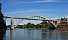
St. Johns Bridge
US 30 Byp. , sidewalks
Portland 5.8
1931
45°35′07″N 122°45′52″W / 45.58528°N 122.76444°W / 45.58528; -122.76444 (St. Johns Bridge )
Burlington Northern Railroad Bridge 5.1
BNSF Railway
Portland 7.0
1908
45°34′36″N 122°44′51″W / 45.57667°N 122.74750°W / 45.57667; -122.74750 (Burlington Northern Railroad Bridge 5.1 )
West Side CSO Tunnel
intercepted sewage overflow
Portland 10.0
2003
45°33′0″N 122°41′52″W / 45.55000°N 122.69778°W / 45.55000; -122.69778 (West Side CSO Tunnel )
Fremont Bridge
I-405 / US 30
Portland 11.1
1973
45°32′16″N 122°40′59″W / 45.53778°N 122.68306°W / 45.53778; -122.68306 (Fremont Bridge )
Broadway Bridge
Broadway ; Portland Streetcar ;Portland 11.7
1913
45°31′55″N 122°40′27″W / 45.53194°N 122.67417°W / 45.53194; -122.67417 (Broadway Bridge )
Steel Bridge
Union Pacific Railway Amtrak MAX Light Rail Eastbank Esplanade (lower level),Harbor Drive (former OR 99W )
Portland 12.1
1912
45°31′39″N 122°40′09″W / 45.52750°N 122.66917°W / 45.52750; -122.66917 (Steel Bridge )
Burnside Bridge
Burnside Street , sidewalks
Portland 12.4
1926
45°31′23″N 122°40′03″W / 45.52306°N 122.66750°W / 45.52306; -122.66750 (Burnside Bridge )
Morrison Bridge
Morrison Street, sidewalks
Portland 12.8
1958
45°31′04″N 122°40′11″W / 45.51778°N 122.66972°W / 45.51778; -122.66972 (Morrison Bridge )
Hawthorne Bridge
Hawthorne Boulevard, sidewalks
Portland 13.1
1910
45°30′47″N 122°40′14″W / 45.51306°N 122.67056°W / 45.51306; -122.67056 (Hawthorne Bridge )
Marquam Bridge
I-5
Portland 13.5
1966
45°30′29″N 122°40′09″W / 45.50806°N 122.66917°W / 45.50806; -122.66917 (Marquam Bridge )
Tilikum Crossing
TriMet MAX Orange Line and buses, Portland Streetcar , cycle lane , sidewalks
Portland 13.8
2015
45°30′18″N 122°40′01″W / 45.5049°N 122.6670°W / 45.5049; -122.6670 (Tilikum Crossing )
Ross Island Bridge
US 26 (Powell Boulevard), sidewalks
Portland 14.0
1926
45°30′04″N 122°39′52″W / 45.50111°N 122.66444°W / 45.50111; -122.66444 (Ross Island Bridge )
Sellwood Bridge
Tacoma Street, sidewalks
Portland 16.5
2016
45°27′52″N 122°39′56″W / 45.46444°N 122.66556°W / 45.46444; -122.66556 (Sellwood Bridge )
Northern Willamette Valley [ ] Middle Willamette Valley [ ] Southern Willamette Valley [ ] Former crossings [ ] See also [ ] Notes [ ]
^ a b Two former bridges over the Willamette River in Portland were named the Madison Street Bridge. Together, they were active from 1891 to 1909.[3] [4]
References [ ]
^ Edward Russo (September 15, 2009). "Popular river crossing renamed" . The Register-Guard ^ "Whilamut Passage Bridge Opens" . KEZI.com. August 8, 2013. Archived from the original on September 30, 2013. Retrieved November 30, 2014 .^ "Hawthorne Bridge: Spanning Willamette River on Hawthorne Boulevard, Portland, Multnomah County, Oregon" (PDF) . Historic American Engineering Record , National Park Service , United States Department of the Interior . p. 2. Retrieved August 18, 2016 .^ "Old Span Wrecked; Madison Bridge in Six Weeks Will Be Only Memory" . The Morning Oregonian . August 2, 1909. p. 14. Retrieved August 18, 2016 .
External links [ ] Categories :
Crossings of the Willamette River Lists of river crossings in the United States Oregon transportation-related lists Hidden categories:
CS1: Julian–Gregorian uncertainty Articles with short description Short description is different from Wikidata Lists of coordinates Geographic coordinate lists Articles with Geo Use mdy dates from September 2019 All articles with dead external links Articles with dead external links from May 2017