Lovewell, Kansas
Lovewell, Kansas | |
|---|---|
 | |
 Lovewell | |
| Coordinates: 39°51′55″N 97°58′54″W / 39.86528°N 97.98167°WCoordinates: 39°51′55″N 97°58′54″W / 39.86528°N 97.98167°W | |
| Country | United States |
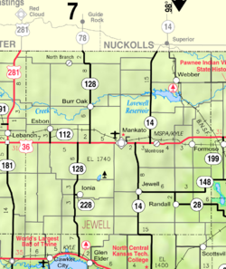
| State | Kansas |
| County | Jewell |
| Elevation | 1,558 ft (475 m) |
| Time zone | UTC-6 (CST) |
| • Summer (DST) | UTC-5 (CDT) |
| Area code | 785 |
| GNIS ID | 472822[1] |


Lovewell is an unincorporated community in Jewell County, Kansas, United States.[1]
History[]
Previously known as Lovewell Station.
Education[]
The community is served by Rock Hills USD 107 public school district.
References[]
Further reading[]
External links[]
Municipalities and communities of Jewell County, Kansas, United States | ||
|---|---|---|
| Cities |  | |
| Unincorporated communities | ||
| Ghost towns | ||
| Townships | ||
| Footnotes | †This populated place is designated a Census-Designated Place (CDP) by the United States Census Bureau. | |
| ||
Categories:
- Unincorporated communities in Jewell County, Kansas
- Unincorporated communities in Kansas