Montrose, Kansas
Montrose, Kansas | |
|---|---|
 | |
 Montrose | |
| Coordinates: 39°47′4″N 98°5′16″W / 39.78444°N 98.08778°WCoordinates: 39°47′4″N 98°5′16″W / 39.78444°N 98.08778°W[1] | |
| Country | United States |
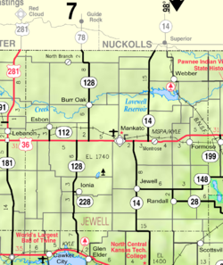
| State | Kansas |
| County | Jewell |
| Elevation | 1,644 ft (501 m) |
| Time zone | UTC-6 (CST) |
| • Summer (DST) | UTC-5 (CDT) |
| Area code | 785 |
| FIPS code | 20-48000 [1] |
| GNIS ID | 472005 [1] |


Montrose is an unincorporated community in Jewell County, Kansas, United States.[2]
History[]
A post office was first established as Delta in 1880, and the settlement was moved to the current site with the arrival of the Rock Island Railroad, and it was renamed Montrose in 1888.[3][4] The origin of the name Montrose is obscure.[5]
Education[]
The community is served by Rock Hills USD 107 public school district.
References[]
- ^ a b c d Geographic Names Information System (GNIS) details for Montrose, Kansas; United States Geological Survey (USGS); October 13, 1978.
- ^ "Montrose, Kansas". Geographic Names Information System. United States Geological Survey.
- ^ "Kansas Post Offices, 1828-1961". Kansas Historical Society. Retrieved 11 June 2014.
- ^ "Kansas Post Offices, 1828-1961, page 2 (archived)". Kansas Historical Society. Retrieved 11 June 2014.
- ^ "Montrose memories". The Superior Express. Jan 25, 2007. pp. 5B. Retrieved 18 October 2015.
Further reading[]
External links[]
Municipalities and communities of Jewell County, Kansas, United States | ||
|---|---|---|
| Cities |  | |
| Unincorporated communities | ||
| Ghost towns | ||
| Townships | ||
| Footnotes | †This populated place is designated a Census-Designated Place (CDP) by the United States Census Bureau. | |
| ||
Categories:
- Unincorporated communities in Jewell County, Kansas
- Unincorporated communities in Kansas