Esbon, Kansas
Esbon, Kansas | |
|---|---|
 Location within Jewell County and Kansas | |
 | |
| Coordinates: 39°49′22″N 98°26′2″W / 39.82278°N 98.43389°WCoordinates: 39°49′22″N 98°26′2″W / 39.82278°N 98.43389°W | |
| Country | United States |
| State | Kansas |
| County | Jewell |
| Founded | 1870s |
| Platted | 1873 |
| Incorporated | 1904 |
| Area | |
| • Total | 0.28 sq mi (0.73 km2) |
| • Land | 0.28 sq mi (0.73 km2) |
| • Water | 0.00 sq mi (0.00 km2) |
| Elevation | 1,844 ft (562 m) |
| Population | |
| • Total | 99 |
| • Estimate (2019)[3] | 92 |
| • Density | 327.40/sq mi (126.47/km2) |
| Time zone | UTC-6 (CST) |
| • Summer (DST) | UTC-5 (CDT) |
| ZIP code | 66941 |
| Area code | 785 |
| FIPS code | 20-21600 [4] |
| GNIS ID | 0471981 [5] |

Esbon is a city in Jewell County, Kansas, United States. As of the 2010 census, the city population was 99.[6]
History[]
Esbon was laid out in 1873.[7] It was incorporated as a city in 1904.[8]
The first post office in Esbon was established in January 1874.[9]
Esbon was a shipping point on the Chicago, Rock Island and Pacific Railroad.[8]
Geography[]
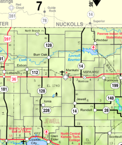
Esbon is located at 39°49′22″N 98°26′2″W / 39.82278°N 98.43389°W (39.822656, -98.433762).[10] According to the United States Census Bureau, the city has a total area of 0.31 square miles (0.80 km2), all of it land.[11]
The town lies 2.5 miles north of U.S. Route 36, and 13 miles west of Mankato, the county seat of Jewell County.
Demographics[]
| Historical population | |||
|---|---|---|---|
| Census | Pop. | %± | |
| 1910 | 347 | — | |
| 1920 | 375 | 8.1% | |
| 1930 | 319 | −14.9% | |
| 1940 | 292 | −8.5% | |
| 1950 | 278 | −4.8% | |
| 1960 | 237 | −14.7% | |
| 1970 | 206 | −13.1% | |
| 1980 | 234 | 13.6% | |
| 1990 | 167 | −28.6% | |
| 2000 | 148 | −11.4% | |
| 2010 | 99 | −33.1% | |
| 2019 (est.) | 92 | [3] | −7.1% |
| U.S. Decennial Census | |||
2010 census[]
As of the census[2] of 2010, there were 99 people, 52 households, and 24 families living in the city. The population density was 319.4 inhabitants per square mile (123.3/km2). There were 84 housing units at an average density of 271.0 per square mile (104.6/km2). The racial makeup of the city was 91.9% White, 1.0% African American, 3.0% Native American, and 4.0% from two or more races. Hispanic or Latino of any race were 1.0% of the population.
There were 52 households, of which 19.2% had children under the age of 18 living with them, 38.5% were married couples living together, 1.9% had a female householder with no husband present, 5.8% had a male householder with no wife present, and 53.8% were non-families. 48.1% of all households were made up of individuals, and 21.2% had someone living alone who was 65 years of age or older. The average household size was 1.90 and the average family size was 2.67.
The median age in the city was 52.3 years. 19.2% of residents were under the age of 18; 4.1% were between the ages of 18 and 24; 18.2% were from 25 to 44; 28.4% were from 45 to 64; and 30.3% were 65 years of age or older. The gender makeup of the city was 54.5% male and 45.5% female.
2000 census[]
As of the census[4] of 2000, there were 148 people, 71 households, and 37 families living in the city. The population density was 484.8 people per square mile (184.3/km2). There were 87 housing units at an average density of 285.0 per square mile (108.4/km2). The racial makeup of the city was 96.62% White and 3.38% Native American.
There were 71 households, out of which 19.7% had children under the age of 18 living with them, 46.5% were married couples living together, 7.0% had a female householder with no husband present, and 46.5% were non-families. 45.1% of all households were made up of individuals, and 23.9% had someone living alone who was 65 years of age or older. The average household size was 2.08 and the average family size was 3.00.
In the city, the population was spread out, with 23.0% under the age of 18, 4.7% from 18 to 24, 25.7% from 25 to 44, 20.3% from 45 to 64, and 26.4% who were 65 years of age or older. The median age was 44 years. For every 100 females, there were 87.3 males. For every 100 females age 18 and over, there were 103.6 males.
The median income for a household in the city was $26,875, and the median income for a family was $34,167. Males had a median income of $24,688 versus $13,125 for females. The per capita income for the city was $17,438. There were none of the families and 6.7% of the population living below the poverty line, including no under eighteens and 16.7% of those over 64.
Religion[]
The community has a Roman Catholic church (Sacred Heart), a United Methodist Church, and a Church of Christ.
Economy[]
The primary business enterprise of the town is a grain elevator at the north end of Grand Avenue. Farming is the principal occupation in the area around Esbon.
Education[]
The community is served by Rock Hills USD 107 public school district.[12] Esbon became a part of Rock Hills USD 107 located in Mankato in 2006 as the district was formed that year by the consolidation of White Rock USD 104 and Mankato USD 278.[13] The Rock Hills High School mascot is Grizzlies.[14] Esbon had an elementary school and high school until 1983.[15] The Esbon High School mascot was Esbon Tigers.[16]
The Esbon Tigers won the Kansas State High School boys class B Track & Field championship in 1947.[17]
School unification consolidated Esbon and Burr Oak schools forming White Rock schools in 1983. Esbon was home of White Rock Middle school located at 203 Grand Ave.[15] The White Rock elementary school and high school were located in Burr Oak. White Rock High School's mascot was the Eagles.[18]
References[]
- ^ "2019 U.S. Gazetteer Files". United States Census Bureau. Retrieved July 24, 2020.
- ^ a b "U.S. Census website". United States Census Bureau. Retrieved 2012-07-06.
- ^ a b "Population and Housing Unit Estimates". United States Census Bureau. May 24, 2020. Retrieved May 27, 2020.
- ^ a b "U.S. Census website". United States Census Bureau. Retrieved 2008-01-31.
- ^ "US Board on Geographic Names". United States Geological Survey. 2007-10-25. Retrieved 2008-01-31.
- ^ "2010 City Population and Housing Occupancy Status". U.S. Census Bureau. Retrieved March 6, 2011.[dead link]
- ^ Kansas State Historical Society (1916). Biennial Report of the Board of Directors of the Kansas State Historical Society. Kansas State Printing Plant. pp. 211.
- ^ a b Blackmar, Frank Wilson (1912). Kansas: A Cyclopedia of State History, Embracing Events, Institutions, Industries, Counties, Cities, Towns, Prominent Persons, Etc. Standard Publishing Company. pp. 597.
- ^ "Kansas Post Offices, 1828-1961". Kansas Historical Society. Retrieved 11 June 2014.
- ^ "US Gazetteer files: 2010, 2000, and 1990". United States Census Bureau. 2011-02-12. Retrieved 2011-04-23.
- ^ "US Gazetteer files 2010". United States Census Bureau. Archived from the original on 2012-01-25. Retrieved 2012-07-06.
- ^ "USD 107 Map" (PDF). Kansas Department of Transportation. Retrieved 2020-04-29.
- ^ "School consolidations in Kansas for past decade". The Topeka Capital-Journal. 2011-07-24. Retrieved 2020-04-26.
- ^ "Rock Hills". USD 107. Retrieved 1 January 2017.
- ^ a b EducationBug.org "Jewell County, Kansas Public Schools". Retrieved on 2008-02-14.
- ^ "Jamestown Set To Pickup The Marbles In PTL ", The Belleville Telescope, 8 December 1977, p.5.
- ^ "Track & Field". KSHSAA. Archived from the original on 13 November 2016. Retrieved 6 January 2017.
- ^ "Panthers, Cougars to Excel in PTL", The Salina Journal, 4 September 1983, p.81.
Further reading[]
External links[]
- Esbon - Directory of Public Officials
- Historic Images of Esbon, Wichita State University Library
- Esbon City Map, KDOT
Municipalities and communities of Jewell County, Kansas, United States | ||
|---|---|---|
| Cities |  | |
| Unincorporated communities | ||
| Ghost towns | ||
| Townships | ||
| Footnotes | †This community is designated a Census-Designated Place (CDP) by the United States Census Bureau. | |
| ||
- Cities in Kansas
- Cities in Jewell County, Kansas