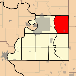
Marion Township, Buchanan County, Missouri
Marion Township | |
|---|---|
 | |
| Coordinates: 39°45′53″N 094°39′20″W / 39.76472°N 94.65556°WCoordinates: 39°45′53″N 094°39′20″W / 39.76472°N 94.65556°W | |
| Country | United States |
| State | Missouri |
| County | Buchanan |
| Area | |
| • Total | 48.26 sq mi (125 km2) |
| • Land | 48.21 sq mi (124.87 km2) |
| • Water | 0.05 sq mi (0.13 km2) 0.1% |
| Elevation | 846 ft (258 m) |
| Population (2010) | |
| • Total | 1,178 |
| • Density | 25.4/sq mi (9.8/km2) |
| FIPS code | 29-45938[2] |
| GNIS feature ID | 0766342 |

Marion Township is one of twelve townships in Buchanan County, Missouri, USA. As of the 2010 census, its population was 1,178.[3]
Marion Township was established in 1837.[4]
Geography[]
Marion Township covers an area of 48.26 square miles (125.0 km2) and contains one incorporated settlement, Easton. It contains eight cemeteries: Blakely, Bowen, Courtney, Kessler, Minor, Moxley, Saint Josephs and Saint Marys.
The streams of Becks Branch, James Branch, Little Third Fork, Muddy Creek, One Hundred and Two River and Third Fork run through this township.
References[]
- ^ "US Board on Geographic Names". United States Geological Survey. 2007-10-25. Retrieved 2008-01-31.
- ^ "U.S. Census website". United States Census Bureau. Retrieved 2008-01-31.
- ^ https://www.census.gov/prod/cen2010/cph-2-27.pdf
- ^ "Buchanan County Place Names, 1928–1945 (archived)". The State Historical Society of Missouri. Archived from the original on 24 June 2016. Retrieved 4 September 2016.CS1 maint: bot: original URL status unknown (link)
External links[]
Municipalities and communities of Buchanan County, Missouri, United States | ||
|---|---|---|
| Cities |  | |
| Villages | ||
| Townships | ||
| CDP | ||
| Other communities | ||
| Footnotes | ‡This populated place also has portions in an adjacent county or counties | |
| ||
This Buchanan County, Missouri state location article is a stub. You can help Wikipedia by . |
Categories:
- Townships in Buchanan County, Missouri
- Townships in Missouri
- Northwest Missouri geography stubs