Rushville, Missouri
Rushville, Missouri | |
|---|---|
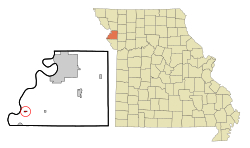 Location of Rushville, Missouri | |
 Rushville Location within Missouri | |
| Coordinates: 39°35′14″N 95°1′30″W / 39.58722°N 95.02500°WCoordinates: 39°35′14″N 95°1′30″W / 39.58722°N 95.02500°W | |
| Country | United States |
| State | Missouri |
| County | Buchanan |
| Township | Rush |
| Area | |
| • Total | 0.20 sq mi (0.51 km2) |
| • Land | 0.20 sq mi (0.51 km2) |
| • Water | 0.00 sq mi (0.00 km2) |
| Elevation | 817 ft (249 m) |
| Population | |
| • Total | 303 |
| • Estimate (2019)[5] | 280 |
| • Density | 1,414.14/sq mi (545.03/km2) |
| Time zone | UTC-6 (Central (CST)) |
| • Summer (DST) | UTC-5 (CDT) |
| ZIP code | 64484 |
| Area code(s) | 816 |
| FIPS code | 29-63596[3] |
| GNIS feature ID | 0730204[4] |


Rushville is a village in Buchanan County, Missouri, United States. The population was 303 at the 2010 census. It is part of the St. Joseph, MO–KS Metropolitan Statistical Area.
History[]
Rushville was laid out in 1847. The village name was derived from the dense growth of rushes nearby.[6]
Geography[]
Rushville is located at 39°35′14″N 95°1′30″W / 39.58722°N 95.02500°W (39.587324, -95.025131).[7]
According to the United States Census Bureau, the village has a total area of 0.25 square miles (0.65 km2), all land.[8]
Demographics[]
| Historical population | |||
|---|---|---|---|
| Census | Pop. | %± | |
| 1880 | 341 | — | |
| 1900 | 412 | — | |
| 1910 | 566 | 37.4% | |
| 1920 | 262 | −53.7% | |
| 1930 | 288 | 9.9% | |
| 1940 | 309 | 7.3% | |
| 1950 | 319 | 3.2% | |
| 1960 | 253 | −20.7% | |
| 1970 | 300 | 18.6% | |
| 1980 | 271 | −9.7% | |
| 1990 | 306 | 12.9% | |
| 2000 | 280 | −8.5% | |
| 2010 | 303 | 8.2% | |
| 2019 (est.) | 280 | [5] | −7.6% |
| U.S. Decennial Census[9] | |||
2010 census[]
As of the census[2] of 2010, there were 303 people, 112 households, and 81 families living in the village. The population density was 1,212.0 inhabitants per square mile (468.0/km2). There were 127 housing units at an average density of 508.0 per square mile (196.1/km2). The racial makeup of the village was 99.3% White and 0.7% from other races. Hispanic or Latino of any race were 0.7% of the population.
There were 112 households, of which 33.0% had children under the age of 18 living with them, 57.1% were married couples living together, 8.9% had a female householder with no husband present, 6.3% had a male householder with no wife present, and 27.7% were non-families. 21.4% of all households were made up of individuals, and 12.5% had someone living alone who was 65 years of age or older. The average household size was 2.71 and the average family size was 3.10.
The median age in the village was 37.8 years. 27.7% of residents were under the age of 18; 6.7% were between the ages of 18 and 24; 24.3% were from 25 to 44; 26.7% were from 45 to 64; and 14.5% were 65 years of age or older. The gender makeup of the village was 50.2% male and 49.8% female.
2000 census[]
As of the census[3] of 2000, there were 280 people, 113 households, and 78 families living in the town. The population density was 1,236.4 people per square mile (470.0/km2). There were 121 housing units at an average density of 534.3 per square mile (203.1/km2). The racial makeup of the town was 99.29% White, 0.36% Pacific Islander, and 0.36% from two or more races.
There were 113 households, out of which 34.5% had children under the age of 18 living with them, 54.0% were married couples living together, 7.1% had a female householder with no husband present, and 30.1% were non-families. 25.7% of all households were made up of individuals, and 12.4% had someone living alone who was 65 years of age or older. The average household size was 2.48 and the average family size was 2.99.
In the town the population was spread out, with 27.5% under the age of 18, 9.3% from 18 to 24, 27.5% from 25 to 44, 20.7% from 45 to 64, and 15.0% who were 65 years of age or older. The median age was 36 years. For every 100 females, there were 87.9 males. For every 100 females age 18 and over, there were 93.3 males.
The median income for a household in the town was $31,875, and the median income for a family was $36,071. Males had a median income of $26,563 versus $18,839 for females. The per capita income for the town was $15,147. About 8.0% of families and 11.2% of the population were below the poverty line, including 16.1% of those under the age of eighteen and 4.4% of those 65 or over.
References[]
- ^ "2019 U.S. Gazetteer Files". United States Census Bureau. Retrieved July 26, 2020.
- ^ Jump up to: a b "U.S. Census website". United States Census Bureau. Retrieved 2012-07-08.
- ^ Jump up to: a b "U.S. Census website". United States Census Bureau. Retrieved 2008-01-31.
- ^ "US Board on Geographic Names". United States Geological Survey. 2007-10-25. Retrieved 2008-01-31.
- ^ Jump up to: a b "Population and Housing Unit Estimates". United States Census Bureau. May 24, 2020. Retrieved May 27, 2020.
- ^ Eaton, David Wolfe (1916). How Missouri Counties, Towns and Streams Were Named. The State Historical Society of Missouri. pp. 264.
- ^ "US Gazetteer files: 2010, 2000, and 1990". United States Census Bureau. 2011-02-12. Retrieved 2011-04-23.
- ^ "US Gazetteer files 2010". United States Census Bureau. Archived from the original on 2012-01-25. Retrieved 2012-07-08.
- ^ "Census of Population and Housing". Census.gov. Retrieved June 4, 2015.
| show Municipalities and communities of Buchanan County, Missouri, United States |
|---|

| show Authority control |
|---|
- Villages in Buchanan County, Missouri
- St. Joseph, Missouri metropolitan area
- Villages in Missouri