Buchanan County, Missouri
Buchanan County | |
|---|---|
U.S. county | |
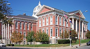 The Buchanan County Courthouse in downtown St. Joseph | |
 Location within the U.S. state of Missouri | |
 Missouri's location within the U.S. | |
| Coordinates: 39°40′N 94°49′W / 39.67°N 94.81°W | |
| Country | |
| State | |
| Founded | December 31, 1838 |
| Named for | James Buchanan |
| Seat | St. Joseph |
| Largest city | St. Joseph |
| Area | |
| • Total | 415 sq mi (1,070 km2) |
| • Land | 408 sq mi (1,060 km2) |
| • Water | 6.6 sq mi (17 km2) 1.6% |
| Population (2020) | |
| • Total | 84,793 |
| • Density | 200/sq mi (79/km2) |
| Time zone | UTC−6 (Central) |
| • Summer (DST) | UTC−5 (CDT) |
| Congressional district | 6th |
| Website | www |

Buchanan County is located in the U.S. state of Missouri. As of the 2020 United States Census, the population was 84,793.[1] Its county seat is St. Joseph.[2] When originally formed in 1838, the county was named Roberts County, after settler Hiram Roberts. It was renamed in 1839 for James Buchanan, then a U.S. Senator and later President of the United States. The county was formed from land annexed to Missouri, as were five other counties.
Buchanan County is included in the Kansas City CSA.
Geography[]
According to the U.S. Census Bureau, the county has a total area of 415 square miles (1,070 km2), of which 408 square miles (1,060 km2) is land and 6.6 square miles (17 km2) (1.6%) is water.[3]
Adjacent counties[]
- Andrew County (north)
- DeKalb County (northeast)
- Clinton County (east)
- Platte County (south)
- Atchison County, Kansas (southwest)
- Doniphan County, Kansas (northwest)
Major highways[]
 Interstate 29
 Interstate 229
 U.S. Route 36
 U.S. Route 59
 U.S. Route 71
 U.S. Route 169
 Route 6
 Route 31
 Route 116
 Route 371
Demographics[]
| Historical population | |||
|---|---|---|---|
| Census | Pop. | %± | |
| 1840 | 6,237 | — | |
| 1850 | 12,975 | 108.0% | |
| 1860 | 23,861 | 83.9% | |
| 1870 | 35,109 | 47.1% | |
| 1880 | 49,792 | 41.8% | |
| 1890 | 70,100 | 40.8% | |
| 1900 | 121,838 | 73.8% | |
| 1910 | 93,020 | −23.7% | |
| 1920 | 93,684 | 0.7% | |
| 1930 | 98,633 | 5.3% | |
| 1940 | 94,067 | −4.6% | |
| 1950 | 96,826 | 2.9% | |
| 1960 | 90,581 | −6.4% | |
| 1970 | 86,915 | −4.0% | |
| 1980 | 87,888 | 1.1% | |
| 1990 | 83,083 | −5.5% | |
| 2000 | 85,998 | 3.5% | |
| 2010 | 89,201 | 3.7% | |
| 2020 | 84,793 | −4.9% | |
| U.S. Decennial Census[4] 1790-1960[5] 1900-1990[6] 1990-2000[7] 2010-2015[1] | |||
As of the census[8] of 2000, there were 85,998 people, 33,557 households, and 21,912 families residing in the county. The population density was 210 people per square mile (81/km2). There were 36,574 housing units at an average density of 89 per square mile (34/km2). The racial makeup of the county was 92.73% White, 4.36% Black or African American, 0.42% Native American, 0.45% Asian, 0.02% Pacific Islander, 0.65% from other races, and 1.37% from two or more races. Approximately 2.43% of the population were Hispanic or Latino of any race.
There were 33,557 households, out of which 30.60% had children under the age of 18 living with them, 49.30% were married couples living together, 12.00% had a female householder with no husband present, and 34.70% were non-families. 28.90% of all households were made up of individuals, and 12.50% had someone living alone who was 65 years of age or older. The average household size was 2.42 and the average family size was 2.98.
In the county, the population was spread out, with 24.30% under the age of 18, 11.00% from 18 to 24, 28.50% from 25 to 44, 21.20% from 45 to 64, and 15.00% who were 65 years of age or older. The median age was 36 years. For every 100 females, there were 96.70 males. For every 100 females age 18 and over, there were 93.90 males.
The median income for a household in the county was $34,704, and the median income for a family was $42,408. Males had a median income of $31,697 versus $21,827 for females. The per capita income for the county was $17,882. About 8.50% of families and 12.20% of the population were below the poverty line, including 15.00% of those under age 18 and 9.60% of those age 65 or over.
Religion[]
According to the Association of Religion Data Archives County Membership Report (2010), Buchanan County is sometimes regarded as being on the northern edge of the Bible Belt, with evangelical Protestantism being the most predominant religion. The most predominant denominations among residents in Buchanan County who adhere to a religion are Southern Baptists (24.96%), Roman Catholics (20.35%), and nondenominational evangelical groups (15.95%).
Education[]
Public schools[]
- Buchanan County R-IV School District – De Kalb
- Rushville Elementary School (PK-06)
- De Kalb Junior/Senior High School (07-12)
- East Buchanan County C-I School District - Gower
- East Buchanan County C-I Middle School (06-08) - Easton
- Mid-Buchanan County R-V School District – Faucett
- Mid-Buchanan County Elementary School (PK-06)
- Mid-Buchanan County High School (07-12)
- St. Joseph School District – St. Joseph
- Coleman Elementary School (K-06)
- Edison Elementary School (PK-06)
- Ellison Elementary School (K-06)
- Field Elementary School (K-06)
- Hall Elementary School (PK-06)
- Hosea Elementary School (PK-06)
- Humboldt Elementary School (PK-06)
- Hyde Elementary School (K-06)
- Lake Elementary School (PK-06)
- Lindbergh Elementary School (PK-06)
- Mark Twain Elementary School (K-06)
- Neely Elementary School (PK-06)
- Noyes Elementary School (PK-06)
- Parkway Elementary School (PK-06)
- Pershing Elementary School (K-06)
- Pickett Elementary School (PK-06)
- Skaith Elementary School (PK-06)
- Webster Elementary School (PK-06)
- Bode Middle School (07-08)
- Robidoux Middle School (07-08)
- Spring Garden Middle (07-08)
- Truman Middle School (07-08)
- Benton High School (09-12)
- Central High School (09-12)
- Lafayette High School (09-12)
Private schools[]
- Baptist Temple Schools – St. Joseph (K-12) – Baptist
- Cathedral School & Early Childhood Center – St. Joseph (NS/PK-08) – Roman Catholic
- Prescott Seventh-day Adventist School – St. Joseph (02-08) – Seventh-day Adventist
- St. Francis Xavier School – St. Joseph (K-09) – Roman Catholic
- St. James School – St. Joseph (K-09) – Roman Catholic
- St. Joseph Christian School – St. Joseph (PK-12) – Nondenominational Christian
- St. Paul Lutheran School – St. Joseph (K-09) – Lutheran
- St. Joseph KinderCare – St. Joseph (NS-PK)
- South Park Christian Academy – St. Joseph (K-12) – Pentecostal
- Bishop LeBlond High School – St. Joseph (09-12) – Roman Catholic
Public libraries[]
Politics[]
Local[]
The Republican Party predominantly controls politics at the local level in Buchanan County. Republicans hold all but three of the elected positions in the county.
| Buchanan County, Missouri | |||
|---|---|---|---|
| Elected countywide officials | |||
| Assessor | Dean Wilson | Republican | |
| Auditor | Tara Horn | Republican | |
| Circuit Clerk | Ashley Thrasher | Republican | |
| County Clerk | Mary Baack-Garvey | Republican | |
| Collector | Peggy Campbell | Democratic | |
| Commissioner (Presiding) | Lee Sawyer | Republican | |
| Commissioner (Eastern District) | Scott Burnham | Republican | |
| Commissioner (Western District) | Ron Hook | Democratic | |
| Prosecuting Attorney | Ron Holliday | Democratic | |
| Public Administrator | Annette Bertelsen | Republican | |
| Recorder | Becky Dunlap | Republican | |
| Sheriff | Bill Puett | Republican | |
| Treasurer | David Gall | Republican | |
State[]
| Year | Republican | Democratic | Third Parties |
|---|---|---|---|
| 2020 | 60.85% 22,147 | 36.34% 13,225 | 2.81% 1,022 |
| 2016 | 52.60% 18,714 | 43.92% 15,628 | 3.48% 1,238 |
| 2012 | 39.61% 13,810 | 56.46% 19,685 | 3.92% 1,368 |
| 2008 | 37.39% 14,442 | 59.94% 23,151 | 2.67% 1,028 |
| 2004 | 50.03% 18,967 | 48.31% 18,317 | 1.66% 629 |
| 2000 | 45.18% 15,602 | 52.12% 17,998 | 2.70% 930 |
| 1996 | 29.76% 9,731 | 67.41% 22,045 | 2.83% 925 |
Buchanan County is split between three legislative districts in the Missouri House of Representatives, all of which are held by Republicans.
- District 9 – Dean Van Schoiack (R-Savannah). Consists of the eastern portion of the county.
| Party | Candidate | Votes | % | ±% | |
|---|---|---|---|---|---|
| Republican | Dean Van Schoiack | 6,598 | 65.10% | +4.41 | |
| Democratic | Karen Planalp | 3,537 | 34.90% | -4.41 | |
| Party | Candidate | Votes | % | ±% | |
|---|---|---|---|---|---|
| Republican | Shelia Solon | 5,154 | 60.69% | -39.31 | |
| Democratic | Bob Bergland | 3,338 | 39.31% | +39.31 | |
- District 10 – Bill Falkner (R-St. Joseph). The district is entirely based in the city of St. Joseph.
| Party | Candidate | Votes | % | ±% | |
|---|---|---|---|---|---|
| Republican | Bill Falkner | 7,110 | 61.03% | +2.89 | |
| Democratic | Colby Murphy | 4,541 | 38.98% | -2.89 | |
| Party | Candidate | Votes | % | ±% | |
|---|---|---|---|---|---|
| Republican | Bill Falkner | 5,753 | 58.13% | +58.13 | |
| Democratic | Shane R. Thompson | 4,144 | 41.87% | -58.13 | |
- District 11 – Brenda Shields (R-St. Joseph). Consists of the southern part of the county.
| Party | Candidate | Votes | % | ±% | |
|---|---|---|---|---|---|
| Republican | Brenda Shields | 9,737 | 70.29% | +5.42 | |
| Democratic | Brady Lee O'Dell | 4,115 | 29.71% | -5.42 | |
| Party | Candidate | Votes | % | ±% | |
|---|---|---|---|---|---|
| Republican | Brenda Shields | 7,275 | 64.87% | -35.13 | |
| Democratic | Brady Lee O'Dell | 3,940 | 35.13% | +35.13 | |
All of Buchanan County is a part of Missouri's 34th District in the Missouri Senate and is currently represented by Tony Luetkemeyer (R-Parkville).
| Party | Candidate | Votes | % | ±% | |
|---|---|---|---|---|---|
| Republican | Tony Luetkemeyer | 15,903 | 53.34% | -0.35 | |
| Democratic | Martin T. Rucker II | 13,913 | 46.66% | +0.35 | |
| Party | Candidate | Votes | % | ±% | |
|---|---|---|---|---|---|
| Republican | Rob Schaaf | 11,068 | 53.69% | ||
| Democratic | Robert Stuber | 9,936 | 46.31% | ||
Federal[]
All of Buchanan County is included in Missouri's 6th Congressional District and is currently represented by Sam Graves (R-Tarkio) in the U.S. House of Representatives. Graves was elected to an eleventh term in 2020 over Democratic challenger Gena Ross.
| Party | Candidate | Votes | % | ±% | |
|---|---|---|---|---|---|
| Republican | Sam Graves | 23,523 | 65.00% | +3.33 | |
| Democratic | Gena L. Ross | 11,659 | 32.22% | -2.58 | |
| Libertarian | Jim Higgins | 1,008 | 2.79% | -0.75 | |
| Party | Candidate | Votes | % | ±% | |
|---|---|---|---|---|---|
| Republican | Sam Graves | 18,471 | 61.67% | -2.59 | |
| Democratic | Henry Robert Martin | 10,422 | 34.80% | +2.97 | |
| Libertarian | Dan Hogan | 1,060 | 3.54% | +1.04 | |
Buchanan County, along with the rest of the state of Missouri, is represented in the U.S. Senate by Josh Hawley (R-Columbia) and Roy Blunt (R-Strafford).
| Party | Candidate | Votes | % | ±% | |
|---|---|---|---|---|---|
| Republican | Josh Hawley | 15,912 | 52.83% | +18.59 | |
| Democratic | Claire McCaskill | 12,889 | 42.80% | -15.93 | |
| Independent | Craig O'Dear | 617 | 2.05% | ||
| Libertarian | Japheth Campbell | 519 | 1.72% | -5.31 | |
| Green | Jo Crain | 180 | 0.60% | +0.60 | |
Blunt was elected to a second term in 2016 over then-Missouri Secretary of State Jason Kander.
| Party | Candidate | Votes | % | ±% | |
|---|---|---|---|---|---|
| Republican | Roy Blunt | 17,658 | 49.60% | +15.36 | |
| Democratic | Jason Kander | 16,103 | 45.23% | -13.50 | |
| Libertarian | Jonathan Dine | 1,043 | 2.93% | -4.10 | |
| Green | Johnathan McFarland | 515 | 1.45% | +1.45 | |
| Constitution | Fred Ryman | 282 | 0.79% | +0.79 | |
Political culture[]
At the presidential level, Buchanan County is a swing county that has become increasingly Republican in recent years. Buchanan County strongly favored Donald Trump in both 2016 and 2020. Barack Obama was the last Democratic presidential nominee to carry Buchanan County in 2008 with a plurality of the vote, but a Democrat hasn't won majority support from the county's voters in a presidential election since Michael Dukakis in 1988.
Missouri presidential preference primaries[]
2020[]
The 2020 presidential primaries for both the Democratic and Republican parties were held in Missouri on March 10. On the Democratic side, former Vice President Joe Biden (D-Delaware) both won statewide and carried Buchanan County by a wide margin. Biden went on to defeat President Donald Trump in the general election.
| Party | Candidate | Votes | % | ±% | |
|---|---|---|---|---|---|
| Democratic | Joe Biden | 4,322 | 57.99 | ||
| Democratic | Bernie Sanders | 2,645 | 35.49 | ||
| Democratic | Tulsi Gabbard | 81 | 1.09 | ||
| Democratic | Others/Uncommitted | 405 | 5.43 | ||
Incumbent President Donald Trump (R-Florida) faced a primary challenge from former Massachusetts Governor Bill Weld, but won both Buchanan County and statewide by overwhelming margins.
| Party | Candidate | Votes | % | ±% | |
|---|---|---|---|---|---|
| Republican | Donald Trump | 3,528 | 96.24 | ||
| Republican | Bill Weld | 23 | 0.63 | ||
| Republican | Others/Uncommitted | 115 | 3.14 | ||
2016[]
The 2016 presidential primaries for both the Republican and Democratic parties were held in Missouri on March 15. Businessman Donald Trump (R-New York) narrowly won the state overall and carried a plurality in Buchanan County. He went on to win the presidency.
| Party | Candidate | Votes | % | ±% | |
|---|---|---|---|---|---|
| Republican | Donald Trump | 4,691 | 41.65 | ||
| Republican | Ted Cruz | 3,879 | 34.44 | ||
| Republican | John Kasich | 1,478 | 13.12 | ||
| Republican | Marco Rubio | 847 | 7.52 | ||
| Republican | Others/Uncommitted | 369 | 3.28 | ||
On the Democratic side, former Secretary of State Hillary Clinton (D-New York) narrowly won statewide, but Senator Bernie Sanders (I-Vermont) carried Buchanan County.
| Party | Candidate | Votes | % | ±% | |
|---|---|---|---|---|---|
| Democratic | Bernie Sanders | 4,148 | 53.65 | ||
| Democratic | Hillary Clinton | 3,443 | 44.54 | ||
| Democratic | Others/Uncommitted | 140 | 1.81 | ||
2012[]
The 2012 Missouri Republican Presidential Primary's results were nonbinding on the state's national convention delegates. Voters in Buchanan County supported former U.S. Senator Rick Santorum (R-Pennsylvania), who finished first in the state at large, but eventually lost the nomination to former Governor Mitt Romney (R-Massachusetts). Delegates to the congressional district and state conventions were chosen at a county caucus, which selected a delegation favoring Romney. Incumbent President Barack Obama easily won the Missouri Democratic Primary and renomination. He defeated Romney in the general election.
2008[]
In 2008, the Missouri Republican Presidential Primary was closely contested, with Senator John McCain (R-Arizona) prevailing and eventually winning the nomination. However, former Governor Mitt Romney (R-Massachusetts) narrowly carried Buchanan County.
| Party | Candidate | Votes | % | ±% | |
|---|---|---|---|---|---|
| Republican | Mitt Romney | 2,216 | 31.94 | ||
| Republican | John McCain | 2,194 | 31.63 | ||
| Republican | Mike Huckabee | 1,825 | 26.31 | ||
| Republican | Ron Paul | 521 | 7.51 | ||
| Republican | Others/Uncommitted | 181 | 2.60 | ||
Then-Senator Hillary Clinton (D-New York) received more votes than any candidate from either party in Buchanan County during the 2008 presidential primary. Despite initial reports that Clinton had won Missouri, Barack Obama (D-Illinois), also a Senator at the time, narrowly defeated her statewide and later became that year's Democratic nominee, going on to win the presidency.
| Party | Candidate | Votes | % | ±% | |
|---|---|---|---|---|---|
| Democratic | Hillary Clinton | 6,689 | 57.09 | ||
| Democratic | Barack Obama | 4,427 | 37.78 | ||
| Democratic | Others/Uncommitted | 601 | 5.13 | ||
Communities[]
Cities[]
Villages[]
- Agency
- Lewis and Clark Village
- Rushville
Unincorporated communities[]
Townships[]
Buchanan County is divided into 12 townships:
Notable people[]
- Charles S.L. Baker, African American businessman and inventor
- Kay Barnes, Mayor of Kansas City, Missouri (1999–2007)
- Dwayne Blakley, professional football player[12]
- Ryan Bradley, figure skater
- Norbert Brodine, cinematographer
- Byron Browne, professional baseball player
- Charles Francis Buddy, bishop, attended Christian Brothers School
- Rob Calloway, boxer
- Harold F. Cherniss, historian of ancient Greece and Plato scholar at Princeton
- Walter Cronkite, iconic television journalist
- Paul Crouch, founder of Trinity Broadcasting Network
- Katherine Kennicott Davis, composer of "The Little Drummer Boy"
- Eminem, rapper and recording artist
- Eugene Field, popular poet in his day, worked for the St. Joseph Gazette and wrote a famous poem about Lover's Lane in St. Joseph
- Ralph D. Foster, broadcasting pioneer
- Betty Garrett, actress, known for On the Town and Laverne & Shirley
- Elijah Gates, State Treasurer of Missouri (1877-1881)
- Anthony Glise, guitarist
- Jody Hamilton, wrestler
- Larry Hamilton, wrestler
- Fred Harman, artist, drew the Red Ryder cartoons and worked with Walt Disney
- Coleman Hawkins, jazz saxophonist[13]
- Shere Hite, sex educator
- Edie Huggins, television journalist[14]
- Bela M. Hughes, pioneer, prominent St. Joseph lawyer in 1850s and 1860s[15]
- William Hyde (journalist), journalist
- Henry Iba, Oklahoma State University men's basketball coach
- Jesse James, iconic outlaw, murdered in St. Joseph
- Kagney Linn Karter, porn actress
- Brian McDonald, writer[16]
- Jeff Morris, actor, known for The Blues Brothers
- Timothy Omundson, actor
- Isaac Parker, federal judge, U.S. Representative from Missouri (1871-1875)
- Travis Partridge, professional football player
- Forrest E. Peden, decorated World War II soldier
- Tom Pendergast, political boss
- Seraphine Eppstein Pisko, executive secretary of the Denver Jewish Hospital
- Frank Posegate, mayor of St. Joseph
- LeRoy Prinz, choreographer and film director
- Arthur Pryor, trombonist
- Sid Rogell, Hollywood producer
- Nellie Tayloe Ross, first woman elected governor of a U.S. state; Governor of Wyoming (1925–1927)[17]
- Martin Rucker, professional football player
- Mike Rucker, professional football player
- Jay Sarno, hotel mogul, founder of Caesars Palace
- Bill Snyder, Kansas State football coach
- Eddie Timanus, Jeopardy! champion, won five times in 1999 despite being blind
- Steve Walsh, musician of band Kansas
- Ruth Warrick, actress, known for Citizen Kane and All My Children
- Jim Webb, U.S. Senator from Virginia (2007-2013)
- Silas Woodson, 21st Governor of Missouri (1873-1875)[18]
- Huston Wyeth, industrialist
- Jane Wyman, Oscar–winning actress and first wife of Ronald Reagan
- Delmer J. Yoakum, artist
- Olive Young, actress and blues singer
See also[]
- List of counties in Missouri
- National Register of Historic Places listings in Buchanan County, Missouri
References[]
- ^ Jump up to: a b "2020 Population and Housing State Data". United States Census Bureau. Retrieved August 31, 2021.
- ^ "Find a County". National Association of Counties. Archived from the original on 2011-05-31. Retrieved 2011-06-07.
- ^ "2010 Census Gazetteer Files". United States Census Bureau. August 22, 2012. Archived from the original on October 21, 2013. Retrieved November 13, 2014.
- ^ "U.S. Decennial Census". United States Census Bureau. Retrieved November 13, 2014.
- ^ "Historical Census Browser". University of Virginia Library. Retrieved November 13, 2014.
- ^ "Population of Counties by Decennial Census: 1900 to 1990". United States Census Bureau. Retrieved November 13, 2014.
- ^ "Census 2000 PHC-T-4. Ranking Tables for Counties: 1990 and 2000" (PDF). United States Census Bureau. Retrieved November 13, 2014.
- ^ "U.S. Census website". United States Census Bureau. Retrieved 2011-05-14.
- ^ Breeding, Marshall. "Rolling Hills Consolidated Library -- Belt Branc". Libraries.org. Retrieved May 8, 2017.
- ^ Breeding, Marshall. "Saint Joseph Public Library". Libraries.org. Retrieved May 8, 2017.
- ^ Leip, David. "Dave Leip's Atlas of U.S. Presidential Elections". uselectionatlas.org. Retrieved 2018-03-24.
- ^ "Dwayne Blakley". databaseFootball.com. Archived from the original on May 30, 2012. Retrieved September 29, 2012.
- ^ Coleman Hawkins Biography, biography.com Retrieved October 27, 2012
- ^ Dribben, Melissa (2008-07-30). "Edie Huggins 1935-2008: A versatile, dogged, endearing NBC10 face". Philadelphia Inquirer. Archived from the original on 2008-08-01. Retrieved 2008-08-18.
- ^ Christensen, Lawrence O.; Foley, William E.; Kramer, Gary R.; Winn, Kenneth H. (1999). Dictionary of Missouri Biography. Columbia, MO: University of Missouri Press. p. 813. ISBN 9780826212221.
- ^ "Interview with Brian McDonald, part 1". Adelaide Screenwriter. Retrieved 31 January 2014.
- ^ "Wyoming Governor Nellie Tayloe Ross". National Governors Association. Retrieved October 14, 2013.
- ^ Christensen, Lawrence O.; Foley, William E.; Kramer, Gary R.; Winn, Kenneth H. (1999). Dictionary of Missouri Biography. Columbia, MO: University of Missouri Press. p. 813. ISBN 9780826212221.
External links[]
- Buchanan County government's website
- St. Joseph Missouri City Directories
- St. Joseph Missouri Yearbook Indexes
- Digitized 1930 Plat Book of Buchanan County Archived 2011-08-16 at the Wayback Machine from University of Missouri Division of Special Collections, Archives, and Rare Books
| show Places adjacent to Buchanan County, Missouri |
|---|
| show Municipalities and communities of Buchanan County, Missouri, United States |
|---|


Coordinates: 39°40′N 94°49′W / 39.67°N 94.81°W
| show Authority control |
|---|
- Missouri counties
- Buchanan County, Missouri
- St. Joseph, Missouri metropolitan area
- 1838 establishments in Missouri
- Populated places established in 1838
- Missouri counties on the Missouri River
- James Buchanan