Hickory County, Missouri
Hickory County | |
|---|---|
U.S. county | |
 Hickory County courthouse in Hermitage | |
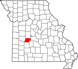 Location within the U.S. state of Missouri | |
 Missouri's location within the U.S. | |
| Coordinates: 37°56′N 93°19′W / 37.94°N 93.32°W | |
| Country | |
| State | |
| Founded | February 14, 1845 |
| Named for | Andrew Jackson, nicknamed "Old Hickory" |
| Seat | Hermitage |
| Largest city | Hermitage |
| Area | |
| • Total | 412 sq mi (1,070 km2) |
| • Land | 399 sq mi (1,030 km2) |
| • Water | 13 sq mi (30 km2) 3.1% |
| Population (2010) | |
| • Total | 9,627 |
| • Estimate (2018) | 9,509 |
| • Density | 23/sq mi (9.0/km2) |
| Time zone | UTC−6 (Central) |
| • Summer (DST) | UTC−5 (CDT) |
| Congressional district | 4th |
| Website | Hickory County, Missouri |

Hickory County is a county located in the U.S. state of Missouri. As of the 2010 census, the population was 9,627.[1] Its county seat is Hermitage.[2] The county was organized February 14, 1845, and named after President Andrew Jackson, whose nickname was "Old Hickory."[3][4] The Pomme de Terre Dam, a Corps of Engineers facility, is located three miles south of Hermitage and forms Lake Pomme de Terre by damming the Pomme de Terre River and Lindley Creek. The county is also home to Lucas Oil Speedway at Wheatland that includes a major circle dirt racing track, an off-road racing track as well as a large man-made water drag racing facility. Truman Reservoir, also a Corps of Engineers facility, floods the Pomme de Terre Reservoir from the northern border of the county southward to the city limits of Hermitage.
Geography[]
According to the U.S. Census Bureau, the county has a total area of 412 square miles (1,070 km2), of which 399 square miles (1,030 km2) is land and 13 square miles (34 km2) (3.1%) is water.[5] It is the fifth-smallest county in Missouri by area.
Adjacent counties[]
- Benton County (north)
- Camden County (east)
- Dallas County (southeast)
- Polk County (south)
- St. Clair County (west)
Major highways[]
Demographics[]
| Historical population | |||
|---|---|---|---|
| Census | Pop. | %± | |
| 1850 | 2,329 | — | |
| 1860 | 4,705 | 102.0% | |
| 1870 | 6,452 | 37.1% | |
| 1880 | 7,387 | 14.5% | |
| 1890 | 9,453 | 28.0% | |
| 1900 | 9,985 | 5.6% | |
| 1910 | 8,741 | −12.5% | |
| 1920 | 7,033 | −19.5% | |
| 1930 | 6,430 | −8.6% | |
| 1940 | 6,506 | 1.2% | |
| 1950 | 5,387 | −17.2% | |
| 1960 | 4,516 | −16.2% | |
| 1970 | 4,481 | −0.8% | |
| 1980 | 6,367 | 42.1% | |
| 1990 | 7,335 | 15.2% | |
| 2000 | 8,940 | 21.9% | |
| 2010 | 9,627 | 7.7% | |
| 2018 (est.) | 9,509 | [6] | −1.2% |
| U.S. Decennial Census[7] 1790-1960[8] 1900-1990[9] 1990-2000[10] 2010-2015[1] | |||
As of the census[11] of 2000, there were 8,940 people, 3,911 households, and 2,737 families residing in the county. The population density was 22 people per square mile (9/km2). There were 6,184 housing units at an average density of 16 per square mile (6/km2). The racial makeup of the county was 97.51% White, 0.08% Black or African American, 0.66% Native American, 0.11% Asian, 0.20% from other races, and 1.44% from two or more races. Approximately 0.76% of the population were Hispanic or Latino of any race.
There were 3,911 households, out of which 22.00% had children under the age of 18 living with them, 59.90% were married couples living together, 6.70% had a female householder with no husband present, and 30.00% were non-families. 26.50% of all households were made up of individuals, and 15.10% had someone living alone who was 65 years of age or older. The average household size was 2.26 and the average family size was 2.70.
In the county, the population was spread out, with 19.90% under the age of 18, 5.30% from 18 to 24, 19.10% from 25 to 44, 29.70% from 45 to 64, and 26.10% who were 65 years of age or older. The median age was 50 years. For every 100 females there were 96.00 males. For every 100 females age 18 and over, there were 92.70 males.
The median income for a household in the county was $25,346, and the median income for a family was $28,779. Males had a median income of $22,679 versus $17,610 for females. The per capita income for the county was $13,536. About 13.00% of families and 19.70% of the population were below the poverty line, including 32.90% of those under age 18 and 11.00% of those age 65 or over.
Education[]
Public schools[]
- Hermitage R-IV School District – Hermitage
- Hermitage Elementary School (PK-05)
- Hermitage Middle School (06-08)
- Hermitage High School (09-12)
- Hickory County R-I School District – Urbana
- Skyline Elementary School (K-04)
- Skyline Middle School (05-08)
- Skyline High School (09-12)
- Weaubleau R-III School District – Weaubleau
- Weaubleau Elementary School (PK-06)
- Weaubleau High School (07-12)
- Wheatland R-II School District[1]
- Wheatland Elementary School (PK-06)
- Wheatland High School (07-12)
Public libraries[]
- Hickory County Library[12]
Politics[]
This section does not cite any sources. (June 2014) |
Local[]
The Republican Party predominantly controls politics at the local level in Hickory County. Republicans hold all but four of the elected positions in the county.
| Hickory County, Missouri | |||
|---|---|---|---|
| Elected countywide officials | |||
| Assessor | Clint Baker | Republican | |
| Circuit Clerk | Cee Cee Smith | Republican | |
| County Clerk | Jeannie Lindsey | Republican | |
| Collector | Karen Stokes | Republican | |
| Commissioner (Presiding) | Robert Sawyer | Republican | |
| Commissioner (District 1) | Chase Crawford | Democratic | |
| Commissioner (District 2) | Rick Pearson | Republican | |
| Coroner | Connie Boller | Republican | |
| Prosecuting Attorney | Michael Brown | Republican | |
| Public Administrator | Vanessa Prettyman | Republican | |
| Recorder | Pamela Hutton | Republican | |
| Sheriff | Brian Whalen | Republican | |
| Surveyor | T. Philip Nasalroad | Democratic | |
| Treasurer | Kenny Ratliff | Republican | |
State[]
| Year | Republican | Democratic | Third Parties |
|---|---|---|---|
| 2016 | 62.30% 2,936 | 34.12% 1,608 | 3.58% 169 |
| 2012 | 46.65% 2,177 | 50.01% 2,334 | 3.34% 156 |
| 2008 | 35.62% 1,820 | 60.96% 3,115 | 3.42% 175 |
| 2004 | 56.54% 2,750 | 42.17% 2,051 | 1.30% 63 |
| 2000 | 47.74% 1,869 | 50.46% 2,132 | 1.80% 76 |
| 1996 | 47.36% 1,869 | 49.90% 1,969 | 2.74% 108 |
All of Hickory County is a part of Missouri's 125th District in the Missouri House of Representatives and is represented by Warren D. Love (R-Osceola).
| Party | Candidate | Votes | % | ±% | |
|---|---|---|---|---|---|
| Republican | Warren D. Love | 3,977 | 100.00% | ||
| Party | Candidate | Votes | % | ±% | |
|---|---|---|---|---|---|
| Republican | Warren D. Love | 2,006 | 100.00% | ||
| Party | Candidate | Votes | % | ±% | |
|---|---|---|---|---|---|
| Republican | Warren D. Love | 3,931 | 100.00% | ||
All of Hickory County is a part of Missouri's 28th District in the Missouri Senate. The seat is held by Sandy Crawford who was elected after the previous incumbent, Mike Parson, was elected Lieutenant Governor in 2016.
| Party | Candidate | Votes | % | ±% | |
|---|---|---|---|---|---|
| Republican | Mike Parson | 2,075 | 100.00% | ||
Federal[]
| Party | Candidate | Votes | % | ±% | |
|---|---|---|---|---|---|
| Republican | Roy Blunt | 2,959 | 62.93% | +20.24 | |
| Democratic | Jason Kander | 1,490 | 31.69% | -17.67 | |
| Libertarian | Jonathan Dine | 135 | 2.87% | -5.08 | |
| Green | Johnathan McFarland | 69 | 1.47% | +1.47 | |
| Constitution | Fred Ryman | 49 | 1.04% | +1.04 | |
| Party | Candidate | Votes | % | ±% | |
|---|---|---|---|---|---|
| Republican | Todd Akin | 1,982 | 42.69% | ||
| Democratic | Claire McCaskill | 2,292 | 49.36% | ||
| Libertarian | Jonathan Dine | 369 | 7.95% | ||
All of Hickory County is included in Missouri's 4th Congressional District and is currently represented by Vicky Hartzler (R-Harrisonville) in the U.S. House of Representatives.
| Party | Candidate | Votes | % | ±% | |
|---|---|---|---|---|---|
| Republican | Vicky Hartzler | 3,434 | 74.44% | +1.87 | |
| Democratic | Gordon Christensen | 994 | 21.55% | -1.76 | |
| Libertarian | Mark Bliss | 185 | 4.01% | -0.11 | |
| Party | Candidate | Votes | % | ±% | |
|---|---|---|---|---|---|
| Republican | Vicky Hartzler | 1,778 | 72.57% | +8.57 | |
| Democratic | Nate Irvin | 571 | 23.31% | -9.02 | |
| Libertarian | Herschel L. Young | 101 | 4.12% | +1.20 | |
| Party | Candidate | Votes | % | ±% | |
|---|---|---|---|---|---|
| Republican | Vicky Hartzler | 2,963 | 64.00% | ||
| Democratic | Teresa Hensley | 1,497 | 32.33% | ||
| Libertarian | Thomas Hollbrook | 135 | 2.92% | ||
| Constitution | Greg Cowan | 35 | 0.75% | ||
Political culture[]
Missouri presidential preference primary (2008)[]
- Former U.S. Senator Hillary Clinton (D-New York) received more votes, a total of 1,056, than any candidate from either party in Hickory County during the 2008 presidential primary.
| Hickory County, Missouri | |
|---|---|
| 2008 Republican primary in Missouri | |
| John McCain | 453 (33.19%) |
| Mike Huckabee | 548 (40.15%) |
| Mitt Romney | 238 (20.73%) |
| Ron Paul | 64 (4.69%) |
| Hickory County, Missouri | |
|---|---|
| 2008 Democratic primary in Missouri | |
| Hillary Clinton | 1,056 (67.95%) |
| Barack Obama | 433 (27.86%) |
| John Edwards (withdrawn) | 52 (3.35%) |
Communities[]
Cities and Towns[]
- Cross Timbers
- Hermitage (county seat)
- Preston
- Weaubleau
- Wheatland
Unincorporated Communities[]
Notable people[]
- Mike Parson - 57th Governor of Missouri
- Sally Rand – legendary burlesque dancer
See also[]
- National Register of Historic Places listings in Hickory County, Missouri
References[]
- ^ Jump up to: a b "State & County QuickFacts". United States Census Bureau. Archived from the original on June 7, 2011. Retrieved September 9, 2013.
- ^ "Find a County". National Association of Counties. Archived from the original on 2011-05-31. Retrieved 2011-06-07.
- ^ Eaton, David Wolfe (1916). How Missouri Counties, Towns and Streams Were Named. The State Historical Society of Missouri. pp. 172.
- ^ Gannett, Henry (1905). The Origin of Certain Place Names in the United States. Govt. Print. Off. pp. 156.
- ^ "2010 Census Gazetteer Files". United States Census Bureau. August 22, 2012. Archived from the original on October 21, 2013. Retrieved November 16, 2014.
- ^ "Population and Housing Unit Estimates". Retrieved November 20, 2019.
- ^ "U.S. Decennial Census". United States Census Bureau. Retrieved November 16, 2014.
- ^ "Historical Census Browser". University of Virginia Library. Retrieved November 16, 2014.
- ^ "Population of Counties by Decennial Census: 1900 to 1990". United States Census Bureau. Retrieved November 16, 2014.
- ^ "Census 2000 PHC-T-4. Ranking Tables for Counties: 1990 and 2000" (PDF). United States Census Bureau. Retrieved November 16, 2014.
- ^ "U.S. Census website". United States Census Bureau. Retrieved 2008-01-31.
- ^ Breeding, Marshall. "Hickory County Library". Libraries.org. Retrieved May 8, 2017.
- ^ Jump up to: a b c "County Results - State of Missouri - 2016 General Election - November 8, 2016 - Official Results". Missouri Secretary of state. December 12, 2016. Retrieved April 28, 2017.
- ^ Leip, David. "Dave Leip's Atlas of U.S. Presidential Elections". uselectionatlas.org. Retrieved 2018-03-25.
External links[]
- Hickory County government's website
- Digitized 1930 Plat Book of Hickory County Archived 2011-08-16 at the Wayback Machine from University of Missouri Division of Special Collections, Archives, and Rare Books
| show Places adjacent to Hickory County, Missouri |
|---|
| show Municipalities and communities of Hickory County, Missouri, United States |
|---|


Coordinates: 37°56′N 93°19′W / 37.94°N 93.32°W
| show Authority control |
|---|
- Missouri counties
- Hickory County, Missouri
- 1845 establishments in Missouri
- Populated places established in 1845