Clinton County, Missouri
Clinton County | |
|---|---|
U.S. county | |
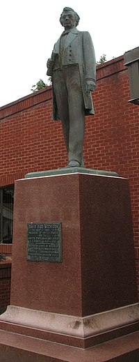 Statue of "President for a Day" David Rice Atchison at the Clinton County Courthouse. | |
 Location within the U.S. state of Missouri | |
 Missouri's location within the U.S. | |
| Coordinates: 39°36′N 94°24′W / 39.6°N 94.4°W | |
| Country | |
| State | |
| Founded | January 2, 1833 |
| Named for | DeWitt Clinton |
| Seat | Plattsburg |
| Largest city | Cameron |
| Area | |
| • Total | 423 sq mi (1,100 km2) |
| • Land | 419 sq mi (1,090 km2) |
| • Water | 4.5 sq mi (12 km2) 1.1% |
| Population (2010) | |
| • Total | 20,743 |
| • Estimate (2018) | 20,470 |
| • Density | 49/sq mi (19/km2) |
| Time zone | UTC−6 (Central) |
| • Summer (DST) | UTC−5 (CDT) |
| Congressional district | 6th |
| Website | www |

Clinton County is a county located in the U.S. state of Missouri and is part of the Kansas City metropolitan area.[1] As of the 2010 U.S. Census, the county had a population of 20,743.[2] Its county seat is Plattsburg.[3] The county was organized January 2, 1833 and named for Governor DeWitt Clinton of New York.[4][5] The county seat of Plattsburg derives its name from a town of a similar name that is the county seat of Clinton County, New York, which was also named for the Governor.
Geography[]
According to the U.S. Census Bureau, the county has a total area of 423 square miles (1,100 km2), of which 419 square miles (1,090 km2) is land and 4.5 square miles (12 km2) (1.1%) is water.[6]
Adjacent counties[]
- DeKalb County (north)
- Caldwell County (east)
- Ray County (southeast)
- Clay County (south)
- Platte County (southwest)
- Buchanan County (west)
Major highways[]
Demographics[]
| Historical population | |||
|---|---|---|---|
| Census | Pop. | %± | |
| 1840 | 2,724 | — | |
| 1850 | 3,786 | 39.0% | |
| 1860 | 7,848 | 107.3% | |
| 1870 | 14,063 | 79.2% | |
| 1880 | 16,073 | 14.3% | |
| 1890 | 17,138 | 6.6% | |
| 1900 | 17,363 | 1.3% | |
| 1910 | 15,297 | −11.9% | |
| 1920 | 14,461 | −5.5% | |
| 1930 | 13,505 | −6.6% | |
| 1940 | 13,261 | −1.8% | |
| 1950 | 11,726 | −11.6% | |
| 1960 | 11,588 | −1.2% | |
| 1970 | 12,462 | 7.5% | |
| 1980 | 15,916 | 27.7% | |
| 1990 | 16,595 | 4.3% | |
| 2000 | 18,979 | 14.4% | |
| 2010 | 20,743 | 9.3% | |
| 2018 (est.) | 20,470 | [7] | −1.3% |
| U.S. Decennial Census[8] 1790-1960[9] 1900-1990[10] 1990-2000[11] 2010-2015[2] | |||
As of the census[12] of 2017, there were 20,554[13] people, 8,990[13] households, and 8,299[13] families residing in the county. The population density was 49.5 people per square mile (18/km2). There were 7,877 housing units at an average density of 19 per square mile (7/km2). The racial makeup of the county was 95.5% White, 1.4% Black or African American, 0.7% Native American, 0.4% Asian, 0.01% Pacific Islander, 0.27% from other races, and 1.9% from two or more races. Approximately 2.1% of the population were Hispanic or Latino of any race.
There were 7,152 households, out of which 34.90% had children under the age of 18 living with them, 61.40% were married couples living together, 8.80% had a female householder with no husband present, and 25.90% were non-families. 22.00% of all households were made up of individuals, and 10.50% had someone living alone who was 65 years of age or older. The average household size was 2.59 and the average family size was 3.03.
In the county, the population was spread out, with 26.80% under the age of 18, 7.40% from 18 to 24, 28.20% from 25 to 44, 23.50% from 45 to 64, and 14.10% who were 65 years of age or older. The median age was 38 years. For every 100 females there were 96.00 males. For every 100 females age 18 and over, there were 91.60 males.
The median income for a household in the county was $57,486, and the median income for a family was $48,244. Males had a median income of $36,307 versus $22,991 for females. The per capita income for the county was $19,056. About 7.30% of families and 9.30% of the population were below the poverty line, including 11.30% of those under age 18 and 12.70% of those age 65 or over.
Education[]
Public schools[]
- Cameron R-I School District – Cameron
- Parkview Elementary School (PK-04)
- Cameron Middle School (05-08)
- Cameron High School (09-12)
- Clinton County R-III School District[permanent dead link] – Plattsburg
- Ellis Elementary School (PK-04)
- Clinton County Middle School (05-08)
- Plattsburg High School (09-12)
- East Buchanan County C-1 School District – Gower
- East Buchanan County Elementary School (PK-05)
- East Buchanan County Middle School (06-08)
- East Buchanan County High School (09-12)
- Lathrop R-II School District – Lathrop
- Lathrop Elementary School (K-05)
- Lathrop Middle School (06-08)
- Lathrop High School (09-12)
Public libraries[]
- Cameron Public Library[14]
Politics[]
This section does not cite any sources. (June 2014) |
Local[]
The Republican Party predominantly controls politics at the local level in Clinton County. Republicans hold all but two of the elected positions in the county.
| Clinton County, Missouri | |||
|---|---|---|---|
| Elected countywide officials | |||
| Assessor | Cindy Carter | Republican | |
| Circuit Clerk | Ellis Dockray | Republican | |
| County Clerk | David Woody | Republican | |
| Collector | Michelle M. Wells | Republican | |
| Commissioner (Presiding) | Patrick Clark Sr. | Republican | |
| Commissioner (District 1) | Gary McCrea | Republican | |
| Commissioner (District 2) | Larry King | Democratic | |
| Coroner | Robert L. Hanks | Republican | |
| Prosecuting Attorney | Brandi Kellam | Republican | |
| Public Administrator | Nancy D. Wingate | Democratic | |
| Recorder | Ellis Dockray | Republican | |
| Sheriff | Larry Fish | Republican | |
| Treasurer | Rita Terwilleger | Republican | |
State[]
| Year | Republican | Democratic | Third Parties |
|---|---|---|---|
| 2016 | 58.97% 6,030 | 37.76% 3,861 | 3.27% 334 |
| 2012 | 45.45% 4,461 | 50.97% 5,003 | 3.58% 351 |
| 2008 | 40.51% 4,199 | 57.00% 5,909 | 2.49% 258 |
| 2004 | 49.06% 4,663 | 49.51% 4,705 | 1.43% 136 |
| 2000 | 46.71% 3,943 | 51.10% 4,313 | 2.19% 185 |
| 1996 | 29.96% 2,142 | 67.87% 4,852 | 2.17% 155 |
All of Clinton County is in Missouri House of Representatives District 8, represented by Jim Neely (R-Cameron).
| Party | Candidate | Votes | % | ±% | |
|---|---|---|---|---|---|
| Republican | James W. (Jim) Neely | 8,665 | 100.00% | +30.97 | |
| Party | Candidate | Votes | % | ±% | |
|---|---|---|---|---|---|
| Republican | James W. (Jim) Neely | 3,824 | 69.03% | +7.58 | |
| Democratic | Ted Rights | 1,716 | 30.97% | -7.58 | |
| Party | Candidate | Votes | % | ±% | |
|---|---|---|---|---|---|
| Republican | James W. (Jim) Neely | 5.905 | 61.45% | ||
| Democratic | James T. (Jim) Crenshaw | 3,705 | 38.55% | ||
All of Clinton County is a part of Missouri's 12th District in the Missouri Senate and is currently represented by Dan Hegeman (R-Cosby).
| Party | Candidate | Votes | % | ±% | |
|---|---|---|---|---|---|
| Republican | Dan Hegeman | 4,430 | 100.00% | ||
Federal[]
| Party | Candidate | Votes | % | ±% | |
|---|---|---|---|---|---|
| Republican | Roy Blunt | 5,614 | 54.91% | +12.60 | |
| Democratic | Jason Kander | 3,990 | 39.03% | -9.77 | |
| Libertarian | Jonathan Dine | 331 | 3.24% | -5.65 | |
| Green | Johnatan McFarland | 142 | 1.39% | +1.39 | |
| Constitution | Fred Ryman | 146 | 1.43% | +1.43 | |
| Party | Candidate | Votes | % | ±% | |
|---|---|---|---|---|---|
| Republican | Todd Akin | 4,142 | 42.31% | ||
| Democratic | Claire McCaskill | 4,777 | 48.80% | ||
| Libertarian | Jonathan Dine | 870 | 8.89% | ||
All of Clinton County is included in Missouri's 6th Congressional District and is currently represented by Sam Graves (R-Tarkio) in the U.S. House of Representatives.
| Party | Candidate | Votes | % | ±% | |
|---|---|---|---|---|---|
| Republican | Sam Graves | 6,997 | 69.41% | +6.32 | |
| Democratic | David M. Blackwell | 2,620 | 25.99% | -6.08 | |
| Libertarian | Russ Lee Monchil | 315 | 3.12% | -1.72 | |
| Green | Mike Diel | 149 | 1.48% | +1.48 | |
| Party | Candidate | Votes | % | ±% | |
|---|---|---|---|---|---|
| Republican | Sam Graves | 3,529 | 63.09% | -0.83 | |
| Democratic | Bill Hedge | 1,794 | 32.07% | -1.13 | |
| Libertarian | Russ Lee Monchil | 271 | 4.84% | +1.96 | |
| Party | Candidate | Votes | % | ±% | |
|---|---|---|---|---|---|
| Republican | Sam Graves | 6,198 | 63.92% | ||
| Democratic | Kyle Yarber | 3,219 | 33.20% | ||
| Libertarian | Russ Lee Monchil | 279 | 2.88% | ||
Communities[]

Cities[]
- Cameron (partly in DeKalb County)
- Gower (partly in Buchanan County)
- Holt (partly in Clay County)
- Lathrop
- Lawson (mostly in Clay and Ray Counties)
- Osborn (partly in DeKalb County)
- Plattsburg (county seat)
- Trimble
Village[]
Census-designated places[]
Other unincorporated places[]
References[]
- ^ https://www.marc.org/Data-Economy/Metrodataline/General-Information/Statistical-Areas[permanent dead link]
- ^ Jump up to: a b "State & County QuickFacts". United States Census Bureau. Archived from the original on September 5, 2015. Retrieved September 7, 2013.
- ^ "Find a County". National Association of Counties. Archived from the original on 2011-05-31. Retrieved 2011-06-07.
- ^ Eaton, David Wolfe (1916). How Missouri Counties, Towns and Streams Were Named. The State Historical Society of Missouri. pp. 277.
- ^ Gannett, Henry (1905). The Origin of Certain Place Names in the United States. Govt. Print. Off. pp. 85.
- ^ "2010 Census Gazetteer Files". United States Census Bureau. August 22, 2012. Archived from the original on October 21, 2013. Retrieved November 14, 2014.
- ^ "Population and Housing Unit Estimates". Retrieved November 29, 2019.
- ^ "U.S. Decennial Census". United States Census Bureau. Retrieved November 14, 2014.
- ^ "Historical Census Browser". University of Virginia Library. Retrieved November 14, 2014.
- ^ "Population of Counties by Decennial Census: 1900 to 1990". United States Census Bureau. Retrieved November 14, 2014.
- ^ "Census 2000 PHC-T-4. Ranking Tables for Counties: 1990 and 2000" (PDF). United States Census Bureau. Retrieved November 14, 2014.
- ^ "U.S. Census website". United States Census Bureau. Retrieved 2011-05-14.
- ^ Jump up to: a b c https://www.census.gov/quickfacts/fact/table/clintoncountymissouri#viewtop
- ^ Breeding, Marshall. "Cameron Public Library". Libraries.org. Archived from the original on November 16, 2018. Retrieved May 8, 2017.
- ^ Jump up to: a b c d e f g h i "County Results, State of Missouri - 2016 General Election - November 8, 2016". Missouri Secretary of State. December 12, 2016. Retrieved April 11, 2017.
- ^ Leip, David. "Dave Leip's Atlas of U.S. Presidential Elections". uselectionatlas.org. Retrieved 2018-03-24.
External links[]
- Digitized 1930 Plat Book of Clinton County Archived 2011-08-16 at the Wayback Machine from University of Missouri Division of Special Collections, Archives, and Rare Books
Coordinates: 39°36′N 94°24′W / 39.60°N 94.40°W
| show Places adjacent to Clinton County, Missouri |
|---|
| show Kansas City metropolitan area's cities and counties |
|---|

| show Municipalities and communities of Clinton County, Missouri, United States |
|---|


| show Authority control |
|---|
- Missouri counties
- Clinton County, Missouri
- 1833 establishments in Missouri
- Populated places established in 1833