Massillon Township, Cedar County, Iowa
Massillon Township, Cedar County | |
|---|---|
 | |
| Coordinates: 41°54′05″N 090°58′01″W / 41.90139°N 90.96694°WCoordinates: 41°54′05″N 090°58′01″W / 41.90139°N 90.96694°W | |
| Country | |
| State | |
| County | Cedar |
| Area | |
| • Total | 35.08 sq mi (90.85 km2) |
| • Land | 35.08 sq mi (90.85 km2) |
| • Water | 0 sq mi (0 km2) |
| Elevation | 778 ft (237 m) |
| Population (2000) | |
| • Total | 330 |
| • Density | 9.4/sq mi (3.6/km2) |
| FIPS code | 19-92895[2] |
| GNIS feature ID | 0468368 |
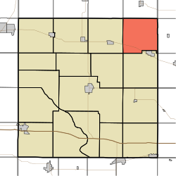
Massillon Township is one of seventeen townships in Cedar County, Iowa, USA. As of the 2000 census, its population was 330.
Geography[]
Massillon Township covers an area of 35.08 square miles (90.9 km2) and contains no incorporated settlements. According to the USGS, it contains three cemeteries: Brink, Center and Massillon. The township also contains the unincorporated settlement of Massillon, Iowa for which it is named.
References[]
- ^ "US Board on Geographic Names". United States Geological Survey. 2007-10-25. Retrieved 2008-01-31.
- ^ "U.S. Census website". United States Census Bureau. Retrieved 2008-01-31.
External links[]
Municipalities and communities of Cedar County, Iowa, United States | ||
|---|---|---|
| Cities | ||
| Townships | ||
| CDPs | ||
| Other communities | ||
| Footnotes | ‡This populated place also has portions in an adjacent county or counties | |
| ||
This article about the geography of Cedar County, Iowa is a stub. You can help Wikipedia by . |
Categories:
- Townships in Cedar County, Iowa
- Townships in Iowa
- Southeast Iowa geography stubs