Sugar Creek Township, Cedar County, Iowa
Sugar Creek Township, Cedar County | |
|---|---|
 | |
| Coordinates: 41°38′30″N 091°03′19″W / 41.64167°N 91.05528°WCoordinates: 41°38′30″N 091°03′19″W / 41.64167°N 91.05528°W | |
| Country | |
| State | |
| County | Cedar |
| Area | |
| • Total | 24.24 sq mi (62.78 km2) |
| • Land | 24.24 sq mi (62.78 km2) |
| • Water | 0 sq mi (0 km2) |
| Elevation | 738 ft (225 m) |
| Population (2000) | |
| • Total | 375 |
| • Density | 15.5/sq mi (6/km2) |
| FIPS code | 19-94023[2] |
| GNIS feature ID | 0468756 |

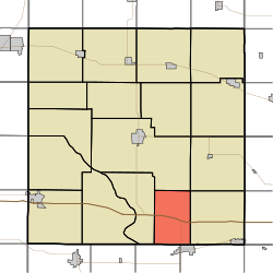
Sugar Creek Township is one of seventeen townships in Cedar County, Iowa, USA. As of the 2000 census, its population was 375.
History[]
Sugar Creek Township is named for the Sugar Creek. The name of the creek may refer to either the large number of sugar maples growing along it or to the sweetness of the water.[3]
Geography[]
Sugar Creek Township covers an area of 24.24 square miles (62.8 km2) and contains no incorporated settlements. According to the USGS, it contains six cemeteries: Centerville, Lime City, Sharon, South Bethel, Sugar Creek Church, and Whitmer.
References[]
- ^ "US Board on Geographic Names". United States Geological Survey. 2007-10-25. Retrieved 2008-01-31.
- ^ "U.S. Census website". United States Census Bureau. Retrieved 2008-01-31.
- ^ Aurner, Clarence Ray (1910). A Topical History of Cedar County, Iowa, Volume 1. S. J. Clarke. pp. 33.
External links[]
Municipalities and communities of Cedar County, Iowa, United States | ||
|---|---|---|
| Cities | ||
| Townships | ||
| CDPs | ||
| Other communities | ||
| Footnotes | ‡This populated place also has portions in an adjacent county or counties | |
| ||
This article about the geography of Cedar County, Iowa is a stub. You can help Wikipedia by . |
Categories:
- Townships in Cedar County, Iowa
- Townships in Iowa
- Southeast Iowa geography stubs