Rochester, Iowa
Rochester, Iowa | |
|---|---|
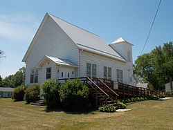 Rochester United Methodist Church | |
 Rochester Location within the state of Iowa | |
| Coordinates: 41°40′24″N 91°09′29″W / 41.67333°N 91.15806°WCoordinates: 41°40′24″N 91°09′29″W / 41.67333°N 91.15806°W | |
| Country | United States |
| State | Iowa |
| County | Cedar |
| Area | |
| • Total | 0.98 sq mi (2.53 km2) |
| • Land | 0.95 sq mi (2.46 km2) |
| • Water | 0.02 sq mi (0.06 km2) |
| Elevation | 665 ft (203 m) |
| Population (2010) | |
| • Total | 133 |
| • Density | 140/sq mi (54.0/km2) |
| Time zone | UTC-6 (Central (CST)) |
| • Summer (DST) | UTC-5 (CDT) |
| ZIP code | 52772 |
| FIPS code | 19-67890 |
| GNIS feature ID | 0460704 |

Rochester is an unincorporated community and census-designated place (CDP) in Rochester Township, Cedar County, Iowa, United States. As of the 2010 census it had a population of 133.[1]
Geography[]
Rochester is located in eastern Iowa in south-central Cedar County, along the north bank of the Cedar River. County Road F44 crosses the river just south of the community, and Interstate 80 at Exit 265 is 2 miles (3 km) to the south.
History[]
Rochester was named after Rochester, New York, known for its flour mills, due to its location on the Cedar River.[2] Rochester's population was 53 in 1902.[3]
References[]
- ^ "Geographic Identifiers: 2010 Demographic Profile Data (G001): Rochester CDP, Iowa". U.S. Census Bureau, American Factfinder. Archived from the original on February 12, 2020. Retrieved November 15, 2013.
- ^ The History of Cedar County, Iowa: Containing a History of the County, Its Cities, Towns, etc. Western Historical Company. 1878. p. 526.
- ^ Cram's Modern Atlas: The New Unrivaled New Census Edition. J. R. Gray & Company. 1902. pp. 203–207.
Municipalities and communities of Cedar County, Iowa, United States | ||
|---|---|---|
| Cities | ||
| Townships | ||
| CDPs | ||
| Other communities | ||
| Footnotes | ‡This populated place also has portions in an adjacent county or counties | |
| ||
This article about the geography of Cedar County, Iowa is a stub. You can help Wikipedia by . |
Categories:
- Census-designated places in Cedar County, Iowa
- Census-designated places in Iowa
- Southeast Iowa geography stubs