
Matinecock, New York
Matinecock, New York
Matinnicoke ("The Hill Country") | |
|---|---|
Village | |
| Incorporated Village of Matinecock | |
 A welcome sign to Matinecock on August 29, 2021. | |
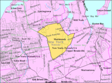
 Location in Nassau County and the state of New York. | |
 Matinecock, New York Location within the state of New York. | |
| Coordinates: 40°52′20″N 73°35′4″W / 40.87222°N 73.58444°W | |
| Country | |
| State | |
| County | |
| Town | Oyster Bay |
| Incorporated | 1928 |
| Named for | The Matinecock People |
| Area | |
| • Total | 2.66 sq mi (6.90 km2) |
| • Land | 2.66 sq mi (6.88 km2) |
| • Water | 0.01 sq mi (0.01 km2) |
| Elevation | 89 ft (27 m) |
| Population (2010) | |
| • Total | 810 |
| �� Estimate (2019)[2] | 833 |
| • Density | 313.39/sq mi (121.01/km2) |
| Time zone | UTC-5 (Eastern (EST)) |
| • Summer (DST) | UTC-4 (EDT) |
| ZIP code | 11560 |
| Area code(s) | 516 |
| FIPS code | 36-46107 |
| GNIS feature ID | 0956671 |
| Website | www |
Matinecock is a village located within the Town of Oyster Bay in Nassau County, on Long Island, in New York, United States. The population was 810 at the 2010 census.
History[]
The village was incorporated in 1928.[3]
In May 1998, Worth Magazine ranked Matinecock as the fifth richest town in America and the richest town in New York.[4]
The village is named for the Matinecock Nation, which inhabited much of the area.[3] "Matinecock" roughly translates to "the Hill Country," and was the Matinecock Nation's name for much of the area.[3][5][6]
Geography[]
According to the United States Census Bureau, the village has a total area of 2.7 square miles (7.0 km2), all land.[7]
Demographics[]
| Historical population | |||
|---|---|---|---|
| Census | Pop. | %± | |
| 1930 | 484 | — | |
| 1940 | 428 | −11.6% | |
| 1950 | 507 | 18.5% | |
| 1960 | 824 | 62.5% | |
| 1970 | 841 | 2.1% | |
| 1980 | 985 | 17.1% | |
| 1990 | 872 | −11.5% | |
| 2000 | 836 | −4.1% | |
| 2010 | 810 | −3.1% | |
| 2019 (est.) | 833 | [2] | 2.8% |
| U.S. Decennial Census[8] | |||
At the 2000 census there were 836 people, 285 households, and 216 families in the village. The population density was 315.6 people per square mile (121.8/km2). There were 313 housing units at an average density of 118.1 per square mile (45.6/km2). The racial makeup of the village was 96.05% White, 1.08% African American, 1.56% Asian, and 1.32% from two or more races. Hispanic or Latino of any race were 3.83%.[9]
Of the 285 households 36.8% had children under the age of 18 living with them, 67.7% were married couples living together, 3.9% had a female householder with no husband present, and 24.2% were non-families. 20.7% of households were one person and 10.2% were one person aged 65 or older. The average household size was 2.93 and the average family size was 3.31.
The age distribution was 26.8% under the age of 18, 4.5% from 18 to 24, 26.1% from 25 to 44, 27.3% from 45 to 64, and 15.3% 65 or older. The median age was 40 years. For every 100 females, there were 95.8 males. For every 100 females age 18 and over, there were 98.1 males.
The median household income was $135,922 and the median family income was $171,832. Males had a median income of $100,000 versus $36,042 for females. The per capita income for the village was $93,559. About 2.1% of families and 4.1% of the population were below the poverty line, including 3.3% of those under age 18 and 4.3% of those age 65 or over.
Education[]
School district[]
The Village of Matinecock is located entirely within the boundaries of the Locust Valley Central School District.[10][11] As such, all children who reside within Matinecock and attend public schools go to Locust Valley's schools.[10][11]
Library district[]
Matinecock is located within the boundaries of the Locust Valley Library District.[10]
References[]
- ^ "2019 U.S. Gazetteer Files". United States Census Bureau. Retrieved July 27, 2020.
- ^ a b "Population and Housing Unit Estimates". United States Census Bureau. May 24, 2020. Retrieved May 27, 2020.
- ^ a b c Winsche, Richard (October 1, 1999). The History of Nassau County Community Place-Names. Interlaken, New York: Empire State Books. ISBN 978-1557871541.
- ^ "OFF THE RACK; The Richer Rich, and Where They Live". NY Times. Retrieved 21 June 2017.
- ^ Editor, Hannah Douglas, Associate. "Matinecock Way: Is it the way to go?". Queens Chronicle. Retrieved 2020-08-10.
{{cite web}}:|last=has generic name (help) - ^ https://www.huntingtonny.gov/filestorage/13747/99540/16499/First_Purchase.pdf
- ^ "US Gazetteer files: 2010, 2000, and 1990". United States Census Bureau. 2011-02-12. Retrieved 2011-04-23.
- ^ "Census of Population and Housing". Census.gov. Retrieved June 4, 2015.
- ^ "U.S. Census website". United States Census Bureau. Retrieved 2008-01-31.
- ^ a b c "Long Island Index: Interactive Map". Long Island Index Maps. Long Island Index.
- ^ a b "Composite School District Boundaries Shapefiles". NCES. Retrieved 2020-10-23.
External links[]
- Oyster Bay (town), New York
- Villages in New York (state)
- Villages in Nassau County, New York