McCormick, South Carolina
McCormick, South Carolina | |
|---|---|
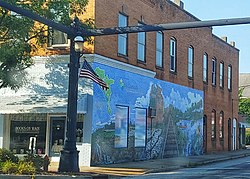 Downtown McCormick | |
 Location in McCormick County and the state of South Carolina. | |
| Coordinates: 33°54′49″N 82°17′21″W / 33.91361°N 82.28917°WCoordinates: 33°54′49″N 82°17′21″W / 33.91361°N 82.28917°W | |
| Country | United States |
| State | South Carolina |
| County | McCormick |
| Area | |
| • Total | 4.05 sq mi (10.49 km2) |
| • Land | 4.05 sq mi (10.49 km2) |
| • Water | 0.00 sq mi (0.00 km2) |
| Elevation | 535 ft (163 m) |
| Population (2010) | |
| • Total | 2,783 |
| • Estimate (2019)[4] | 2,352 |
| • Density | 580.45/sq mi (224.13/km2) |
| Time zone | UTC−5 (Eastern (EST)) |
| • Summer (DST) | UTC−4 (EDT) |
| ZIP codes | 29835, 29899 |
| Area code(s) | 864 |
| FIPS code | 45-43720[2] |
| GNIS feature ID | 1246583[3] |
| Website | www.townofmccormicksc.org |

McCormick is a town in McCormick County, South Carolina, United States. The population was 2,783 at the 2010 census. It is the county seat of McCormick County. The town of McCormick is named for inventor Cyrus McCormick.
History[]
The Dorn Gold Mine, Dorn's Flour and Grist Mill, Joseph Jennings Dorn House, Eden Hall, Farmer's Bank, John Albert Gibert M.D. House, Otway Henderson House, Hotel Keturah, McCormick County Courthouse, McCormick Train Station, and M.L.B. Sturkey House are listed on the National Register of Historic Places.[5]
Geography[]
McCormick is located at 33°54′49″N 82°17′21″W / 33.91361°N 82.28917°W (33.913565, -82.289154).[6]
According to the United States Census Bureau, the town has a total area of 3.8 square miles (9.8 km2), all land.
Demographics[]
| Historical population | |||
|---|---|---|---|
| Census | Pop. | %± | |
| 1900 | 237 | — | |
| 1910 | 613 | 158.6% | |
| 1920 | 1,284 | 109.5% | |
| 1930 | 1,304 | 1.6% | |
| 1940 | 1,456 | 11.7% | |
| 1950 | 1,744 | 19.8% | |
| 1960 | 1,998 | 14.6% | |
| 1970 | 1,864 | −6.7% | |
| 1980 | 1,725 | −7.5% | |
| 1990 | 1,659 | −3.8% | |
| 2000 | 1,489 | −10.2% | |
| 2010 | 2,783 | 86.9% | |
| 2019 (est.) | 2,352 | [4] | −15.5% |
| U.S. Decennial Census[7] | |||
At the 2000 census there were 1,489 people, 657 households, and 400 families living in the town. The population density was 396.4 people per square mile (152.9/km2). There were 737 housing units at an average density of 196.2 per square mile (75.7/km2). The racial makeup of the town was 32.51% White, 64.07% African American, 0.13% Native American, 0.13% Asian, 1.41% from other races, and 1.75% from two or more races. Hispanic or Latino of any race were 1.54%.[2]
Of the 657 households 26.3% had children under the age of 18 living with them, 33.3% were married couples living together, 23.9% had a female householder with no husband present, and 39.1% were non-families. 37.4% of households were one person and 16.0% were one person aged 65 or older. The average household size was 2.24 and the average family size was 2.95.
The age distribution was 24.0% under the age of 18, 8.6% from 18 to 24, 22.5% from 25 to 44, 26.3% from 45 to 64, and 18.7% 65 or older. The median age was 41 years. For every 100 females, there were 77.9 males. For every 100 females age 18 and over, there were 75.8 males.
The median household income was $19,688 and the median family income was $34,375. Males had a median income of $26,027 versus $20,263 for females. The per capita income for the town was $14,338. About 20.7% of families and 26.8% of the population were below the poverty line, including 38.3% of those under age 18 and 18.4% of those age 65 or over. According to the 2010 Census, the population was 2,783. 1,900 (68.27%) were Black or African, 820 (29.46%) were White, 26 (0.93%) were two or more races, 14 (0.50%) were Asian, 13 (0.47%) were some other race, 5 (0.18%) were American Indian or Alaska Native, 5 (0.18%) were Native Hawaiian or other Pacific Islander. 45 (1.62%) were Hispanic or Latino of any race.[8]
Education[]
McCormick has a public library, the McCormick County Library.[9]
Notable people[]
- John C. Calhoun - Vice President of the United States
- Johnny Letman - Musician
- Patrick Noble - SC Governor
- Sara M. Evans - Historian
References[]
- ^ "2019 U.S. Gazetteer Files". United States Census Bureau. Retrieved July 29, 2020.
- ^ Jump up to: a b "U.S. Census website". United States Census Bureau. Retrieved 2008-01-31.
- ^ "US Board on Geographic Names". United States Geological Survey. 2007-10-25. Retrieved 2008-01-31.
- ^ Jump up to: a b "Population and Housing Unit Estimates". United States Census Bureau. May 24, 2020. Retrieved May 27, 2020.
- ^ "National Register Information System". National Register of Historic Places. National Park Service. July 9, 2010.
- ^ "US Gazetteer files: 2010, 2000, and 1990". United States Census Bureau. 2011-02-12. Retrieved 2011-04-23.
- ^ "Census of Population and Housing". Census.gov. Retrieved June 4, 2015.
- ^ http://censusviewer.com/city/sc/mccormick/2010
- ^ "Locations & Hours". Greenville County Library System. Retrieved 13 June 2019.
| show Municipalities and communities of McCormick County, South Carolina, United States |
|---|

| show Authority control |
|---|
- Towns in McCormick County, South Carolina
- Towns in South Carolina
- County seats in South Carolina