Grovetown, Georgia
hideThis article has multiple issues. Please help or discuss these issues on the talk page. (Learn how and when to remove these template messages)
|
Grovetown, Georgia | |
|---|---|
| Motto(s): A community that cares | |
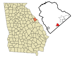 Location in Columbia County and the state of Georgia | |
| Coordinates: 33°26′58″N 82°11′49″W / 33.44944°N 82.19694°WCoordinates: 33°26′58″N 82°11′49″W / 33.44944°N 82.19694°W | |
| Country | United States |
| State | Georgia |
| County | Columbia |
| Government | |
| • Mayor | Gary Jones[1] |
| Area | |
| • Total | 5.26 sq mi (13.63 km2) |
| • Land | 5.25 sq mi (13.60 km2) |
| • Water | 0.01 sq mi (0.03 km2) |
| Elevation | 482 ft (147 m) |
| Population (2010) | |
| • Total | 15,152 |
| • Estimate (2019)[6] | 15,152 |
| • Density | 2,885.00/sq mi (1,113.99/km2) |
| est. | |
| Time zone | UTC-5 (Eastern (EST)) |
| • Summer (DST) | UTC-4 (EDT) |
| ZIP Code | 30813 |
| Area code(s) | 706 |
| FIPS code | 1335716[4] |
| GNIS feature ID | 356123[5] |
| Website | Official website |

Grovetown is a city in Columbia County, Georgia, United States. It is part of the Augusta metropolitan area and the Central Savannah River Area. The 2019 population estimate was 15,152.[4] The mayor is Gary Jones.[1]
History[]
This section needs additional citations for verification. (April 2012) |
From the building of the Georgia Railroad, which travels through the city until at least the 1860s, the community was known as "Belair".[2][failed verification] The city was chartered by the Georgia Legislature and officially incorporated on January 1, 1881.[2] The name of the small village purportedly came from the old Grove Baptist Church that was founded in 1808. A poet famous in the post-Civil War era, Paul Hamilton Hayne, moved to Copse Hill in the Parham Road area in the 1860s. He solicited the United States Postal Service to establish the Grovetown post office. The first U.S. mail service was inaugurated on September 28, 1877, with Charles Clifford as postmaster. Mr. Clifford was also the train depot agent and the owner of the corner store.[7]
The first railroad depot was a small structure built in 1878–79. The last depot was an ornate structure built in 1891 at a cost of $5,041.74. It served the citizens of Grovetown until 1970, when passenger trains no longer traveled on the Augusta–Atlanta line. It was demolished in 1973.[7]
Many wealthy and influential Augusta residents had summer homes in Grovetown, escaping the heat and disease of the city. They commuted on the old "Picayune" train, relying on its frequent service. The Rosland Hotel, later known as the "Eagle", was built in the 1880s. Its huge rotunda was frequently used for church gatherings, suppers, parties, and dances. It later became a boarding house and burned in the 1970s. The Church of Christ is now located on the site.[7]
Several country stores were established on Old Wrightsboro Road near the railroad crossing. One was S. F. Poole's store, where the gazebo now stands at the corner with Robinson Avenue, with a "philosophers' bench"[clarification needed] by the door. During the early days, many famous residents lived in the Grovetown area: Hayne, the literary figure; Stewart Phinizy and James Tobin, cotton brokers; Charles Phinizy, banker and railroad president; Dr. H. H. Steiner, physician; and John Dodge, pharmacist and harness racing enthusiast. Dodge brought his stable from Ohio and built a large home and racetrack.[7]
With the construction of Camp Gordon in 1942, Grovetown experienced rapid growth; it was no longer a small agricultural town. Due to its close proximity to Fort Gordon, Many military families looked to Grovetown for housing. Gradually, more and more retired military saw the benefits of living in the small town and population began to grow and stabilize.[7]
Annexation and multi-housing construction has increased the population of the formerly quiet town. Currently, Grovetown has a population of approximately 15,000,[4] up from the 1990 census figure of 3,596. A variety of stores, dining establishments, schools, and churches add to the town's culture. Services include recreational facilities, a public safety department, two fire stations, water and sewer services, a senior center, and museum.[7]
Geography[]
Grovetown is located in southern Columbia County. Downtown Augusta is 15 miles (24 km) east. The northern boundary of Fort Gordon is 2 miles (3 km) south.
According to the United States Census Bureau, Grovetown has a total area of 4.8 square miles (12.5 km2), of which 0.01 square miles (0.03 km2), or 0.23%, is water.[8]
Demographics[]
| Historical population | |||
|---|---|---|---|
| Census | Pop. | %± | |
| 1900 | 527 | — | |
| 1910 | 558 | 5.9% | |
| 1920 | 425 | −23.8% | |
| 1930 | 267 | −37.2% | |
| 1960 | 1,396 | — | |
| 1970 | 3,169 | 127.0% | |
| 1980 | 3,384 | 6.8% | |
| 1990 | 3,596 | 6.3% | |
| 2000 | 6,089 | 69.3% | |
| 2010 | 11,216 | 84.2% | |
| 2019 (est.) | 15,152 | [6] | 35.1% |
| U.S. Decennial Census[9] | |||
As of 2019,[4] there were 15,152 people and 4,028 households residing in the city. As of the 2010 United States Census, the population density was 2,326.0 people per square mile (3,721.6/km2). There were 2,473 housing units at an average density of 857.7 per square mile (331.5/km2).[citation needed] The racial makeup of the city was 61.3% White, 27.8% African American, 0.9% Native American, 0.7% Asian, 0.0% Pacific Islander, and 7.8% from two or more races. Hispanic or Latino of any race were 15.6% of the population.
In the city, the population was spread out, with 24.4% under the age of 18 and 8.1% who were 65 years of age or older.
The median income for a household in the city was $68,756. The per capita income for the city was $24,599.
Parks and recreation[]
City parks include the Liberty Park Community Center,[10] and Goodale Park,[10] which is named after Joseph Daniel "Danny" Goodale Jr., a Vietnam veteran who died in 1969.[11][12]
Education[]
Grovetown Middle School, Grovetown Elementary School, and Cedar Ridge Elementary School are located in the city limits of Grovetown.[13] Grovetown High School, Columbia Middle School, Brookwood Elementary School, and Euchee Creek Elementary School are located near the city.[13] Baker Place Elementary School is also near the city.
Infrastructure[]
Transportation[]
Grovetown is mainly served by Georgia State Route 223 (SR 223), locally known as Robinson Avenue from just northwest of Fort Gordon's Gate 2 to the intersection with Harlem–Grovetown Road and as Wrightsboro Road past this point. It is also served by SR 388 east of this intersection. Here, SR 388 takes on the Wrightsboro Road name until an intersection with Katherine Street. At this intersection, the state highway turns left onto Horizon South Parkway, while Wrightsboro Road continues toward Augusta. Harlem–Grovetown Road connects the city with Harlem.
There are railroad tracks of CSX Transportation that extend through Grovetown, used mostly by freight trains.
See also[]
![]() Georgia (U.S. state) portal
Georgia (U.S. state) portal
References[]
- ^ Jump up to: a b "Gary Jones". Cityofgrovetown.com. Retrieved February 11, 2018.
- ^ Jump up to: a b c "Grovetown". Georgia.gov. Archived from the original on January 10, 2019. Retrieved February 11, 2018.
- ^ "2019 U.S. Gazetteer Files". United States Census Bureau. Retrieved July 9, 2020.
- ^ Jump up to: a b c d "QuickFacts: Grovetown city, Georgia". United States Census Bureau. Retrieved January 9, 2021.
- ^ "GNIS Detail – Grovetown". United States Geological Survey. Retrieved February 11, 2018.
- ^ Jump up to: a b "Population and Housing Unit Estimates". United States Census Bureau. May 24, 2020. Retrieved May 27, 2020.
- ^ Jump up to: a b c d e f "City History". Cityofgrovetown.com. Retrieved February 11, 2018.
- ^ "Geographic Identifiers: 2010 Demographic Profile Data (G001): Grovetown city, Georgia". U.S. Census Bureau, American Factfinder. Archived from the original on February 12, 2020. Retrieved July 29, 2014.
- ^ "Census of Population and Housing". Census.gov. Retrieved June 4, 2015.
- ^ Jump up to: a b "Parks and City Facilities". Cityofgrovetown.com. Retrieved April 1, 2020.
- ^ "Grovetown remembers fallen soldier". The Augusta Chronicle. May 26, 1997. Retrieved April 1, 2020 – via NewsBank.
- ^ "Joseph D Goodale Jr –Army". Virtual Vietnam Veterans Memorial Fund. Retrieved February 11, 2018.
- ^ Jump up to: a b "Education". Cityofgrovetown.com. Retrieved February 11, 2018.
External links[]
| show Municipalities and communities of Columbia County, Georgia, United States |
|---|

| show Authority control |
|---|
- Grovetown, Georgia
- Cities in Georgia (U.S. state)
- Cities in Columbia County, Georgia
- Augusta metropolitan area