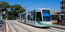
Melbourne tram route 109
| Route 109 | ||||
|---|---|---|---|---|
| Box Hill – Port Melbourne | ||||
 | ||||
 | ||||
| Overview | ||||
| System | Melbourne | |||
| Operator | Yarra Trams | |||
| Depot | Kew | |||
| Vehicle | A class C class | |||
| Predecessors | Route 42, 111 | |||
| Night-time | Friday & Saturday | |||
| Route | ||||
| Locale | Melbourne, Australia | |||
| Start | Box Hill | |||
| Via | Collins Street | |||
| End | Port Melbourne | |||
| Service | ||||
| Journey time | 55-75 minutes | |||
| Operates | Daily | |||
| Zone(s) | Free Zone: 1-8, 123, 124 Myki Zone 1: Stops 9-47, 124A-129 Zone 1/2 overlap: Stops 47-58 | |||
| Timetable | Route 109 timetable | |||
| Map | Route 109 map | |||
| ||||

Melbourne tram route 109 is operated by Yarra Trams on the Melbourne tram network. It operates from Box Hill to Port Melbourne. The 19 kilometres (12 mi)[1] route is operated by A and C class trams from Kew depot.[2][3]
The route runs along a light rail track between Southbank and Port Melbourne, using the right-of-way of the former Port Melbourne railway line, the second railway in Australia, which opened in 1854, which was converted to light rail in 1987. It is one of the most patronised routes in Melbourne, with over 15.6 million trips in 2015.[4]
History[]
The origins of route 109 lie in separate tram lines, a cable tram from Spencer Street to the Yarra River, a horse tram from the Yarra River to Kew Cemetery, an electric line from Kew Junction to Box Hill (extended over the years), as well as the Port Melbourne railway line.
A cable line was opened by the Melbourne Tramway & Omnibus Company from Spencer Street to Brunswick Street along Collins Street, MacArthur Street, Gisborne Street and Victoria Parade on 2 October 1886, and extended to the west side of the Yarra River along Victoria Parade and Victoria Street on 22 November 1886.[5] A connecting horse tram was built from the east side of the Yarra River to Kew Cemetery, along Barkers Road, High Street South and High Street, opening on 28 December 1887.
The Prahran & Malvern Tramways Trust (PMTT) opened a line from High Street to Burke Road along Cotham Road on 30 May 1913.[6] On 1 November 1914 the PMTT received permission to convert the horse tram line to electric traction, and the new electric line was opened on 24 February 1915.[6] The PMTT extended the Cotham Road line to Union Road, Mont Albert along Whitehorse Road, on 30 September 1916.[6]
In 1929 the Melbourne & Metropolitan Tramways Board (MMTB) started converting the Collins Street cable lines to electric traction, with the last cable tram running down Collins Street on 14 September 1929, and the first electric tram on 8 December 1929.[7] At the same time the MMTB built a new electric line down the centre of Victoria Parade to replace the cable line, which opened on 15 September 1929.[7] For the next six decades the Melbourne to Mont Albert tram was numbered 42, celebrated by a 1982 theatrical production, Storming Mont Albert by Tram, which was performed on a specially-chartered Route 42 tram from the Mont Albert terminus to the city and return.[8]
The line was extended south-west to Port Melbourne along Spencer Street and the former Port Melbourne railway line on 21 December 1987 following the conversion of the railway (along with the St Kilda line) to light rail.[9][10] The broad gauge 1,600 mm (5 ft 3 in) track was re-gauged to standard gauge 1,435 mm (4 ft 8+1⁄2 in) and the overhead voltage was reduced from 1500 V DC to 600 V DC with light rail platforms built adjacent to or near the former stations platforms. Initially services operated as route 111 between Carlton Gardens and Port Melbourne. On 19 December 1993, routes 42 and 111 were combined as route 109.[11]
The line was extended from its original terminus at Mont Albert to Box Hill along Whitehorse Road, about 2.2 kilometres (1.4 mi), at the cost of $28 million, on 2 June 2003.[12][13] In January 2016, route 109 began operating through the night on Fridays and Saturdays as part of the Night Network.[14]
Route[]
Description[]

Route 109 runs from Box Hill, travelling west on Whitehorse Road through the suburbs of Mont Albert, Surrey Hills, Balwyn and Deepdene. Entering Kew at Burke Road, Whitehorse Road becomes Cotham Road. It continues west, through Kew Junction and then south west along High Street, High Street South and turns west into Barkers Road.
It crosses the Yarra River into Victoria Street, Richmond and continues west, at Hoddle Street Victoria Street becomes Victoria Parade, it passes through St Vincent's Plaza, passing St Vincent's Hospital, the Royal Victorian Eye and Ear Hospital and turns south onto Gisborne Street, continues south west along MacArthur Street and turns west into Collins Street, entering the CBD, passing Melbourne Town Hall and City Square.
It turns south into Spencer Street, passing Southern Cross station, then crosses the Yarra River and enters Southbank on Clarendon Street before traversing the suburbs of South Melbourne and Port Melbourne on a right-of-way using the former Port Melbourne railway line and terminates at Port Melbourne railway station, near Station Pier.
Operation[]
Route 109 is operates from Kew depot[15] and is run by A2 and C1 class trams.
Map[]
| hide Route 109 | ||||||||||||||||||||||||||||||||||||||||||||||||||||||||||||||||||||||||||||||||||||||||||||||||||||||||||||||||||||||||||||||||||||||||||||||||||||||||||||||||||||||||||||||||||||||||||||||||||||||||||||||||||||||||||||||||||||||||||||||||||||||||||||||||||||||||||||||||||||||||||||||||||||||||||||||||||||||||||||||||||||||||||||||||||||||||||||||||||||||||||||||||||||||||||||||||||||||||||||||||||||||||||||||||||||||||||||||||||||||||||||||||||||||||||||||||||||||||||||||||||||||||||||||||||||||||||||||||||||||||||||||||||||||||||||||||||||||||||||||||||||||||||||||||||||||||||||||||||||||||||||||||||||||||||||||||||||||||||||||||||||||||||||||||||||||||||||||||||||||||||||||||
|---|---|---|---|---|---|---|---|---|---|---|---|---|---|---|---|---|---|---|---|---|---|---|---|---|---|---|---|---|---|---|---|---|---|---|---|---|---|---|---|---|---|---|---|---|---|---|---|---|---|---|---|---|---|---|---|---|---|---|---|---|---|---|---|---|---|---|---|---|---|---|---|---|---|---|---|---|---|---|---|---|---|---|---|---|---|---|---|---|---|---|---|---|---|---|---|---|---|---|---|---|---|---|---|---|---|---|---|---|---|---|---|---|---|---|---|---|---|---|---|---|---|---|---|---|---|---|---|---|---|---|---|---|---|---|---|---|---|---|---|---|---|---|---|---|---|---|---|---|---|---|---|---|---|---|---|---|---|---|---|---|---|---|---|---|---|---|---|---|---|---|---|---|---|---|---|---|---|---|---|---|---|---|---|---|---|---|---|---|---|---|---|---|---|---|---|---|---|---|---|---|---|---|---|---|---|---|---|---|---|---|---|---|---|---|---|---|---|---|---|---|---|---|---|---|---|---|---|---|---|---|---|---|---|---|---|---|---|---|---|---|---|---|---|---|---|---|---|---|---|---|---|---|---|---|---|---|---|---|---|---|---|---|---|---|---|---|---|---|---|---|---|---|---|---|---|---|---|---|---|---|---|---|---|---|---|---|---|---|---|---|---|---|---|---|---|---|---|---|---|---|---|---|---|---|---|---|---|---|---|---|---|---|---|---|---|---|---|---|---|---|---|---|---|---|---|---|---|---|---|---|---|---|---|---|---|---|---|---|---|---|---|---|---|---|---|---|---|---|---|---|---|---|---|---|---|---|---|---|---|---|---|---|---|---|---|---|---|---|---|---|---|---|---|---|---|---|---|---|---|---|---|---|---|---|---|---|---|---|---|---|---|---|---|---|---|---|---|---|---|---|---|---|---|---|---|---|---|---|---|---|---|---|---|---|---|---|---|---|---|---|---|---|---|---|---|---|---|---|---|---|---|---|---|---|---|---|---|---|---|---|---|---|---|---|---|---|---|---|---|---|---|---|---|---|---|---|---|---|---|---|---|---|---|---|---|---|---|---|---|---|---|---|---|---|---|---|---|---|---|---|---|---|---|---|---|---|---|---|---|---|---|---|---|---|---|---|---|---|---|---|---|---|---|---|---|---|---|---|---|---|---|---|---|---|---|---|---|---|---|---|---|---|---|---|---|---|---|---|---|---|---|---|---|---|---|---|---|---|---|---|---|---|---|---|---|---|---|---|---|---|---|---|---|---|---|---|---|---|---|---|---|---|---|---|---|---|---|---|---|---|---|---|---|---|---|---|---|---|---|---|---|---|---|---|---|---|---|---|---|---|---|---|---|---|---|---|---|---|---|---|---|---|---|---|---|---|---|---|---|---|---|---|---|---|---|---|---|---|---|---|---|---|---|---|---|---|---|---|---|---|---|---|---|---|---|---|---|---|---|---|---|---|---|---|---|---|---|---|---|---|---|---|---|---|---|---|---|---|---|---|---|---|---|---|---|---|---|---|---|---|---|---|---|---|---|---|---|---|---|---|---|---|---|---|---|---|---|---|
| Box Hill - Port Melbourne via Mont Albert, City & Southbank Free tram zone covers stops 124 to 8, fare zone 1 from stop 57 to 10, 124A to 129, fare zone 2 from stop 57 to 47 | ||||||||||||||||||||||||||||||||||||||||||||||||||||||||||||||||||||||||||||||||||||||||||||||||||||||||||||||||||||||||||||||||||||||||||||||||||||||||||||||||||||||||||||||||||||||||||||||||||||||||||||||||||||||||||||||||||||||||||||||||||||||||||||||||||||||||||||||||||||||||||||||||||||||||||||||||||||||||||||||||||||||||||||||||||||||||||||||||||||||||||||||||||||||||||||||||||||||||||||||||||||||||||||||||||||||||||||||||||||||||||||||||||||||||||||||||||||||||||||||||||||||||||||||||||||||||||||||||||||||||||||||||||||||||||||||||||||||||||||||||||||||||||||||||||||||||||||||||||||||||||||||||||||||||||||||||||||||||||||||||||||||||||||||||||||||||||||||||||||||||||||||||
| ||||||||||||||||||||||||||||||||||||||||||||||||||||||||||||||||||||||||||||||||||||||||||||||||||||||||||||||||||||||||||||||||||||||||||||||||||||||||||||||||||||||||||||||||||||||||||||||||||||||||||||||||||||||||||||||||||||||||||||||||||||||||||||||||||||||||||||||||||||||||||||||||||||||||||||||||||||||||||||||||||||||||||||||||||||||||||||||||||||||||||||||||||||||||||||||||||||||||||||||||||||||||||||||||||||||||||||||||||||||||||||||||||||||||||||||||||||||||||||||||||||||||||||||||||||||||||||||||||||||||||||||||||||||||||||||||||||||||||||||||||||||||||||||||||||||||||||||||||||||||||||||||||||||||||||||||||||||||||||||||||||||||||||||||||||||||||||||||||||||||||||||||
| Note: Green denotes free tram zone | ||||||||||||||||||||||||||||||||||||||||||||||||||||||||||||||||||||||||||||||||||||||||||||||||||||||||||||||||||||||||||||||||||||||||||||||||||||||||||||||||||||||||||||||||||||||||||||||||||||||||||||||||||||||||||||||||||||||||||||||||||||||||||||||||||||||||||||||||||||||||||||||||||||||||||||||||||||||||||||||||||||||||||||||||||||||||||||||||||||||||||||||||||||||||||||||||||||||||||||||||||||||||||||||||||||||||||||||||||||||||||||||||||||||||||||||||||||||||||||||||||||||||||||||||||||||||||||||||||||||||||||||||||||||||||||||||||||||||||||||||||||||||||||||||||||||||||||||||||||||||||||||||||||||||||||||||||||||||||||||||||||||||||||||||||||||||||||||||||||||||||||||||
Bus route[]
When cruise ships are berthed at Station Pier, Transit Systems Victoria operate a parallel bus service as route 109 between Station Pier and the Arts Centre.[16]
References[]
- ^ www.google.com/maps
- ^ Facts & figures Archived 29 May 2014 at the Wayback Machine Yarra Trams
- ^ Route 109 Yarra Trams
- ^ "Facts & figures". Yarra Trams. Archived from the original on 4 January 2017. Retrieved 26 January 2015.
- ^ Melbourne Tramway & Omnibus Company Limited Running Journal volume 9 no 3 page 16
- ^ Jump up to: a b c "Milestones, 1911 – 1920", Yarra Trams, archived from the original on 27 September 2011, retrieved 9 October 2011
- ^ Jump up to: a b "Milestones, 1921 – 1930", Yarra Trams, archived from the original on 20 March 2012, retrieved 9 October 2011
- ^ "Storming Mont Albert by Tram - Melbourne Moomba Festival". Performance Archive. Theatre Works: St Kilda. Retrieved 11 March 2014.
- ^ Jones, Colin (1993). Watch for Trams. Kenthurst: Kangaroo Press. p. 118. ISBN 0 86417 544 2.
- ^ "Milestones, 1981 – 1990", Yarra Trams, archived from the original on 20 March 2012, retrieved 26 September 2011
- ^ "Melbourne News" Trolley Wire issue 256 February 1994 page 23
- ^ "Box Hill Extension Opening". Yarra Trams. 5 February 2003. Archived from the original on 3 September 2007. Retrieved 9 October 2011.
- ^ "Trams return to Box Hill" Trolley Wire issue 293 May 2003 pages 11-14
- ^ Night Tram Public Transport Victoria
- ^ "Kew Depot", Vicsig, retrieved 9 October 2011
- ^ 109 Express Port Melbourne to Arts Centre Archived 10 March 2016 at the Wayback Machine Public Transport Victoria
External links[]
 Media related to Melbourne tram route 109 at Wikimedia Commons
- Route 109 timetable and map
- Tram routes in Melbourne
- Collins Street, Melbourne