Mont-Carmel, Quebec
Mont-Carmel | |
|---|---|
Municipality | |
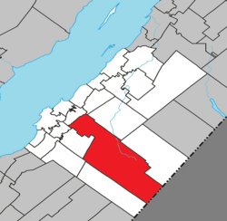 Location within Kamouraska RCM | |
 Mont-Carmel Location in eastern Quebec | |
| Coordinates: 47°26′23″N 69°51′31″W / 47.43972°N 69.85861°WCoordinates: 47°26′23″N 69°51′31″W / 47.43972°N 69.85861°W[1] | |
| Country | |
| Province | |
| Region | Bas-Saint-Laurent |
| RCM | Kamouraska |
| Constituted | July 1, 1855 |
| Government | |
| • Mayor | Denis Lévesque |
| • Federal riding | Montmagny—L'Islet—Kamouraska—Rivière-du-Loup |
| • Prov. riding | Côte-du-Sud |
| Area | |
| • Total | 438.60 km2 (169.34 sq mi) |
| • Land | 427.85 km2 (165.19 sq mi) |
| Population | |
| • Total | 1,136 |
| • Density | 2.7/km2 (7/sq mi) |
| • Pop 2006-2011 | |
| • Dwellings | 662 |
| Time zone | UTC−5 (EST) |
| • Summer (DST) | UTC−4 (EDT) |
| Postal code(s) | G0L 1W0 |
| Area code(s) | 418 and 581 |
| Highways | |
| Website | www |

Mont-Carmel is a municipality in the Canadian province of Quebec, located in the Kamouraska Regional County Municipality, on the Canada–United States border.
Geography[]
Spanning over 75% of the width of the Bas-Saint-Laurent region in which it resides, Mont-Carmel is the second largest subdivision within the Kamouraska Regional County Municipality and borders the United States at its southwest limit.
Communities and locations[]
The following designated areas reside within the municipality's boundaries:[1]
- Eatonville – a hamlet located at 47°20′16″N 69°41′01″W / 47.33778°N 69.68361°W
- Lac-de-l'Est – a vacation cottage community located at 47°13′39″N 69°35′26″W / 47.22750°N 69.59056°W
Municipal council[]
- Mayor: Denis Lévesque
- Councillors: Colette Beaulieu, Luc Forgues, Lauréat Jean, Karine St-Jean, Kathleen Saint-Jean, Pierre Saillant
See also[]
References[]
- ^ Jump up to: a b Reference number 42055 of the Commission de toponymie du Québec (in French)
- ^ Jump up to: a b Geographic code 14005 in the official Répertoire des municipalités (in French)
- ^ Jump up to: a b "(Code 2414005) Census Profile". 2011 census. Statistics Canada. 2012.
External links[]
 Media related to Mont-Carmel, Quebec at Wikimedia Commons
| show Adjacent Municipal Subdivisions |
|---|
| hide | |
|---|---|
| Cities and towns | |
| Municipalities | |
| Parishes |
|
| Unorganized territories | |
| |
| show Authority control |
|---|
Categories:
- Municipalities in Quebec
- Incorporated places in Bas-Saint-Laurent