Sainte-Anne-de-la-Pocatière
Sainte-Anne-de-la-Pocatière | |
|---|---|
Parish municipality | |
 | |
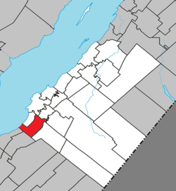 Location within Kamouraska RCM | |
 Sainte-Anne-de-la-Pocatière Location in eastern Quebec | |
| Coordinates: 47°21′N 70°00′W / 47.350°N 70.000°WCoordinates: 47°21′N 70°00′W / 47.350°N 70.000°W[1] | |
| Country | |
| Province | |
| Region | Bas-Saint-Laurent |
| RCM | Kamouraska |
| Constituted | July 1, 1855 |
| Government | |
| • Mayor | François Lagacé |
| • Federal riding | Montmagny—L'Islet—Kamouraska—Rivière-du-Loup |
| • Prov. riding | Côte-du-Sud |
| Area | |
| • Total | 79.70 km2 (30.77 sq mi) |
| • Land | 55.22 km2 (21.32 sq mi) |
| Population | |
| • Total | 1,717 |
| • Density | 31.1/km2 (81/sq mi) |
| • Pop 2006-2011 | |
| • Dwellings | 700 |
| Time zone | UTC−5 (EST) |
| • Summer (DST) | UTC−4 (EDT) |
| Postal code(s) | G0R 2A0 |
| Area code(s) | 418 and 581 |
| Highways | |
| Website | www |

Sainte-Anne-de-la-Pocatière is a parish municipality in the Canadian province of Quebec, located in the Kamouraska Regional County Municipality.
Municipal council[]
- Mayor: Miles McCall
- Councillors: Dominique Bélanger, Luc Martin Deroy, Martine Hudon, Carole Lévesque, Alphée Pelletier, Philippe Roy
Notable people[]
- Marie-Claude Bourbonnais, glamour model
See also[]
References[]
- ^ Reference number 56030 of the Commission de toponymie du Québec (in French)
- ^ Jump up to: a b Geographic code 14090 in the official Répertoire des municipalités (in French)
- ^ Jump up to: a b "(Code 2414090) Census Profile". 2011 census. Statistics Canada. 2012.
External links[]
 Media related to Sainte-Anne-de-la-Pocatière at Wikimedia Commons
| show Adjacent Municipal Subdivisions |
|---|
| hide | |
|---|---|
| Cities and towns | |
| Municipalities | |
| Parishes |
|
| Unorganized territories | |
| |
| show Authority control |
|---|
This Bas-Saint-Laurent location article is a stub. You can help Wikipedia by . |
Categories:
- Parish municipalities in Quebec
- Incorporated places in Bas-Saint-Laurent
- Bas-Saint-Laurent geography stubs