Saint-Onésime-d'Ixworth, Quebec
Saint-Onésime-d'Ixworth | |
|---|---|
Municipality | |
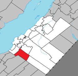 Location within Kamouraska RCM. | |
 Saint-Onésime-d'Ixworth Location in eastern Quebec. | |
| Coordinates: 47°18′N 69°56′W / 47.300°N 69.933°WCoordinates: 47°18′N 69°56′W / 47.300°N 69.933°W[1] | |
| Country | |
| Province | |
| Region | Bas-Saint-Laurent |
| RCM | Kamouraska |
| Constituted | May 13, 1859 |
| Government | |
| • Mayor | Jacques Dionne |
| • Federal riding | Montmagny—L'Islet—Kamouraska—Rivière-du-Loup |
| • Prov. riding | Côte-du-Sud |
| Area | |
| • Total | 99.80 km2 (38.53 sq mi) |
| • Land | 100.95 km2 (38.98 sq mi) |
| There is an apparent contradiction between two authoritative sources | |
| Population | |
| • Total | 559 |
| • Density | 5.5/km2 (14/sq mi) |
| • Pop 2006-2011 | |
| • Dwellings | 308 |
| Time zone | UTC−5 (EST) |
| • Summer (DST) | UTC−4 (EDT) |
| Postal code(s) | G0R 3W0 |
| Area code(s) | 418 and 581 |
| Highways | No major routes |
| Website | www |

Saint-Onésime-d'Ixworth is a municipality in the Canadian province of Quebec, located in the Kamouraska Regional County Municipality.
Municipal council[]
- Mayor: Jacques Dionne
- Councillors: Jean-Guy Beaulieu, Michèle Bond, Jean-Marie Dionne, Alfred Ouellet, Bertrand Ouellet, Isabelle Veilleux
See also[]
References[]
- ^ Reference number 57340 of the Commission de toponymie du Québec (in French)
- ^ Jump up to: a b Geographic code 14080 in the official Répertoire des municipalités (in French)
- ^ Jump up to: a b "(Code 2414080) Census Profile". 2011 census. Statistics Canada. 2012.
- ^ http://en.db-city.com/Canada--Quebec--Bas-Saint-Laurent--Saint-On%C3%A9sime-d%27Ixworth
| show Adjacent Municipal Subdivisions |
|---|
| hide | |
|---|---|
| Cities and towns | |
| Municipalities | |
| Parishes |
|
| Unorganized territories | |
| |
| show Authority control |
|---|
This Bas-Saint-Laurent location article is a stub. You can help Wikipedia by . |
Categories:
- Municipalities in Quebec
- Incorporated places in Bas-Saint-Laurent
- Bas-Saint-Laurent geography stubs