Monthois
This article may be expanded with text translated from the corresponding article in French. (December 2008) Click [show] for important translation instructions.
|
Monthois | |
|---|---|
Commune | |
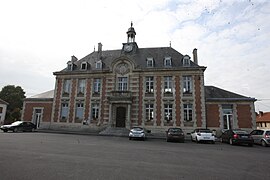 Town hall | |
 Coat of arms | |
Location of Monthois  | |
 Monthois | |
| Coordinates: 49°18′46″N 4°42′34″E / 49.3128°N 4.7094°ECoordinates: 49°18′46″N 4°42′34″E / 49.3128°N 4.7094°E | |
| Country | France |
| Region | Grand Est |
| Department | Ardennes |
| Arrondissement | Vouziers |
| Canton | Attigny |
| Intercommunality | Argonne Ardennaise |
| Government | |
| • Mayor (2020–2026) | Vincent Fleury |
| Area 1 | 11.98 km2 (4.63 sq mi) |
| Population (Jan. 2018)[1] | 379 |
| • Density | 32/km2 (82/sq mi) |
| Time zone | UTC+01:00 (CET) |
| • Summer (DST) | UTC+02:00 (CEST) |
| INSEE/Postal code | 08303 /08400 |
| 1 French Land Register data, which excludes lakes, ponds, glaciers > 1 km2 (0.386 sq mi or 247 acres) and river estuaries. | |


Monthois (French pronunciation: [mɔ̃twa]) is a commune in the Ardennes department in northern France.
Population[]
| Year | Pop. | ±% |
|---|---|---|
| 1962 | 390 | — |
| 1968 | 417 | +6.9% |
| 1975 | 363 | −12.9% |
| 1982 | 388 | +6.9% |
| 1990 | 376 | −3.1% |
| 1999 | 336 | −10.6% |
| 2008 | 382 | +13.7% |
Monuments[]
| Wikimedia Commons has media related to Monthois. |
Monthois features a monument built to recognize the 372nd Infantry of the 93rd American Division, who fought a battle in the town in early October 1918.
See also[]
References[]
- ^ "Populations légales 2018". The National Institute of Statistics and Economic Studies. 28 December 2020.
| Prefecture | |
|---|---|
| Subprefectures |
|
| Other |
|
This Ardennes geographical article is a stub. You can help Wikipedia by . |
Categories:
- Communes of Ardennes (department)
- Ardennes (department) geography stubs