Sormonne
This article may be expanded with text translated from the corresponding article in French. (December 2008) Click [show] for important translation instructions.
|
Sormonne | |
|---|---|
Commune | |
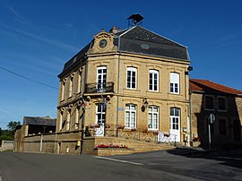 The town hall in Sormonne | |
Location of Sormonne  | |
 Sormonne | |
| Coordinates: 49°48′41″N 4°34′02″E / 49.8114°N 4.5672°ECoordinates: 49°48′41″N 4°34′02″E / 49.8114°N 4.5672°E | |
| Country | France |
| Region | Grand Est |
| Department | Ardennes |
| Arrondissement | Charleville-Mézières |
| Canton | Rocroi |
| Government | |
| • Mayor (2020–2026) | François Deneux[1] |
| Area 1 | 4.75 km2 (1.83 sq mi) |
| Population (Jan. 2018)[2] | 540 |
| • Density | 110/km2 (290/sq mi) |
| Time zone | UTC+01:00 (CET) |
| • Summer (DST) | UTC+02:00 (CEST) |
| INSEE/Postal code | 08429 /08150 |
| 1 French Land Register data, which excludes lakes, ponds, glaciers > 1 km2 (0.386 sq mi or 247 acres) and river estuaries. | |


Sormonne is a commune in the Ardennes department and Grand Est region of north-eastern France.
Geography[]
The river Sormonne, a left tributary of the Meuse, flows through the commune.
Population[]
| Year | Pop. | ±% |
|---|---|---|
| 1946 | 242 | — |
| 1954 | 234 | −3.3% |
| 1962 | 238 | +1.7% |
| 1968 | 223 | −6.3% |
| 1975 | 231 | +3.6% |
| 1982 | 397 | +71.9% |
| 1990 | 531 | +33.8% |
| 1999 | 542 | +2.1% |
| 2007 | 565 | +4.2% |
| 2015 | 551 | −2.5% |
See also[]
References[]
- ^ "Répertoire national des élus: les maires". data.gouv.fr, Plateforme ouverte des données publiques françaises (in French). 9 August 2021.
- ^ "Populations légales 2018". The National Institute of Statistics and Economic Studies. 28 December 2020.
| Wikimedia Commons has media related to Sormonne. |
| Prefecture | |
|---|---|
| Subprefectures |
|
| Other |
|
This Ardennes geographical article is a stub. You can help Wikipedia by . |
Categories:
- Communes of Ardennes (department)
- Ardennes (department) geography stubs