Morra, Netherlands
Morra
Moarre | |
|---|---|
Village | |
 Saint John, Morra | |
 Flag  Coat of arms | |
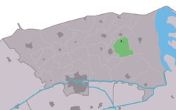 Location in the Dongeradeel municipality | |
 Morra Location in the Netherlands | |
| Coordinates: Coordinates: 53°22′21″N 06°05′19″E / 53.37250°N 6.08861°E | |
| Country | |
| Province | |
| Municipality | Noardeast-Fryslân |
| Population (2017) | |
| • Total | 227 |
| Time zone | UTC+1 (CET) |
| • Summer (DST) | UTC+2 (CEST) |
| Postal code | 9204 |
| Telephone area | 0519 |

Morra is a hamlet in Noardeast-Fryslân, Friesland, the Netherlands with roughly 227 inhabitants in January 2017.[1] Before 2019, the village was part of the Dongeradeel municipality.
History[]
It was not consolidated when various other hamlets within the parish were consolidated into one village. Within the hamlet stands a church with a characteristic 13th century tower. Highway N-361 runs just to the south of the hamlet.
Morra was surrounded by fens (marshland) which are now cultivated. The name Morra means marshland in Frisian, and is related to the English word moor.
The people in Morra are predominantly Frisians and speak West Frisian. The hamlet has locally produced drama productions, an orchestra, and a handball club.
Morra is adjacent to the hamlet of Lioessens and they are administered together as a pair (dubbeldorp) sharing facilities such as the local sports field and the primary school. There was a station called Morra-Lioessens on the North Friesland Railway, which opened in 1913 and closed in 1935, although it reopened again briefly during World War II from May 1940 to July 1942.
References[]
- ^ Aantal inwoners per woonplaats in Dongeradeel op 1 januari 2017 Archived 2017-10-21 at the Wayback Machine - Dongeradeel
External links[]
- "Morra" from the official website of Dongeradeel Municipality, in Dutch
- "Morra" Maplace aerial view of Morra
![]() Media related to Morra, Noardeast-Fryslân at Wikimedia Commons
Media related to Morra, Noardeast-Fryslân at Wikimedia Commons
This Friesland location article is a stub. You can help Wikipedia by . |
- Noardeast-Fryslân
- Populated places in Friesland
- Friesland geography stubs