Mungungo
| Mungungo Queensland | |||||||||||||||
|---|---|---|---|---|---|---|---|---|---|---|---|---|---|---|---|
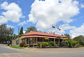 Waratah Hotel at Mungungo, 2017 | |||||||||||||||
 Mungungo | |||||||||||||||
| Coordinates | 24°46′02″S 151°09′50″E / 24.7672°S 151.1638°ECoordinates: 24°46′02″S 151°09′50″E / 24.7672°S 151.1638°E | ||||||||||||||
| Population | 77 (2016 census)[1] | ||||||||||||||
| • Density | 0.752/km2 (1.948/sq mi) | ||||||||||||||
| Postcode(s) | 4630 | ||||||||||||||
| Area | 102.4 km2 (39.5 sq mi) | ||||||||||||||
| Time zone | AEST (UTC+10:00) | ||||||||||||||
| Location | |||||||||||||||
| LGA(s) | North Burnett Region | ||||||||||||||
| State electorate(s) | Callide | ||||||||||||||
| Federal division(s) | Flynn | ||||||||||||||
| |||||||||||||||

Mungungo is a rural town and locality in the North Burnett Region, Queensland, Australia.[2][3] In the 2016 census, Mungungo had a population of 77 people.[1]
Geography[]
Mungungo is in the Wide Bay-Burnett region, 488 kilometres (303 mi) north west of the state capital, Brisbane.
History[]
The name Mungungo is believed to mean "darkness" or "night" in an unidentified indigenous language. Until 1929, the town was known as Waratah.[3]
The Gladstone to Monto railway line reached Mungungo in 1930.
Amenities[]
Mungungo is well known throughout the surrounding land for its pub which is one of the few available eateries in the area.
References[]
- ^ a b Australian Bureau of Statistics (27 June 2017). "Mungungo (SSC)". 2016 Census QuickStats. Retrieved 20 October 2018.

- ^ "Mungungo – town in North Burnett Region (entry 23491)". Queensland Place Names. Queensland Government. Retrieved 30 November 2019.
- ^ a b "Mungungo – locality in North Burnett Region (entry 45400)". Queensland Place Names. Queensland Government. Retrieved 30 November 2019.
External links[]
| Wikimedia Commons has media related to Mungungo. |
Categories:
- Towns in Queensland
- North Burnett Region
- Localities in Queensland