[3] Name on the Register
Image
Date listed[4]
Location
City or town
Description
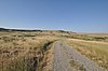
1
Upload image March 25, 1999 (#99000343 ) 3 miles (4.8 km) north of Fort Smith on the Bighorn River [5] 45°20′06″N 107°54′12″W / 45.335000°N 107.90333°W / 45.335000; -107.90333 (Annashisee Iisaxpuatahcheeaashisee-Medicine Wheel on Bighorn River ) Fort Smith
2
Baldwin House Upload image August 3, 1987 (#87001270 ) 25 3rd Ave. 45°19′02″N 107°22′00″W / 45.317222°N 107.366667°W / 45.317222; -107.366667 (Baldwin House ) Lodge Grass Demolished
3
Bighorn Ditch Headgate
December 12, 1976 (#76000174 ) West of Fort Smith at the mouth of Bighorn Canyon 45°18′56″N 107°57′03″W / 45.315556°N 107.950833°W / 45.315556; -107.950833 (Bighorn Ditch Headgate ) Fort Smith
4
John Boyum House
April 11, 1991 (#91000371 ) 225 W. 6th St. 45°44′05″N 107°36′35″W / 45.734722°N 107.609722°W / 45.734722; -107.609722 (John Boyum House ) Hardin
5
April 11, 1991 (#91000368 ) 604 N. Cody 45°44′04″N 107°36′36″W / 45.734444°N 107.61°W / 45.734444; -107.61 (Thomas H. Burke House ) Hardin
6
Cammock's Hotel Upload image August 30, 1987 (#87001271 ) 28 N. Main St. 45°18′57″N 107°21′49″W / 45.315833°N 107.363611°W / 45.315833; -107.363611 (Cammock's Hotel ) Lodge Grass Demolished
7
Camp Four Upload image January 21, 1992 (#91001940 ) 11 miles northeast of Fort Smith on Fort Smith-Hardin County Road 45°24′50″N 107°53′43″W / 45.413889°N 107.895278°W / 45.413889; -107.895278 (Camp Four ) Fort Smith
8
Chief Plenty Coups (Alek-Chea-Ahoosh) House
October 6, 1970 (#70000354 ) 1 mile west of Pryor off 45°25′44″N 108°32′45″W / 45.428889°N 108.545833°W / 45.428889; -108.545833 (Chief Plenty Coups (Alek-Chea-Ahoosh) House ) Pryor
9
Chivers Memorial Church Upload image August 3, 1987 (#87001272 ) East of the former CB&Q railroad tracks, along the western side of U.S. Route 87 45°18′51″N 107°21′40″W / 45.314167°N 107.361111°W / 45.314167; -107.361111 (Chivers Memorial Church ) Lodge Grass Demolished
10
Commercial District
August 14, 1985 (#85001845 ) Roughly bounded by 4th, Crook, the Burlington Northern line, 1st and Crow Sts. 45°43′46″N 107°36′30″W / 45.729444°N 107.608333°W / 45.729444; -107.608333 (Commercial District ) Hardin
11
Upload image August 3, 1987 (#87001274 ) Eastern side of Main St. 45°19′02″N 107°21′49″W / 45.317222°N 107.363611°W / 45.317222; -107.363611 (J.W. Drew Grain Elevator ) Lodge Grass Demolished
12
April 11, 1991 (#91000370 ) 704 N. Crow Ave. 45°44′08″N 107°36′31″W / 45.735556°N 107.608611°W / 45.735556; -107.608611 (William Ebeling House ) Hardin
13
April 11, 1991 (#91000374 ) 416 W. 3rd St. 45°43′53″N 107°36′43″W / 45.731389°N 107.611944°W / 45.731389; -107.611944 (Charles S. Eder House ) Hardin
14
First Baptist Church
April 11, 1991 (#91000369 ) 524 N. Custer Ave. 45°44′03″N 107°36′26″W / 45.734167°N 107.607222°W / 45.734167; -107.607222 (First Baptist Church ) Hardin
15
Fort C.F. Smith Historic District Upload image October 10, 1975 (#75000163 ) East of Fort Smith in the Bighorn Canyon National Recreation Area 45°17′59″N 107°54′59″W / 45.299722°N 107.916389°W / 45.299722; -107.916389 (Fort C.F. Smith Historic District ) Fort Smith
16
April 11, 1991 (#91000376 ) 520 W. 3rd St. 45°43′52″N 107°36′51″W / 45.731111°N 107.614167°W / 45.731111; -107.614167 (Haverfield Hospital ) Hardin
17
April 11, 1991 (#91000377 ) 416 Crawford Ave. 45°43′58″N 107°36′41″W / 45.732778°N 107.611389°W / 45.732778; -107.611389 (Francis Kopriva House ) Hardin
18
Upload image July 8, 1981 (#81000659 ) Northeast of Decker in Tongue River Reservoir State Park 45°08′00″N 106°45′52″W / 45.133333°N 106.764444°W / 45.133333; -106.764444 (Lee Homestead ) Decker Probably demolished.
19
Little Bighorn Battlefield National Monument
October 15, 1966 (#66000428 ) 15 miles south of Hardin 45°31′20″N 107°22′39″W / 45.522222°N 107.3775°W / 45.522222; -107.3775 (Little Bighorn Battlefield National Monument ) Hardin
20
Lodge Grass City Jail
August 3, 1987 (#87001276 ) Alley south of 3rd Ave. 45°19′01″N 107°21′53″W / 45.316944°N 107.364722°W / 45.316944; -107.364722 (Lodge Grass City Jail ) Lodge Grass
21
August 3, 1987 (#87001275 ) 1st Ave. 45°18′55″N 107°21′54″W / 45.315278°N 107.365°W / 45.315278; -107.365 (Lodge Grass Merchandise Company Store ) Lodge Grass
22
December 20, 2002 (#02001547 ) 45°31′46″N 106°57′28″W / 45.529444°N 106.957778°W / 45.529444; -106.957778 (Moncure Tipi ) Busby
23
Upload image December 15, 1992 (#92001321 ) Roughly 15 miles south of Birney on Hanging Woman Creek 45°08′10″N 106°28′39″W / 45.136111°N 106.4775°W / 45.136111; -106.4775 (OW Ranch ) Birney
24
Upload image August 3, 1987 (#87001278 ) 8 N. Main St. 45°18′57″N 107°21′49″W / 45.315833°N 107.363611°W / 45.315833; -107.363611 (George Pease's Second Store ) Lodge Grass Demolished
25
April 11, 1991 (#91000373 ) 119 W. 6th St. 45°44′04″N 107°36′26″W / 45.734444°N 107.607222°W / 45.734444; -107.607222 (J.J. Ping House ) Hardin
26
April 11, 1991 (#91000378 ) 719 N. Custer Ave. 45°44′08″N 107°37′10″W / 45.735556°N 107.619444°W / 45.735556; -107.619444 (Reno Apartments ) Hardin
27
August 14, 1985 (#85001846 ) Roughly bounded by 5th, 4th, Crow, and Cody 45°43′56″N 107°36′28″W / 45.732222°N 107.607778°W / 45.732222; -107.607778 (Residential District ) Hardin
28
Rosebud Battlefield-Where the Girl Saved Her Brother
August 21, 1972 (#72000735 ) , 12 miles south of Kirby 45°13′17″N 106°59′21″W / 45.221389°N 106.989167°W / 45.221389; -106.989167 (Rosebud Battlefield-Where the Girl Saved Her Brother ) Kirby
29
John Ryan's House Upload image August 3, 1987 (#87001277 ) 15 N. Helen St. 45°18′51″N 107°21′50″W / 45.314167°N 107.363889°W / 45.314167; -107.363889 (John Ryan's House ) Lodge Grass Demolished
30
St. Joseph Catholic Church
April 11, 1991 (#91000379 ) 710 N. Custer Ave. 45°44′09″N 107°36′26″W / 45.735833°N 107.607222°W / 45.735833; -107.607222 (St. Joseph Catholic Church ) Hardin
31
August 17, 1990 (#90001214 ) On the Big Horn River in the Crow Indian Reservation 45°27′48″N 107°43′37″W / 45.463333°N 107.726944°W / 45.463333; -107.726944 (St. Xavier Mission Church and Rectory ) St. Xavier
32
Upload image August 3, 1987 (#87001279 ) 18 Helen St. 45°18′53″N 107°21′53″W / 45.314722°N 107.364722°W / 45.314722; -107.364722 (Jay Sharp's Store ) Lodge Grass Demolished
33
Upload image August 3, 1987 (#87001273 ) 4 S. George St. 45°18′49″N 107°22′05″W / 45.313611°N 107.368056°W / 45.313611; -107.368056 (Simmonsen's House ) Lodge Grass Demolished
34
August 3, 1987 (#87001280 ) 10 W. Hester Ave. 45°18′49″N 107°22′03″W / 45.313611°N 107.3675°W / 45.313611; -107.3675 (Dominic Stevens House ) Lodge Grass
35
April 11, 1991 (#91000372 ) 217 W. Sixth St. 45°44′05″N 107°36′34″W / 45.734722°N 107.609444°W / 45.734722; -107.609444 (Sullivan Rooming House ) Hardin
36
James J. Sullivan House
April 11, 1991 (#91000380 ) 220 W. 3rd St. 45°43′52″N 107°36′32″W / 45.731111°N 107.608889°W / 45.731111; -107.608889 (James J. Sullivan House ) Hardin
37
Upload image August 3, 1987 (#87001281 ) George St. 45°18′50″N 107°22′05″W / 45.313889°N 107.368056°W / 45.313889; -107.368056 (J.M. Trytten House ) Lodge Grass Demolished
38
April 11, 1991 (#91000381 ) 502 N. Cody 45°44′01″N 107°36′39″W / 45.733556°N 107.610881°W / 45.733556; -107.610881 (J.S. Tupper House ) Hardin
39
Upload image January 25, 2011 (#10001188 ) Rosebud Battlefield Rd., 3 miles west of MT 314 45°12′55″N 107°00′22″W / 45.2153°N 107.0061°W / 45.2153; -107.0061 (Alvin Young Barn and Cabin Historic District ) Busby vicinity