National Register of Historic Places listings in Cowlitz County, Washington

Location of Cowlitz County in Washington
This list presents the full set of buildings, structures, objects, sites, or districts designated on the National Register of Historic Places in Cowlitz County, Washington, and offers brief descriptive information about each of them. The National Register recognizes places of national, state, or local historic significance across the United States.[1] Out of over 90,000 National Register sites nationwide,[2] Washington is home to approximately 1,500,[3] and 32 of those are found partially or wholly in Cowlitz County.
- This National Park Service list is complete through NPS recent listings posted February 11, 2022.[4]
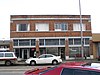
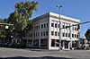
Current listings[]


See also[]
- National Register of Historic Places listings in Washington state
- Listings in neighboring counties: Clark, Columbia, Lewis, Skamania, Wahkiakum
- Historic preservation
- History of Washington (state)
- Index of Washington-related articles
References[]
- ^ Andrus, Patrick W.; Shrimpton, Rebecca H.; et al. (2002), How to Apply the National Register Criteria for Evaluation, National Register Bulletin, National Park Service, U.S. Department of the Interior, retrieved June 20, 2014.
- ^ National Park Service, National Register of Historic Places Program: Research, retrieved January 28, 2015.
- ^ Department of Archaeology and Historic Preservation, Washington Information System for Architectural and Archaeological Records Data (WISAARD), retrieved February 14, 2015.
- ^ National Park Service, United States Department of the Interior, "National Register of Historic Places: Weekly List Actions", retrieved February 11, 2022.
- ^ Numbers represent an alphabetical ordering by significant words. Various colorings, defined here, differentiate National Historic Landmarks and historic districts from other NRHP buildings, structures, sites or objects.
- ^ "National Register Information System". National Register of Historic Places. National Park Service. April 24, 2008.
- ^ The eight-digit number below each date is the number assigned to each location in the National Register Information System database, which can be viewed by clicking the number.
External links[]
- Washington Department of Archaeology and Historic Preservation, Historic Register program
- National Park Service, National Register of Historic Places site
 Media related to National Register of Historic Places in Cowlitz County, Washington at Wikimedia Commons
| Lists by county |
|  |
|---|---|---|
| Other lists |
| |
| Topics | |
|---|---|
| Lists by state |
|
| Lists by insular areas | |
| Lists by associated state | |
| Other areas | |
| Related | |
| |
Municipalities and communities of Cowlitz County, Washington, United States | ||
|---|---|---|
| Cities |  | |
| CDPs | ||
| Other communities |
| |
| Footnotes | ‡This populated place also has portions in an adjacent county or counties | |
| ||
Categories:
- National Register of Historic Places in Cowlitz County, Washington
- Lists of National Register of Historic Places in Washington (state) by county