National Register of Historic Places listings in Kittitas County, Washington
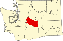
Location of Kittitas County in Washington
This is a list of the National Register of Historic Places listings in Kittitas County, Washington.
This is intended to be a complete list of the properties and districts on the National Register of Historic Places in Kittitas County, Washington, United States. Latitude and longitude coordinates are provided for many National Register properties and districts; these locations may be seen together in a map.[1]
There are 25 properties and districts listed on the National Register in the county. Another property was once listed but has been removed.
- This National Park Service list is complete through NPS recent listings posted February 11, 2022.[2]
Current listings[]


Former listings[]
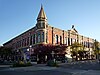
| [3] | Name on the Register | Image | Date listed | Date removed | Location | City or town | Description |
|---|---|---|---|---|---|---|---|
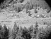
| 1 | 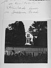 |
February 25, 1982 (#82004257) | February 5, 2001 | Off US 7B | Ellensburg vicinity | Listed in 1982. |
See also[]
References[]
- ^ The latitude and longitude information provided in this table was derived originally from the National Register Information System, which has been found to be fairly accurate for about 99% of listings. Some locations in this table may have been corrected to current GPS standards.
- ^ National Park Service, United States Department of the Interior, "National Register of Historic Places: Weekly List Actions", retrieved February 11, 2022.
- ^ a b Numbers represent an alphabetical ordering by significant words. Various colorings, defined here, differentiate National Historic Landmarks and historic districts from other NRHP buildings, structures, sites or objects.
- ^ "National Register Information System". National Register of Historic Places. National Park Service. April 24, 2008.
- ^ The eight-digit number below each date is the number assigned to each location in the National Register Information System database, which can be viewed by clicking the number.
- ^ [1]
- ^ Larry Nickel (July 1976). "National Register of Historic Places Inventory-Nomination: Downtown Ellensburg Historic District". National Park Service. Retrieved February 1, 2022. With accompanying 12 photos from 1976, the second being of the Masonic Temple.
External links[]
![]() Media related to National Register of Historic Places in Kittitas County, Washington at Wikimedia Commons
Media related to National Register of Historic Places in Kittitas County, Washington at Wikimedia Commons
| Lists by county |
|  |
|---|---|---|
| Other lists |
| |
| Topics | |
|---|---|
| Lists by state |
|
| Lists by insular areas | |
| Lists by associated state | |
| Other areas | |
| Related | |
| |
Municipalities and communities of Kittitas County, Washington, United States | ||
|---|---|---|
| Cities |  | |
| Town | ||
| CDPs | ||
| Other communities | ||
| Footnotes | ‡This populated place also has portions in an adjacent county or counties | |
| ||
Categories:
- Lists of National Register of Historic Places in Washington (state) by county
- National Register of Historic Places in Kittitas County, Washington