Natonin
Natonin | |
|---|---|
| Municipality of Natonin | |
 Flag  Seal | |
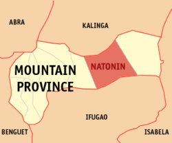 Map of Mountain Province with Natonin highlighted | |
OpenStreetMap  | |
 Natonin Location within the Philippines | |
| Coordinates: 17°06′N 121°17′E / 17.1°N 121.28°ECoordinates: 17°06′N 121°17′E / 17.1°N 121.28°E | |
| Country | Philippines |
| Region | Cordillera Administrative Region |
| Province | Mountain Province |
| District | Lone district |
| Founded | 1915 |
| Barangays | 11 (see Barangays) |
| Government | |
| • Type | Sangguniang Bayan |
| • Mayor | Jose T. Agagon |
| • Vice Mayor | Christopher M. Bayowan |
| • Representative | Maximo Y. Dalog Jr. |
| • Electorate | 8,049 voters (2019) |
| Area | |
| • Total | 252.00 km2 (97.30 sq mi) |
| Elevation | 831 m (2,726 ft) |
| Highest elevation | 1,879 m (6,165 ft) |
| Lowest elevation | 276 m (906 ft) |
| Population (2020 census) [3] | |
| • Total | 10,339 |
| • Density | 41/km2 (110/sq mi) |
| • Households | 2,187 |
| Economy | |
| • Income class | 4th municipal income class |
| • Poverty incidence | 35.67% (2015)[4] |
| • Revenue | ₱105,140,058.96 (2020) |
| • Assets | ₱164,656,681.95 (2020) |
| • Expenditure | ₱98,733,746.36 (2020) |
| • Liabilities | ₱110,286,147.62 (2020) |
| Service provider | |
| • Electricity | Mountain Province Electric Cooperative (MOPRECO) |
| Time zone | UTC+8 (PST) |
| ZIP code | 2624 |
| PSGC | |
| IDD : area code | +63 (0)74 |
| Native languages | Balangao Bontoc Ilocano Tagalog |

Natonin, officially the Municipality of Natonin, is a 4th class municipality in the province of Mountain Province, Philippines. According to the 2020 census, it has a population of 10,339 people. [3]
Geography[]
The municipality is very mountainous, with very little level ground lending itself to agriculture. The barangays are geographically isolated by high (700m) mountains covered in jungle. It has a total land area of around 20 000 hectares.
Barangays[]
Natonin is politically subdivided into 11 barangays:
- Alunogan
- Balangao
- Banao
- Banawel
- Butac
- Maducayan
- Poblacion
- Saliok
- Santa Isabel
- Tonglayan
- Pudo
Climate[]
| Climate data for Natonin, Mountain Province | |||||||||||||
|---|---|---|---|---|---|---|---|---|---|---|---|---|---|
| Month | Jan | Feb | Mar | Apr | May | Jun | Jul | Aug | Sep | Oct | Nov | Dec | Year |
| Average high °C (°F) | 20 (68) |
21 (70) |
23 (73) |
26 (79) |
26 (79) |
26 (79) |
25 (77) |
25 (77) |
24 (75) |
23 (73) |
22 (72) |
20 (68) |
23 (74) |
| Average low °C (°F) | 14 (57) |
15 (59) |
16 (61) |
17 (63) |
18 (64) |
18 (64) |
18 (64) |
18 (64) |
18 (64) |
18 (64) |
17 (63) |
16 (61) |
17 (62) |
| Average precipitation mm (inches) | 103 (4.1) |
73 (2.9) |
49 (1.9) |
38 (1.5) |
141 (5.6) |
144 (5.7) |
172 (6.8) |
181 (7.1) |
155 (6.1) |
148 (5.8) |
147 (5.8) |
208 (8.2) |
1,559 (61.5) |
| Average rainy days | 17.1 | 12.8 | 11.0 | 9.6 | 18.9 | 21.5 | 23.5 | 24.5 | 21.7 | 16.1 | 17.1 | 20.5 | 214.3 |
| Source: Meteoblue [5] | |||||||||||||
Demographics[]
| Year | Pop. | ±% p.a. |
|---|---|---|
| 1918 | 5,118 | — |
| 1939 | 5,999 | +0.76% |
| 1948 | 5,847 | −0.28% |
| 1960 | 9,397 | +4.03% |
| 1970 | 5,690 | −4.89% |
| 1975 | 6,691 | +3.30% |
| 1980 | 7,325 | +1.83% |
| 1990 | 9,813 | +2.97% |
| 1995 | 8,997 | −1.61% |
| 2000 | 9,065 | +0.16% |
| 2007 | 9,431 | +0.55% |
| 2010 | 10,048 | +2.33% |
| 2015 | 10,272 | +0.42% |
| 2020 | 10,339 | +0.13% |
| Source: Philippine Statistics Authority [6] [7] [8][9] | ||
The natives of Natonin are generally called Balangaos, or Iferangao, and speak the Finerangao language. There are two sub-tribes: the Hakki, who inhabit the western part of the town, and the Majukayyongs, who inhabit the barangays of Saliok and Maducayan. The Majukayyongs initially came from southern Kalinga Province. Populations of the town are of Igorot lineage. Headhunting was practiced throughout Natonin as late as the mid-1930s, but was set aside in favor of Christianity and education after World War II.
Languages[]
Natonin is home to two indigenous languages which have existed there since before the arrival of the Spanish: the Balangaw dialect and the Kinalinga dialect. Immigrants from the Ilocos Region came in the 1970s and imported the Ilokano dialect during the era of martial law.
Economy[]
| Poverty Incidence of Natonin | |
| Source: Philippine Statistics Authority[10][11][12][13][14][15] | |
The primary crop is rice, although a lack of arable land, mechanization and fertilizers limits the harvest to a subsistence level only. Families rely on small livestock populations to supplement the diet. Fruits and wild coffee are harvested from the forest. The barangay of Poblacion boasts of numerous family ponds which raise tilapia for consumption. Due to the terrain, rice is planted on terraced fields. Locals consider the rice terraces of Natonin to be equal or superior to those of Banaue to the south.
Transportation[]
Transportation throughout Natonin is largely undeveloped roads. The only paved roads (as of 2007) are in Poblacion proper. Roads frequently become impassable in the rainy seasons. Some barangays (notably Maducayan) are inaccessible by road. Maducayan lies one mile beyond a recent road extension from the center of Saliok to the westernmost situ of Saliok.
Tourism[]
Natonin has the following tourism sites:
- The Legendary Silent Mountain of Binaratan, located in Barangay Maducayan.
- The Apatan Rice Terraces
- The Balococ Waterfall
- The Naropaan Waterfall
- Tongalayan Rice Terraces
- Lagan River in Balangao
- Penadna Waterfalls
- Lettalet Waterfalls
References[]
- ^ Municipality of Natonin | (DILG)
- ^ "2015 Census of Population, Report No. 3 – Population, Land Area, and Population Density" (PDF). Philippine Statistics Authority. Quezon City, Philippines. August 2016. ISSN 0117-1453. Archived (PDF) from the original on May 25, 2021. Retrieved July 16, 2021.
- ^ a b Census of Population (2020). "Cordillera Administrative Region (CAR)". Total Population by Province, City, Municipality and Barangay. PSA. Retrieved 8 July 2021.
- ^ https://psa.gov.ph/sites/default/files/City%20and%20Municipal-level%20Small%20Area%20Poverty%20Estimates_%202009%2C%202012%20and%202015_0.xlsx; publication date: 10 July 2019; publisher: Philippine Statistics Authority.
- ^ "Natonin: Average Temperatures and Rainfall". Meteoblue. Retrieved 8 March 2020.
- ^ Census of Population (2015). "Cordillera Administrative Region (CAR)". Total Population by Province, City, Municipality and Barangay. PSA. Retrieved 20 June 2016.
- ^ Census of Population and Housing (2010). "Cordillera Administrative Region (CAR)". Total Population by Province, City, Municipality and Barangay. NSO. Retrieved 29 June 2016.
- ^ Censuses of Population (1903–2007). "Cordillera Administrative Region (CAR)". Table 1. Population Enumerated in Various Censuses by Province/Highly Urbanized City: 1903 to 2007. NSO.
- ^ "Province of Mountain Province". Municipality Population Data. Local Water Utilities Administration Research Division. Retrieved 17 December 2016.
- ^ "Poverty incidence (PI):". Philippine Statistics Authority. Retrieved 28 December 2020.
- ^ https://psa.gov.ph/sites/default/files/NSCB_LocalPovertyPhilippines_0.pdf; publication date: 29 November 2005; publisher: Philippine Statistics Authority.
- ^ https://psa.gov.ph/sites/default/files/2003%20SAE%20of%20poverty%20%28Full%20Report%29_1.pdf; publication date: 23 March 2009; publisher: Philippine Statistics Authority.
- ^ https://psa.gov.ph/sites/default/files/2006%20and%202009%20City%20and%20Municipal%20Level%20Poverty%20Estimates_0_1.pdf; publication date: 3 August 2012; publisher: Philippine Statistics Authority.
- ^ https://psa.gov.ph/sites/default/files/2012%20Municipal%20and%20City%20Level%20Poverty%20Estima7tes%20Publication%20%281%29.pdf; publication date: 31 May 2016; publisher: Philippine Statistics Authority.
- ^ https://psa.gov.ph/sites/default/files/City%20and%20Municipal-level%20Small%20Area%20Poverty%20Estimates_%202009%2C%202012%20and%202015_0.xlsx; publication date: 10 July 2019; publisher: Philippine Statistics Authority.
External links[]
Places adjacent to Natonin | ||||||||||||||||
|---|---|---|---|---|---|---|---|---|---|---|---|---|---|---|---|---|
| ||||||||||||||||
- Municipalities of Mountain Province