Ocean Pines, Maryland
Ocean Pines, Maryland | |
|---|---|
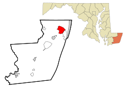 Location In Worcester County and the state of Maryland | |
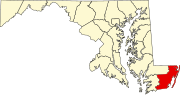
 Ocean Pines Location within the state of Maryland | |
| Coordinates: 38°23′1″N 75°9′10″W / 38.38361°N 75.15278°WCoordinates: 38°23′1″N 75°9′10″W / 38.38361°N 75.15278°W | |
| Country | United States |
| State | Maryland |
| County | Worcester |
| Government | |
| • Type | Homeowners' association |
| • President, Board of Directors | Larry Perrone |
| • General Manager | John W Viola |
| Area | |
| • Total | 9.4 sq mi (24.1 km2) |
| • Land | 6.7 sq mi (17.2 km2) |
| • Water | 2.7 sq mi (7.0 km2) |
| Elevation | 10 ft (3 m) |
| Population (2010) | |
| • Total | 11,710 |
| • Density | 1,758.5/sq mi (679.0/km2) |
| Time zone | UTC−5 (Eastern (EST)) |
| • Summer (DST) | UTC−4 (EDT) |
| ZIP code | 21811 |
| Area code(s) | 410, 443 |
| FIPS code | 24-58275 |
| GNIS feature ID | 0590933 |
| Website | http://www.oceanpines.org |


Ocean Pines is a census-designated place (CDP) in Worcester County, Maryland, United States. The population was 11,710 at the 2010 census. It is part of the Salisbury, Maryland-Delaware Metropolitan Statistical Area. It shares the same ZIP code as Berlin.
The community began as a small resort in 1968 and today is the largest residential community in Worcester County
History[]
In 1984, Gerald S Klien bought $55 million in property for development using Merritt Commercial Savings and Loan assets including a $2 million Maryland Marine wastewater plant. Maple Lawn and Burleigh developer partner Stuart Greenbaum, purchased 800 additional acres for subdivision. In 1985 Worcester County commissioners condemned the Maryland Marine Systems Merritt Commercial Savings and Loan owned sewer system embroiled in the Jeffery Levitt Scandal in order to remove a development moratorium. The system had failed to implement $1.3 million in required maintenance to prevent sewer overflow into the streets creating the moratorium.[1]
Geography[]
Ocean Pines is located at 38°23′1″N 75°9′10″W / 38.38361°N 75.15278°W (38.383692, −75.152755).[2]
According to the United States Census Bureau, the CDP has a total area of 9.4 square miles (24 km2), of which 6.7 square miles (17 km2) is land and 2.7 square miles (7.0 km2) (29.0%) is water.
Demographics[]
| Historical population | |||
|---|---|---|---|
| Census | Pop. | %± | |
| 1990 | 4,251 | — | |
| 2000 | 10,496 | 146.9% | |
| 2010 | 11,710 | 11.6% | |
| source:[3] | |||
At the 2010 census,[4] there were 11,710 people, 5,471 households and 3,457 families residing in the CDP. The population density was 1,758.5 per square mile (597.7/km2). There were 8,870 housing units at an average density of 1323.9/sq mi (511.1/km2). The racial makeup of the CDP was 94.5% White, 2.4% African American, 0.2% Native American, 0.9% Asian, 0.7% from other races, and 1.2% from two or more races. Hispanic or Latino of any race were 2.4% of the population.
There were 5,471 households, of which 10.4% had children under the age of 18 living with them, 60.0% were married couples living together, 7.1% had a female householder with no husband present, and 30.3% were non-families. 25.3% of all households were made up of individuals, and 14.4% had someone living alone who was 65 years of age or older. The average household size was 2.14 and the average family size was 2.50.
16.8% of the population were under the age of 18, 4.1% from 18 to 24, 15.4% from 25 to 44, 32.0% from 45 to 64, and 34.5% who were 65 years of age or older. The median age was 57.6 years. For every 100 females, there were 92.7 males. For every 100 females age 18 and over, there were 90.3 males.
The median household income was $46,328 and the median family income was $76,123. Males had a median income of $51,489 compared with $42,261 for females. The per capita income for the CDP was $40,418. About 1.5% of families and 4.0% of the population were below the poverty line, including 5.0% of those under age 18 and 2.9% of those age 65 or over.
References[]
- ^ Marry Corddry (4 September 1985). "Ocean Pines sewers may be condemned". The Baltimore Sun.
- ^ "US Gazetteer files: 2010, 2000, and 1990". United States Census Bureau. 2011-02-12. Retrieved 2011-04-23.
- ^ "CENSUS OF POPULATION AND HOUSING (1790-2010)". U.S. Census Bureau. Retrieved 1 August 2011.
- ^ "U.S. Census website". United States Census Bureau. Retrieved 2008-01-31.
External links[]
| show Municipalities and communities of Worcester County, Maryland, United States |
|---|
| show Authority control |
|---|
- Census-designated places in Worcester County, Maryland
- Census-designated places in Maryland
- Salisbury metropolitan area