Crisfield, Maryland
Crisfield, Maryland | |
|---|---|
City | |
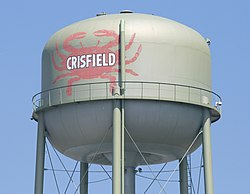 Crisfield water tower | |
| Nickname(s): The Seafood Capital of the World | |
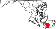
 Location in Somerset County and the state of Maryland | |
 Crisfield Location within the state of Maryland | |
| Coordinates: 37°59′3″N 75°51′8″W / 37.98417°N 75.85222°WCoordinates: 37°59′3″N 75°51′8″W / 37.98417°N 75.85222°W | |
| Country | |
| State | |
| County | |
| Founded | 1663 |
| Incorporation | 1872 |
| Founded by | Benjamin Summers |
| Named for | John Woodland Crisfield |
| Government | |
| • Type | Mayor–council–manager |
| • Mayor | Barry Dize |
| • Crisfield City Council | show
Council members |
| Area | |
| • Total | 3.17 sq mi (8.22 km2) |
| • Land | 1.74 sq mi (4.49 km2) |
| • Water | 1.44 sq mi (3.72 km2) |
| Elevation | 3 ft (1 m) |
| Lowest elevation | 0 ft (0 m) |
| Population | |
| • Total | 2,726 |
| • Estimate (2019)[5] | 2,564 |
| • Density | 1,476.96/sq mi (570.41/km2) |
| • Demonym | Crisfielder |
| Time zone | UTC−5 (Eastern (EST)) |
| • Summer (DST) | UTC−4 (EDT) |
| ZIP code | 21817 |
| Area code(s) | 410, 443 |
| FIPS code | 24-20775 |
| GNIS feature ID | 0583972 |
| Website | www |


Crisfield is a town in Somerset County, Maryland, United States, located on the Tangier Sound, an arm of the Chesapeake Bay. The population was 2,515 at the 2020 census. It is included in the Salisbury, Maryland-Delaware Metropolitan Statistical Area. Crisfield has the distinction of being the southernmost incorporated city in Maryland.
The site of today's Crisfield was initially a small fishing village called Annemessex Neck. During European colonization, it was renamed Somers Cove, after Benjamin Summers. When the business potential for seafood was discovered, John W. Crisfield decided to bring the Pennsylvania Railroad to Crisfield, and the quiet fishing town grew. Crisfield is now known as the "Seafood Capital of the World". The city's success was so great that the train soot and oyster shells prompted the extension of the city's land into the marshes. City residents often claim that the downtown area is literally built atop oyster shells.
Crisfield began to slip into decline along with the declining health of the Chesapeake Bay, prompting a "strategic revitalization plan" to address the city's future needs. Currently, Crisfield is largely a tourist destination. It hosts many annual events and festivals, the most prominent of which is the . Crisfield is also a major gateway to Smith Island and Tangier Island.
History[]

The Annemessex, a branch of the local Pocomoke Indian tribe of the Algonquin Nation, were the first inhabitants of the area. Their small fishing village was known as Annemessex Neck.[6] The nearby is also named after them.[7]
On February 10, 1663, Benjamin Summers, a settler from Yorkshire or Hertfordshire, England, arrived from Northampton County, Virginia to claim his headright. He patented a 300-acre (1.21 km2) [though in actuality only 250 acres (1.01 km2)] parcel of land, which he named "Emmessex".[8] He later patented another 200 acres (0.81 km2) of land on September 23, 1683, naming it "Musketa Hummock".[9] Both of these plots of land are located in the present-day Crisfield Election District. Another plot of land, named "Little Worth" and totalling 100 acres (0.40 km2), was also patented in Annemessex.[9] These three plots of land would eventually come to be known collectively as Somers Cove.[7]
Somers Cove soon became a major East Coast distribution center for seafood. The town grew faster than other settlements on the Delmarva Peninsula, with over 100 buildings in 1804, while Princess Anne and Salisbury had 40 and 4 respectively.[10]
In 1854, a survey of the Chesapeake Bay revealed that the area was a lucrative fishing location, with extensive oyster beds around Somers Cove.[11]
In 1866, John W. Crisfield, a Princess Anne attorney, was instrumental in bringing the Eastern Shore Railroad, a branch of the Pennsylvania Railroad system, to the Somers Cove seaport. The Crisfield Secondary Branch of the railroad opened on November 6 of that year.[12] The town was formally incorporated in 1872 as a city, and renamed Crisfield in honor of the attorney's efforts. The railroad bolstered the economy of the new city and Crisfield prospered greatly, as did other towns and settlements along its route, such as Marion Station to the north.
Seafood was soon being shipped all over the United States, and Crisfield became known as the "Seafood Capital of the World", a nickname still carried by the city. An industrial boom followed. By 1904, the City of Crisfield was the second largest city in Maryland, after Baltimore,[7] with the population topping off at about 25,000 at that time. The city's seafood industry attracted new residents from as far away as New England and the Midwestern United States.[13] The city also had a baseball team before long: the Crisfield Crabbers, who played in the Eastern Shore Baseball League.
The success of the city's seafood industry filled the city with train soot and large quantities of oyster shells. Around the turn of the 20th century, businessmen would buy plots of land at the southwest edge of the city and discard the shells and soot into the salt marshes. This shell midden eventually grew to become a peninsula roughly a half-mile long.[14] Downtown Crisfield was built atop this new land, and this leads to the common statement that Crisfield was so prosperous that it is "literally built on top of oyster shells".
James Reed, an African American native to North Carolina was lynched by a mob of whites in Crisfield, Maryland on July 28, 1907. He was thought to have killed the local police chief.[15]
The city experienced several fires, the most well-known of which is known as the Great Fire of 1928. It began on March 29 at the Crisfield Opera House and quickly spread to the downtown area, completely destroying it and causing over $1 million in damages.[16]
Crisfield's prosperity began to decline along with the health of the Chesapeake Bay. Oyster populations declined to the point where the watermen could no longer fully support themselves on their daily catches. Some businesses began to move out of Crisfield, while others shut down. On April 1, 1976, the railroad that had brought prosperity to Crisfield was abandoned as Conrail was established.[17] However, Maryland Route 413, a new, straight vehicular highway was built before the railroad was abandoned, along the railroad right-of-way. As large businesses in the United States grew, they passed the shrinking Crisfield by until the late 20th century. Fast-food restaurants began to slowly find business in the city, starting in the late 1990s, alongside the many seafood restaurants already in town. A large supermarket had been in city plans for a decade, though it wasn't until April 2010 that it opened for business. Crisfield has also been a target for large waterfront properties, with several large condominiums being built in the mid-2000s in the downtown area, along with other places flanking Crisfield's harbors. A "strategic revitalization plan" has been in the works since 2006 to address future growing needs and beautification of the city.[18]
Crisfield continues to be famous for its seafood throughout Maryland and the United States, particularly the Maryland Crab, and it abounds with restaurants, seafood packing houses, and seafood distribution companies. Several seafood restaurants across the country carry the city's name.
The Crisfield Armory, Crisfield Historic District, Cullen Homestead Historic District, Make Peace, Nelson Homestead, Capt. Leonard Tawes House, and Ward Brothers' House and Shop are listed on the National Register of Historic Places.[19]
Geography[]

Crisfield is a very compact city, with little vacant land. According to the United States Census Bureau, the city has a total area of 3.06 square miles (7.93 km2), of which 1.62 square miles (4.20 km2) (53.0%) is land and 1.44 square miles (3.73 km2) (47.0%) is water.[20] As one of the southern points on the Delmarva Peninsula and one very close to the Chesapeake Bay, the city is extremely flat, with the elevation never rising above 3 feet (0.91 m).
The city of Crisfield is surrounded by salt marshes and was built on a floodplain. The downtown is especially prone to flooding during large storms and hurricanes. On October 29, 2012, Hurricane Sandy's storm surge left most of the city underwater. Ongoing local concerns about flooding and the impact of sea level rise were featured in The Washington Post in October 2013.[21]
Crisfield is the southernmost city in the state of Maryland; the point farthest south is geographically located at Ape Hole. Regardless of this, Southern Maryland is an official region of the state not associated with the Eastern Shore, and areas of Saint Mary's County are sometimes claimed to be the southernmost point of the state.[22]
Climate[]
Crisfield's location on the Atlantic Coastal Plain in Maryland gives it a humid subtropical climate, with hot, humid summers and cool to mild winters. Its proximity to water, as well as a common trend on the Delmarva Peninsula, means that the city does not see much snowfall in the winters. Crisfield. Inner Harbor Baltimore, and the border of Assateague Island on the Atlantic Barrier Island are the only hardiness zone 8a examples in Maryland.
| hideClimate data for Crisfield, Maryland | |||||||||||||
|---|---|---|---|---|---|---|---|---|---|---|---|---|---|
| Month | Jan | Feb | Mar | Apr | May | Jun | Jul | Aug | Sep | Oct | Nov | Dec | Year |
| Record high °F (°C) | 64 (18) |
69 (21) |
77 (25) |
87 (31) |
91 (33) |
92 (33) |
99 (37) |
98 (37) |
92 (33) |
90 (32) |
78 (26) |
71 (22) |
99 (37) |
| Average high °F (°C) | 44 (7) |
47 (8) |
55 (13) |
65 (18) |
74 (23) |
82 (28) |
87 (31) |
85 (29) |
79 (26) |
69 (21) |
58 (14) |
49 (9) |
66 (19) |
| Average low °F (°C) | 30 (−1) |
31 (−1) |
38 (3) |
48 (9) |
57 (14) |
66 (19) |
71 (22) |
71 (22) |
64 (18) |
53 (12) |
43 (6) |
34 (1) |
51 (10) |
| Record low °F (°C) | −1 (−18) |
3 (−16) |
10 (−12) |
27 (−3) |
38 (3) |
46 (8) |
51 (11) |
50 (10) |
45 (7) |
30 (−1) |
22 (−6) |
7 (−14) |
−1 (−18) |
| Average precipitation inches (mm) | 3.25 (83) |
3.00 (76) |
4.29 (109) |
2.81 (71) |
3.12 (79) |
2.83 (72) |
4.14 (105) |
4.15 (105) |
2.76 (70) |
2.78 (71) |
2.80 (71) |
2.51 (64) |
38.44 (976) |
| Source: Weather.com[23] | |||||||||||||
Demographics[]
| Historical population | |||
|---|---|---|---|
| Census | Pop. | %± | |
| 1880 | 986 | — | |
| 1890 | 1,565 | 58.7% | |
| 1900 | 3,165 | 102.2% | |
| 1910 | 3,468 | 9.6% | |
| 1920 | 4,116 | 18.7% | |
| 1930 | 3,850 | −6.5% | |
| 1940 | 3,908 | 1.5% | |
| 1950 | 3,688 | −5.6% | |
| 1960 | 3,540 | −4.0% | |
| 1970 | 3,078 | −13.1% | |
| 1980 | 2,924 | −5.0% | |
| 1990 | 2,880 | −1.5% | |
| 2000 | 2,723 | −5.5% | |
| 2010 | 2,726 | 0.1% | |
| 2019 (est.) | 2,564 | [5] | −5.9% |
| U.S. Decennial Census[24] | |||

Crisfield is part of the Salisbury-Ocean Pines CSA, a combined statistical area (CSA) which includes the Salisbury metropolitan area (Somerset and Wicomico counties) and the Ocean Pines micropolitan area (Worcester County),[25][26][27] which had a combined population of 155,934 at the 2000 census.[28] Salisbury is the principal city of this CSA.
2010 census[]
As of the census[3] of 2010, there were 2,726 people, 1,113 households, and 667 families residing in the city. The population density was 1,682.7 inhabitants per square mile (649.7/km2). There were 1,531 housing units at an average density of 945.1 per square mile (364.9/km2). The racial makeup of the city was 59.0% White, 36.4% African American, 0.6% Native American, 0.5% Asian, 1.3% from other races, and 2.3% from two or more races. Hispanic or Latino of any race were 3.7% of the population.
There were 1,113 households, of which 33.6% had children under the age of 18 living with them, 30.1% were married couples living together, 25.8% had a female householder with no husband present, 4.0% had a male householder with no wife present, and 40.1% were non-families. 35.4% of all households were made up of individuals, and 15.4% had someone living alone who was 65 years of age or older. The average household size was 2.38 and the average family size was 3.06.
The median age in the city was 38.4 years. 27.8% of residents were under the age of 18; 8.3% were between the ages of 18 and 24; 21.5% were from 25 to 44; 24.6% were from 45 to 64; and 17.7% were 65 years of age or older. The gender makeup of the city was 44.0% male and 56.0% female.
2000 census[]
As of the census[28] of 2000, there were 2,723 people, 1,172 households, and 723 families residing in the city. The population density was 1,674.9 people per square mile (645.0/km2). There were 1,357 housing units at an average density of 834.7 per square mile (321.4/km2). The racial makeup of the city was 58.54% White, 37.46% African American, 0.40% Native American, 0.51% Asian, 0.04% Pacific Islander, 0.37% from other races, and 2.68% from two or more races. Hispanic or Latino of any race were 1.65% of the population.
There were 1,172 households, out of which 30.3% had children under the age of 18 living with them, 32.9% were married couples living together, 25.4% had a female householder with no husband present, and 38.3% were non-families. 34.3% of all households were made up of individuals, and 18.9% had someone living alone who was 65 years of age or older. The average household size was 2.30 and the average family size was 2.92.
In the city, the age distribution of the population shows 27.8% under the age of 18, 8.3% from 18 to 24, 24.5% from 25 to 44, 21.2% from 45 to 64, and 18.1% who were 65 years of age or older. The median age was 37 years. For every 100 females, there were 75.6 males. For every 100 females age 18 and over, there were 71.3 males.
The median income for a household in the city was $17,979, and the median income for a family was $23,929. Males had a median income of $30,078 versus $20,670 for females. The per capita income for the city was $12,387. About 30.5% of families and 34.2% of the population were below the poverty line, including 46.8% of those under age 18 and 30.2% of those age 65 or over.
Crime[]
Crisfield gained a new police chief in 2007—Chief Michael L. Tabor, who retired from the Baltimore Police Department to head law enforcement in the city.[29] Since then, crime rates have been on a steady decline, generally halving between 2006 and 2008.[30][31] The most prevalent crime in the city is property crime, down from a high of 180 in 2006[30] to 92 in 2008.[30] Theft is also very common. Violent crimes, such as murder and forcible rape, are rare, though the numbers for those are on the decline as well.[30][31] In January 2010, it was reported that Crisfield experienced an 81% decrease in crime rates of all kinds since 2007.[32]
Economy[]
Crisfield's economy is centered largely around retail, health care, and automotive.[4] Seafood is also an important part of Crisfield's economy, just as it has been for most of its existence, with several packing plants existing within the city. In 1997, the company began selling seafood online, caught by local watermen.[33]
The largest employer inside Crisfield's limits is the McCready Memorial Hospital.[6] The second largest employer in the city is the Sherwin-Williams plant (formerly Rubberset company), which manufactures paintbrushes and roller covers.[6][34]
In the past, the economy was centered on the watermen and seafood. About 150 seafood processing and packing plants were located within the city in its heyday. As the health of the Chesapeake Bay began to decline, so did the numbers for the blue crab catch, which have fallen by 70% since the 1990s.[6] Regulations have been placed on harvest of female crabs in order to control overharvesting.
Most of the labor force in Crisfield works outside of the city and elsewhere on the peninsula—the largest seafood employer in Somerset County is located nearby in Hopewell.[6] Additionally, a new industrial park, slated for construction as early as September 2013 just north of Crisfield, near Carvel Hall and along MD 413, will expand Crisfield's corporate limits.[35]
Culture[]


Due to Crisfield being the main access point to Smith Island, it is an area with many speakers of the unique Smith Island accent.[36] It also serves Smith Island cake, the Maryland state dessert, in many of its restaurants.
Annual events[]
Since 1986, Crisfield has hosted the Scorchy Tawes Pro-Am Fishing Tournament. The 3-day tournament features cash prizes for different fishing categories, and nightly block-parties at Side Street Restaurant.
The annual J. Millard Tawes Crab and Clam Bake takes place on the third Wednesday of each July. The event, which began in 1976, is named for the former governor born in Crisfield, and attracts many politicians from across the state each year.
Crisfield's largest event is the annual National Hard Crab Derby & Fair, held every Labor Day weekend, which began in 1947. Major highlights of the Crab Derby include a parade through Main Street, the Little Miss, Little Mr. and Miss Crustacean Pageants, the Boat Docking Contest (which began in 1971[37]), the Crab Picking contest, and the Crab Bowl. The Crab Bowl turns the Somers Cove Marina into fairgrounds with rides, concerts, vendor stands, and fireworks.
Museums[]
Crisfield has several museums: the J. Millard Tawes Historical Museum, the Ward Brothers Workshop, and the J. Millard Tawes Library.
Government[]
This section needs expansion. You can help by . (September 2010) |

Crisfield is said to have a mayor–council–manager government. Administration is handled by the City Manager, who is appointed by the mayor and city council. The mayor is elected by the citizens of Crisfield, and the council members are as well. All serve four-year terms.[38]
Sports and recreation[]
The city once had a minor league baseball team: the Crisfield Crabbers, who played in now-defunct Eastern Shore Baseball League. Several little league baseball and high school sports teams remain in the city.
Wellington Beach and Park was open with life guards and concession stand in the 1980s, but closed. However, through Program Open Space, Crisfield received funding to build and reopen it.[39][40] Crisfield's public Wellington Beach and Park reopened in early 2012 as Brick Kiln Beach. However, after Hurricane Sandy hit later that year, the beach required major reconstruction. The beach was renamed and reopened to the public on June 2, 2013 at 1:00 PM.[41] The park has a play area, a gazebo, and bathrooms during the summer months. It also is a popular crabbing spot.
Nearby Janes Island State Park is a large marshy island made of almost completely undeveloped land, and is colonized by various birds and marine life. It offers fishing, swimming beaches, picnicking, camping, a playground, and has about thirty miles of water trails which can be accessed by canoe. The beaches allow swimming as well.[42]
Education[]
Public schools[]

Crisfield's two public schools are part of the Somerset County Public Schools district, which is headquartered in Westover.
- Carter G. Woodson Elementary School − This school is located on South Somerset Avenue and currently serves grades K−5. This was changed from 2004, where it was the middle school, serving grades 6−8; school consolidation in the county changed the school and gave it a renovation. Much earlier than that, the school was the Crisfield Colored High School.
- Crisfield Academy and High School − Originally known as just Crisfield High School, this building is located on North Somerset Avenue between the intersections of Potomac Street and Mercury Drive, and serves grades 8−12. Before consolidation, it handled grades 9−12. The school is the first educational facility built beyond the original Crisfield Academy, and has existed in four different buildings on three different sites, all located close to or on Somerset Avenue.
Private schools[]
- Crisfield Christian Academy − The building, located on Maryland Avenue north of Maple Street, hosts the only private religious school in the city. This school, however, is no longer of use
Other[]
- Crisfield Head Start − The Crisfield's branch of the Head Start was located in the old Crisfield Elementary School #3 on Jacksonville Road for over twenty years, until the mid-2000s, when the building was razed to make way for a Food Lion. It moved several times until it found a home at the former H. Dewayne Whittington Primary School building on Asbury Avenue, until it closed in 2012, when Hurricane Sandy dealt severe damage to the building. Headstart relocated yet again to space at Crisfield High School building before the building on Asbury was razed in early 2017. Before school consolidation, the building on Asbury Avenue was the public primary school, serving grades K−2.[43]
Transportation[]
Travel by water[]
As Crisfield's heritage is on the water, it has many points of access to the Tangier Sound and Chesapeake Bay.
Crisfield has two public docks. The city dock is located at the end of Main Street (MD 413). The city dock is the landing for mail ships, large commercial ships, and passenger ferries to Smith Island and Reedville, Virginia via Tangier Island.[44][45] The city dock pavilion is a popular site for public events. The county dock, located one block west at the end of Broad Street, is largely used for freight, and was rehabilitated in the mid-2000s. The Little Boat Harbor, located on Brick Kiln Road is utilized mostly by smaller workboats.
Somers Cove Marina, a large marina built in Crisfield in the 1960s, is currently owned by the State of Maryland.[46] The marina hosts many of the city's large events, such as the National Hard Crab Derby.
Throughout Crisfield's history, there has been discussion of a high-speed ferry link between Crisfield and the Western Shore, with large vessels that can accommodate large numbers of vehicles and tractor-trailers. The proposed site for a Western Shore landing has ranged from Point Lookout State Park in Maryland[47] to Reedville in Northumberland County, Virginia.[48] Proponents state that a high-speed ferry link will reduce travel times to adjacent points on the western shore by as much as two and a half hours[47][48] as the Bay Bridges are far from one another, spurring tourism and economic growth on both sides.[47][48] The most recent proposal came in the 2000s; however, it was deemed that a ferry would not be economically feasible. Money earmarked for the ferry service was released to the city for an upgrade of the city dock.[44]
Major roads[]

The city of Crisfield is accessible by two main state highways: Maryland Route 413 (the main route through the city and is known colloquially as "The Strip") and Maryland Route 667. Both routes connect directly to U.S. Route 13, the main north−south thoroughfare of the Delmarva Peninsula. Additionally, Maryland Route 358 (Jacksonville Road) leads to the nearby Janes Island State Park, and Maryland Route 460 (Hall Highway) is the main access point to the hospital. Maryland Route 380 (Byrdtown Road and Main Street Extension) lead to the Crisfield suburbs of and ; this area is commonly referred to by the locals as "Down Neck".[49]
Major streets not maintained by the state are Somerset Avenue, which is located at the northern edge of town and travels south, paralleling the eastern city boundary and fronted mostly by homes; all of the public schools in the city are located down this corridor. There is also Main Street, which provides access to City Hall, the post office, police department, the library, and many of the businesses in the city, and also intersects Somerset Avenue at the only stoplight in the city. Main Street merges with Maryland Route 413 near the Crisfield Fire Department, becoming a four-lane boulevard. Broadway Avenue, running parallel to Main Street one block south, was once a major business center in the city as well, fronted by many businesses and churches and passed directly through the city's marina; however, it no longer reaches the marina, and a large number of the stores and warehouses along it have closed.
Bicycles and pedestrians[]
As part of expansion of bicycle infrastructure across the state of Maryland, MD 413 inside the city limits received bicycle lanes for almost its full length in 2017. There is also a proposal to convert the abandoned Crisfield Secondary Branch alongside MD 413 to a Crisfield–Westover Rail Trail. Part of this plan included the bike lanes already installed in Crisfield.[50][51]
Public transportation[]
The two bus routes serving Crisfield, Route 706 North and Route 706 South, are operated by Shore Transit, which provides the commuter bus service for the lower Eastern Shore. Both routes travel along Somerset Avenue and MD 413, and Cove Street, and stop at McCready Memorial Hospital. All buses provide access to the Princess Anne transfer hub with limited service to Salisbury; thus riders can get access to other points on the Eastern Shore.
Airports[]
The Crisfield Municipal Airport is located near Hopewell. The main access road to the airport is on Plantation Road in Hopewell, south of the MD 667 intersection there; from Crisfield it is accessible via Jacksonville Road. The airport has been a recent target for expansion.
Infrastructure[]
Public utilities[]
Crisfield possesses three water towers and a public sewer system; both provide municipal services as far north as Plantation Road in Hopewell.[4] The most recent water tower was installed in the early 2000s. It also has a sewage water treatment plant, which is notably overburdened and obsolete.[4]
The main electrical provider in the city is Delmarva Power, owned by Exelon, and a large substation is located north of town. Choptank Electric Cooperative also serves the city's outskirts. In the past, Crisfield possessed a power plant, located downtown on Seventh Street. This was removed around the time of the decommissioning of the rail line, as the railroad once ended there; power is now tapped from a substation in Princess Anne via subtransmission line. The main telephone provider is Verizon Communications. In the mid-2000s, a fiber-optic cable was installed along the length of MD 413, improving internet service. A prominent cellphone tower was also installed in the center of Marion Station to the north in 2010.
Health care[]

Crisfield is currently home to the only hospital in Somerset County: McCready Memorial Hospital, accessible by Hall Highway and by Byrd Road from the north on Jacksonville Road. The next closest hospital is Peninsula Regional Medical Center in Salisbury. McCready Hospital is located on the Annemessex River, and is flanked by the Alice Byrd Tawes Nursing Home, which was built in 1968 and was replaced by a new four-story building in 2010.
Notable people[]
- Ward Brothers, famous wooden-carved, wildfowl, decoy makers
- J. Millard Tawes, 54th Governor of Maryland
- Harry Clifton Byrd, American university administrator, educator, athlete, coach, and politician
In popular culture[]
Crisfield and its environs are the setting for most of the books in the Tillerman Cycle series by Cynthia Voigt.
The movie Hookman 2 was mostly filmed in Crisfield in winter 2010−2011 and was released in 2013.[52] Crisfield is the hometown of most of the cast and crew members and is called "Hometown, Maryland" in the movie. The film is currently available on Amazon and YouTube.[53]
See also[]
- Eshelman
- Janes Island Light
- Marion Station, Maryland, a nearby community which also prospered due to the railroad and went into decline later
- Tulls Corner, Maryland, a nearby ghost town
- Crisfield Armory
- Crisfield Historic District
- WBEY-FM
References[]
- ^ "MINUTES". 2010-07-28. Archived from the original (DOC) on 2012-03-06. Retrieved 2010-09-06.
- ^ "2019 U.S. Gazetteer Files". United States Census Bureau. Retrieved July 25, 2020.
- ^ Jump up to: a b "U.S. Census website". United States Census Bureau. Retrieved 2013-01-25.
- ^ Jump up to: a b c d "City of Crisfield, Maryland: Comprehensive Plan" (PDF). 2007. Archived from the original (PDF) on 2014-06-29. Retrieved 2010-08-13.
- ^ Jump up to: a b "Population and Housing Unit Estimates". United States Census Bureau. May 24, 2020. Retrieved May 27, 2020.
- ^ Jump up to: a b c d e "Crisfield, Md. Community Profile" (PDF). 2008. p. 5. Archived from the original (PDF) on 2011-06-13. Retrieved 2010-09-06.
- ^ Jump up to: a b c "A Short History of the City of Crisfield". City of Crisfield. Retrieved 2009-03-25.
- ^ Vernon L. Skinner & F. Edward Wright, Colonial Families of the Eastern Shore of Maryland, Volume 18, p. 164 (Summers Family of Somerset County). Retrieved here
- ^ Jump up to: a b Vernon L. Skinner & F. Edward Wright, Colonial Families of the Eastern Shore of Maryland, Volume 18, p. 165 (Summers Family of Somerset County). Retrieved here
- ^ Moser, Jason (2011). The Art and Mystery of Shipbuilding: An Archaeological Study of Shipyards, Shipwrights and Shipbuilding in Somerset County, Maryland 1660–1900. Florida: Florida State University Libraries.
- ^ "History of Crisfield". Archived from the original on May 5, 2009. Retrieved 2009-12-17.
- ^ "PRR CHRONOLOGY 1866" (PDF). The Pennsylvania Railroad Technical & Historical Society. June 2004. Retrieved 2010-09-06.
- ^ "Come Visit Somerset County, Maryland: Location − Crisfield". Archived from the original on 2010-08-07. Retrieved 2010-09-07.
- ^ Rhodes, Jason (2007). Somerset County, Maryland: A Brief History. pp. 7, 10. ISBN 978-0-7385-4239-3. Retrieved 2009-11-24.
- ^ "Archives of Maryland (Biographical Series)". James Reed. Retrieved 20 July 2015.
- ^ Rhodes, Jason (2007). Somerset County, Maryland: A Brief History. pp. 67, 68, 69. ISBN 978-0-7385-4239-3. Retrieved 2009-11-24.
- ^ "PRR CHRONOLOGY 1976" (PDF). The Pennsylvania Railroad Technical & Historical Society. November 2005. Retrieved 2009-03-25.
- ^ Peter Johnston & Associates, LLC (2007). "City of Crisfield, Maryland Strategic Revitalization Plan". Archived from the original on 2011-07-15. Retrieved 2009-10-22.
- ^ "National Register Information System". National Register of Historic Places. National Park Service. July 9, 2010.
- ^ "US Gazetteer files 2010". United States Census Bureau. Archived from the original on 2012-01-25. Retrieved 2013-01-25.
- ^ Montgomery, David (2013-10-24). "Crisfield, Md., beats back a rising Chesapeake Bay". The Washington Post. Retrieved 2013-10-27.
- ^ Harley, Lenn. "Maps and facts about real estate in Saint Mary's County, Maryland". Archived from the original on 2010-06-08. Retrieved 2009-10-22.
- ^ "Monthly Weather Forecast for Crisfield, Maryland (21817)". The Weather Channel. Retrieved 2010-09-11.
- ^ "Census of Population and Housing". Census.gov. Retrieved June 4, 2015.
- ^ METROPOLITAN STATISTICAL AREAS AND COMPONENTS Archived May 26, 2007, at the Wayback Machine, Office of Management and Budget, 2007-05-11. Accessed 2008-08-01.
- ^ MICROPOLITAN STATISTICAL AREAS AND COMPONENTS Archived June 29, 2007, at the Wayback Machine, Office of Management and Budget, 2007-05-11. Accessed 2008-08-01.
- ^ COMBINED STATISTICAL AREAS AND COMPONENT CORE BASED STATISTICAL AREAS Archived June 29, 2007, at the Wayback Machine, Office of Management and Budget, 2007-05-11. Accessed 2008-08-01.
- ^ Jump up to: a b "U.S. Census website". United States Census Bureau. Retrieved 2008-01-31.
- ^ "City police major to head force in Crisfield". The Baltimore Sun. Baltimore, Maryland. 2007-02-07. Retrieved 2010-09-05.
- ^ Jump up to: a b c d "Offenses Known to Law Enforcement by State by City, 2006". Uniform Crime Report, 2006. September 2007. Retrieved 2012-02-11.
- ^ Jump up to: a b "Offenses Known to Law Enforcement by State by City, 2008". Uniform Crime Report, 2009. September 2009. Retrieved 2012-02-11.
- ^ "Crisfield Police Department January 2010 City Council Meeting" (DOC). 2010. Retrieved 2010-09-11.
- ^ Walker, Leslie (August 2, 2001). "They Blazed A Trail for Online Retail". The Washington Post. Retrieved May 1, 2020.
- ^ "Governor O'Malley Visits Crisfield Rubberset Plant, Continues "Jobs Across Maryland" Tour". Annapolis, Maryland. 2010-07-21. Archived from the original on 2010-07-25. Retrieved 2010-09-05.
- ^ Holland, Liz (2010-08-13). "Crisfield industrial park is on the fast track". The Salisbury Daily Times. Archived from the original on July 2, 2014. Retrieved 2010-09-06.
- ^ "The North Carolina Language and Life Project". Retrieved 2010-09-05.
- ^ Rhodes, Jason (2006). National Hard Crab Derby. Charleston, South Carolina; Chicago; Portsmouth, New Hampshire; San Francisco, California: Arcadia Publishing. p. 8. ISBN 0-7385-4253-9.
- ^ "Welcome to Crisfield, Maryland – Government". Retrieved 2010-09-06.
- ^ "BOARD OF PUBLIC WORKS - AFTER MEETING AGENDA SUMMARY Meeting Date: Wednesday, August 05, 2009" (PDF). Annapolis, Maryland. p. 8. Archived from the original (PDF) on June 10, 2011. Retrieved 2010-09-06.
- ^ "Analysis of the FY 2010 Maryland Executive Budget, 2009: Community Parks and Playgrounds" (PDF). Department of Natural Resources. 2009. Archived from the original (PDF) on 2011-03-18. Retrieved 2010-09-06.
- ^ "Restoration Complete: New Crisfield Beach To Reopen". Crisfield, Maryland. Archived from the original on 2013-09-06. Retrieved 2012-06-02.
- ^ "Maryland Department of Natural Resources: Janes Island State Park". Archived from the original on 2010-04-21. Retrieved 2010-04-21.
- ^ "School razing renews Whittington namesake issue".
- ^ Jump up to: a b "Crisfield's Handy building razed for dock upgrades". 2013-08-27. Archived from the original on 2014-07-02. Retrieved 2013-08-27.
- ^ "Tangier Island Cruises, Inc. Cross Bay Ferry Service". Archived from the original on 2013-08-19. Retrieved 2013-08-27.
- ^ Rhodes, Jason (2006). Crisfield: The First Century. pp. 37, 38. ISBN 0-7385-4239-3.
- ^ Jump up to: a b c "High-Speed Ferry for Southern Maryland Under Study. . ". 2000-07-03. Archived from the original on 2011-05-16. Retrieved 2010-02-27.
- ^ Jump up to: a b c "ECONOMIC IMPACT OF THE PROPOSED REEDVILLE-CRISFIELD FERRY SERVICE" (PDF). 2006-08-01. Retrieved 2010-02-28.
- ^ Rhodes, Jason (2006). Crisfield: The First Century. p. 48. ISBN 0-7385-4239-3. Retrieved 2010-09-12.
- ^ "Maryland Greenways – Somerset County". Archived from the original on 2013-10-11. Retrieved 2014-02-01.
- ^ "Somerset Priority Letter for Recommended Transportation Improvements" (PDF). July 2013. Retrieved 2014-03-22.
- ^ Hookman 2 (2013) - IMDb
- ^ https://www.youtube.com/watch?v=ptoWu3KNCcY
External links[]
| Wikivoyage has a travel guide for Crisfield. |
- http://www.crisfield.com/
- Crisfield Area Chamber of Commerce website
- Website for McCready Hospital and Tawes Nursing Home
- Website for Crisfield Police Department
| show Municipalities and communities of Somerset County, Maryland, United States |
|---|
| show Authority control |
|---|
- Crisfield, Maryland
- Crabbing communities in Maryland
- Cities in Maryland
- Fishing communities in Maryland
- Cities in Somerset County, Maryland
- Salisbury metropolitan area
- Maryland populated places on the Chesapeake Bay
- 1872 establishments in Maryland