Outline of Chhattisgarh
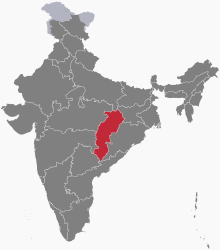
Location of Chhattisgarh
The following outline is provided as an overview of and topical guide to Chhattisgarh:
Chhattisgarh – state in central India. The state was formed on 1 November 2000 by partitioning 27 Chhattisgarhi-speaking southeastern districts of Madhya Pradesh.
General reference[]
Names[]
- Common English name: Chhattisgarh
- Official English name: Chhattisgarh
- Nickname(s):
- Adjectival(s): Chhattisgarhi
- Demonym(s): Chhattisgarhis
- Abbreviations and name codes
- ISO 3166-2 code: IN-CT
- Vehicle registration code: CG
Rankings (amongst India's states)[]
- by population: 17th
- by area (2011 census): 10th
- by crime rate (2015): 11th
- by gross domestic product (GDP) (2014): 16th
- by Human Development Index (HDI):
- by life expectancy at birth:
- by literacy rate:
Geography of Chhattisgarh[]
Geography of Chhattisgarh
- Chhattisgarh is: an Indian state
- Population of Chhattisgarh: 27,928,015
- Area of Chhattisgarh: 135,194.5 km2 (52,198.9 sq mi)
- Atlas of Chhattisgarh
Location of Chhattisgarh[]
- Chhattisgarh is situated within the following regions:
- Time zone: Indian Standard Time (UTC+05:30)
| show Places adjacent to Outline of Chhattisgarh |
|---|
Environment of Chhattisgarh[]
Protected areas of Chhattisgarh[]
Natural geographic features of Chhattisgarh[]
Regions of Chhattisgarh[]
Ecoregions of Chhattisgarh[]
- Eastern Highlands moist deciduous forests
- Central Deccan Plateau Dry Deciduous Forests
- Chhota-Nagpur dry deciduous forests
- Narmada Valley dry deciduous forests
- Northern dry deciduous forests
Administrative divisions of Chhattisgarh[]
Districts of Chhattisgarh[]
- Balod district
- Baloda Bazar district
- Balrampur district
- Bastar district
- Bemetara district
- Bijapur district
- Bilaspur district
- Dantewada district
- Dhamtari district
- Durg district
- Gariaband district
- Janjgir–Champa district
- Jashpur district
- Kanker district
- Kabirdham district
- Kondagaon district
- Korba district
- Koriya district
- Mahasamund district
- Mungeli district
- Narayanpur district
- Raigarh district
- Raipur district
- Rajnandgaon district
- Surguja district
- Sukma district
- Surajpur district
- Gaurela pendra marwahi
Municipalities of Chhattisgarh[]
Demography of Chhattisgarh[]
Demographics of Chhattisgarh
Government and politics of Chhattisgarh[]
- Form of government: Indian state government (parliamentary system of representative democracy)
- Capital of Chhattisgarh: Raipur
- Elections in Chhattisgarh
Union government in Chhattisgarh[]
- Rajya Sabha members from Chhattisgarh
- Chhattisgarh Pradesh Congress Committee
- Indian general election, 2009 (Chhattisgarh)
- Indian general election, 2014 (Chhattisgarh)
Branches of the government of Chhattisgarh[]
Executive branch of the government of Chhattisgarh[]
- Head of state: Governor of Chhattisgarh, [[]]
- Head of government: Chief Minister of Chhattisgarh, [[]]
Legislative branch of the government of Chhattisgarh[]
Chhattisgarh Legislative Assembly
- Constituencies of Chhattisgarh Legislative Assembly
Judicial branch of the government of Chhattisgarh[]
- High Court of Chhattisgarh
Law and order in Chhattisgarh[]
History of Chhattisgarh[]
History of Chhattisgarh
History of Chhattisgarh, by period[]
Prehistoric Chhattisgarh[]
Ancient Chhattisgarh[]
- Dakshina Kosala Kingdom
Medieval Chhattisgarh[]
Colonial Chhattisgarh[]
Contemporary Chhattisgarh[]
History of Chhattisgarh, by region[]
History of Chhattisgarh, by subject[]
Culture of Chhattisgarh[]
- Cuisine of Chhattisgarh
- Languages of Chhattisgarh
- Monuments in Chhattisgarh
- World Heritage Sites in Chhattisgarh
Art in Chhattisgarh[]
Religion in Chhattisgarh[]
Religion in Chhattisgarh
Sports in Chhattisgarh[]
-
- Chhattisgarh Cricket Association
- Chhattisgarh cricket team
Symbols of Chhattisgarh[]
Symbols of Chhattisgarh
- State animal:
- State bird:
- State flower:
- State symbol:
- State tree: sal
Economy and infrastructure of Chhattisgarh[]
Education in Chhattisgarh[]
Health in Chhattisgarh[]
See also[]
References[]
External links[]
Chhattisgarhat Wikipedia's sister projects
 Definitions from Wiktionary
 Media from Wikimedia Commons
 News from Wikinews
 Quotations from Wikiquote
 Texts from Wikisource
 Textbooks from Wikibooks
 Travel guides from Wikivoyage
 Resources from Wikiversity
![]() Wikimedia Atlas of Chhattisgarh
Wikimedia Atlas of Chhattisgarh
- Chhattisgarh News
- Chhattisgarh fact profile, by the India Brand Equity Foundation (IBEF)
- . Encyclopædia Britannica (11th ed.). 1911.
Categories:
- Outlines of Indian states
- Wikipedia outlines
- Chhattisgarh
- Chhattisgarh-related lists