Pointe-Fortune, Quebec
Pointe-Fortune | |
|---|---|
Village municipality | |
 | |
 Coat of arms | |
| Motto(s): La fortune aime les audacieux | |
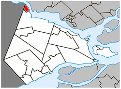 Location within Vaudreuil-Soulanges RCM. | |
 Pointe-Fortune Location in southern Quebec. | |
| Coordinates: 45°34′N 74°23′W / 45.567°N 74.383°WCoordinates: 45°34′N 74°23′W / 45.567°N 74.383°W[1] | |
| Country | |
| Province | |
| Region | Montérégie |
| RCM | Vaudreuil-Soulanges |
| Constituted | 28 August 1880 |
| Government | |
| • Mayor | François Belanger |
| • Federal riding | Vaudreuil-Soulanges |
| • Prov. riding | Soulanges |
| Area | |
| • Total | 9.60 km2 (3.71 sq mi) |
| • Land | 8.35 km2 (3.22 sq mi) |
| Population (2011)[4] | |
| • Total | 542 |
| • Density | 64.9/km2 (168/sq mi) |
| • Pop 2006-2011 | |
| • Dwellings | 265 |
| Time zone | UTC−5 (EST) |
| • Summer (DST) | UTC−4 (EDT) |
| Postal code(s) | J0P 1N0 |
| Area code(s) | 450 and 579 |
| Highways | |
| Website | pointefortune |

Pointe-Fortune (French pronunciation: [pwɛ̃t fɔʁtyn]) is a village municipality in southwestern Quebec, Canada, on the Ottawa River (Rivière des Outaouais) in Vaudreuil-Soulanges Regional County Municipality, northwest of Montreal. The population at the 2011 Census was 542.
Demographics[]
Population[]
| Canada census – Pointe-Fortune, Quebec community profile | |||
|---|---|---|---|
| 2011 | 2006 | ||
| Population: | 542 (+6.9% from 2006) | 507 (+10.9% from 2001) | |
| Land area: | 8.35 km2 (3.22 sq mi) | 8.35 km2 (3.22 sq mi) | |
| Population density: | 64.9/km2 (168/sq mi) | 60.7/km2 (157/sq mi) | |
| Median age: | 44.7 (M: 46.7, F: 42.8) | 44.8 (M: 45.4, F: 44.4) | |
| Total private dwellings: | 265 | 241 | |
| Median household income: | $.N/A | $39,297 | |
| Notes: 2011 income data for this area has been suppressed for data quality or confidentiality reasons. – References: 2011[5] 2006[6] earlier[7] | |||
|
|
|
Language[]
| Canada Census Mother Tongue - Pointe-Fortune, Quebec[8] | ||||||||||||||||||
|---|---|---|---|---|---|---|---|---|---|---|---|---|---|---|---|---|---|---|
| Census | Total | French
|
English
|
French & English
|
Other
| |||||||||||||
| Year | Responses | Count | Trend | Pop % | Count | Trend | Pop % | Count | Trend | Pop % | Count | Trend | Pop % | |||||
2011
|
540
|
435 | 80.56% | 75 | 13.89% | 10 | 1.85% | 20 | 3.70% | |||||||||
2006
|
505
|
375 | 74.26% | 105 | 20.79% | 0 | 0.00% | 25 | 4.95% | |||||||||
2001
|
455
|
395 | 86.81% | 40 | 8.79% | 0 | 0.00% | 20 | 4.40% | |||||||||
1996
|
455
|
395 | n/a | 86.81% | 60 | n/a | 13.19% | 0 | n/a | 0.00% | 0 | n/a | 0.00% | |||||
Attractions[]
Macdonell-Williamson House,[9] which owes its existence to the fur trade and the legendary Voyageurs, is located at the historical boundary marker, which still stands and marked the division between Upper and Lower Canada.
Pointe Fortune celebrated its 100th anniversary in 2004.
The village was originally served by the Catholic parish of St Francois Xavier, established in 1904, which eventually closed on December 24, 2014. The church was sold and is now privately owned.
Education[]
Commission Scolaire des Trois-Lacs operates Francophone schools.[10]
Lester B. Pearson School Board operates Anglophone schools.[12]
- Soulanges Elementary School in Saint-Télesphore or Evergreen Elementary and Forest Hill Elementary (Junior Campus and Senior campus) in Saint-Lazare
See also[]
References[]
- ^ Reference number 50159 of the Commission de toponymie du Québec (in French)
- ^ a b "Ministère des Affaires municipales, des Régions et de l'Occupation du territoire: Pointe-Fortune". Archived from the original on 3 February 2014. Retrieved 11 March 2012.
- ^ "Parliament of Canada Federal Riding History: VAUDREUIL--SOULANGES (Quebec)". Archived from the original on 18 June 2009. Retrieved 22 March 2009.
- ^ a b 2011 Statistics Canada Census Profile: Pointe-Fortune, Quebec
- ^ "2011 Community Profiles". 2011 Canadian Census. Statistics Canada. 5 July 2013.
- ^ "2006 Community Profiles". 2006 Canadian Census. Statistics Canada. 30 March 2011. Retrieved 21 February 2014.
- ^ "2001 Community Profiles". 2001 Canadian Census. Statistics Canada. 17 February 2012.
- ^ a b Statistics Canada: 1996, 2001, 2006, 2011 census
- ^ Maison Macdonell-Williamson House
- ^ "Les écoles et les centres". Commission Scolaire des Trois-Lacs. Retrieved 18 January 2013.
- ^ "Liste des bassins desservis par les écoles en 2017-2018." Commission Scolaire des Trois-Lacs. Retrieved 30 September 2017.
- ^ "School Board Map." Lester B. Pearson School Board. Retrieved 28 September 2017.
Adjacent Municipal Subdivisions | |
|---|---|
| Cities & towns | |
|---|---|
| Municipalities | |
| Villages | |
| |
- Villages in Quebec
- Incorporated places in Vaudreuil-Soulanges Regional County Municipality