Pincourt
Pincourt | |
|---|---|
City | |
 | |
 Location within Vaudreuil-Soulanges RCM. | |
 Pincourt Location in southern Quebec. | |
| Coordinates: 45°23′N 73°59′W / 45.383°N 73.983°WCoordinates: 45°23′N 73°59′W / 45.383°N 73.983°W[1] | |
| Country | |
| Province | |
| Region | Montérégie |
| RCM | Vaudreuil-Soulanges |
| Constituted | 1 January 1950 |
| Government | |
| • Mayor | Yvan Cardinal |
| • Federal riding | Vaudreuil-Soulanges |
| • Prov. riding | Vaudreuil |
| Area | |
| • Total | 7.11 km2 (2.75 sq mi) |
| • Land | 7.54 km2 (2.91 sq mi) |
| There is an apparent contradiction between two authoritative sources | |
| Population (2016)[4] | |
| • Total | 14,558 |
| • Density | 2,048.1/km2 (5,305/sq mi) |
| • Pop 2011–2016 | |
| • Dwellings | 5,471 |
| Time zone | UTC−5 (EST) |
| • Summer (DST) | UTC−4 (EDT) |
| Postal code(s) | |
| Area code(s) | 514 and 438 |
| Highways | |
| Website | www |

Pincourt is a municipality on the island of Île Perrot, off the western tip of the island of Montreal, Quebec. The population as of the Canada 2011 Census was 14,305. The town shares the island with the three other municipalities of Notre-Dame-de-l'Île-Perrot, Terrasse Vaudreuil and L'Île-Perrot, bordering on each one. The south end of the Ottawa River (Rivière des Outaouais) flows between Vaudreuil-Dorion and Pincourt, defining the town's western boundary.
Many houses, condos and townhouses are newly built as the town has undergone a building boom, which also included the opening of the new francophone Chêne-Bleu high school. The municipality also has two bilingual primary schools and one French primary school. Several parks and natural protected areas are open throughout the year for recreation.
Demographics[]
Population[]
| hideCanada census – Pincourt community profile | |||
|---|---|---|---|
| 2011 | 2006 | ||
| Population: | 14,305 (+27.8% from 2006) | 11,197 (+10.8% from 2001) | |
| Land area: | 7.54 km2 (2.91 sq mi) | 7.54 km2 (2.91 sq mi) | |
| Population density: | 1,896.7/km2 (4,912/sq mi) | 1,484.5/km2 (3,845/sq mi) | |
| Median age: | 38.2 (M: 37.5, F: 38.8) | 38.5 (M: 37.9, F: 39.2) | |
| Total private dwellings: | 5,320 | 4,277 | |
| Median household income: | $75,103 | $64,428 | |
| References: 2011[4] 2006[6] earlier[7] | |||
|
|
|
Language[]
| Canada Census Mother Tongue – Pincourt, Quebec[8] | ||||||||||||||||||
|---|---|---|---|---|---|---|---|---|---|---|---|---|---|---|---|---|---|---|
| Census | Total | French
|
English
|
French & English
|
Other
| |||||||||||||
| Year | Responses | Count | Trend | Pop % | Count | Trend | Pop % | Count | Trend | Pop % | Count | Trend | Pop % | |||||
2011
|
14,105
|
6,990 | 49.56% | 4,980 | 35.31% | 280 | 1.98% | 1,855 | 13.15% | |||||||||
2006
|
11,150
|
6,125 | 54.93% | 3,905 | 35.02% | 235 | 2.11% | 885 | 7.94% | |||||||||
2001
|
10,065
|
6,040 | 60.01% | 3,430 | 34.08% | 130 | 1.29% | 465 | 4.62% | |||||||||
1996
|
9,930
|
5,670 | n/a | 57.10% | 3,750 | n/a | 37.76% | 130 | n/a | 1.31% | 380 | n/a | 3.83% | |||||
Infrastructure[]
Transportation[]

Quebec Autoroute 20 runs along the north end of Pincourt and is accessible via Boulevard Cardinal Léger (exit 35), the only proper exit overpass along the section of the highway from Autoroute 30 to the island of Montréal, all others consisting of at-grade intersections with traffic lights. There is one other autoroute junction for Pincourt consisting of an at-grade intersection at Boulevard de l'Île.
On the city's western border, the Taschereau Bridge crosses the Ottawa River to Vaudreuil-Dorion.
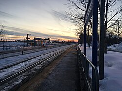
There is a shuttle bus service that runs during rush hours operated by CIT La Presqu'Île connecting to the Vaudreuil-Hudson commuter train line. The CIT also offers various bus connections to Vaudreuil-Dorion, Sainte-Anne-de-Bellevue and other West-Island destinations.
Schools[]
Commission Scolaire des Trois-Lacs operates Francophone schools.[9]
- École Notre-Dame-de-Lorette
- Some areas are zoned to École Virginie-Roy in L'Île-Perrot[10]
Lester B. Pearson School Board operates Anglophone schools. It is zoned to Edgewater Elementary School and St. Patrick Elementary School.[11]
See also[]
References[]
- ^ Reference number 49351 of the Commission de toponymie du Québec (in French)
- ^ Jump up to: a b "Ministère des Affaires municipales, des Régions et de l'Occupation du territoire: Pincourt". Archived from the original on 15 December 2013. Retrieved 11 March 2012.
- ^ "Parliament of Canada Federal Riding History: VAUDREUIL-SOULANGES (Quebec)". Archived from the original on 18 June 2009. Retrieved 23 March 2009.
- ^ Jump up to: a b c "2011 Community Profiles". 2011 Canadian Census. Statistics Canada. 5 July 2013. Retrieved 2 February 2014.
- ^ Town of Pincourt. "New Postal Codes in Pincourt". Web. Retrieved 19 April 2014.
- ^ "2006 Community Profiles". 2006 Canadian Census. Statistics Canada. 30 March 2011. Retrieved 2 February 2014.
- ^ "2001 Community Profiles". 2001 Canadian Census. Statistics Canada. 17 February 2012.
- ^ Jump up to: a b Statistics Canada: 1996, 2001, 2006, 2011 census
- ^ "Les écoles et les centres". Commission Scolaire des Trois-Lacs. Retrieved 18 January 2013.
- ^ "Liste des bassins desservis par les écoles en 2017–2018." Commission Scolaire des Trois-Lacs. Retrieved on 30 September 2017.
- ^ "School Board Map." Lester B. Pearson School Board. Retrieved on 28 September 2017.
| show Adjacent Municipal Subdivisions |
|---|
| hide | |
|---|---|
| Cities & towns | |
| Municipalities | |
| Villages | |
| |
- Cities and towns in Quebec
- Incorporated places in Vaudreuil-Soulanges Regional County Municipality
- Greater Montreal