Port Renfrew
Port Renfrew | |
|---|---|
 | |
| Nickname(s): The Land of Plenty, The Tall Tree Capital of Canada | |
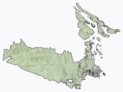 Port Renfrew Location of Port Renfrew within the Capital Regional District | |
 Port Renfrew Location of Port Renfrew in British Columbia | |
| Coordinates: 48°33′31″N 124°23′57″W / 48.55861°N 124.39917°WCoordinates: 48°33′31″N 124°23′57″W / 48.55861°N 124.39917°W | |
| Country | |
| Province | |
| Area | |
| • Land | 8.69 km2 (3.36 sq mi) |
| Population (2016) | |
| • Total | 144 |
| • Density | 16.6/km2 (43/sq mi) |
| Website | https://www.portrenfrew.com |

Port Renfrew is a small unincorporated community located on the south shore of Port San Juan, an inlet on the west coast of Vancouver Island in British Columbia, Canada. Port Renfrew has a population of 144 (as of the 2016 Census)[1] and has been touted as "the Tall Tree Capital of Canada".[2][3]
History[]
This section needs expansion. You can help by . (August 2020) |
Port Renfrew has been the home of the First Nations of Canada since time immemorial. The Pacheedaht First Nation, meaning "People of the Sea Foam", have traditional village sites in and around the main town centre.
Originally named Port San Juan, the original settlers changed the name to honour Lord Renfrew who planned to settle crofters there. The name change was due to mail being sent to the San Juan Islands instead of Port San Juan. However, the inlet the town sits beside retains the name Port San Juan. Like many coastal Vancouver Island communities, Port Renfrew has a rich history of forestry and fishing.
Between 1830 and 1925, 137 major shipping tragedies occurred in the immediate vicinity of the entrance to the Strait of Juan de Fuca. This stretch of coastline around Port Renfrew became known as the Graveyard of the Pacific.
Geography[]
Located at the head of the Port San Juan inlet, Port Renfrew lies adjacent to this natural harbour as well as the San Juan River. The other end of the inlet is located on the Juan de Fuca Strait near its confluence with the Pacific Ocean. The San Juan Valley lies northeast of the town, surrounded by mountains on all sides.
Port Renfrew can be accessed from Victoria via British Columbia Highway 14 or from Lake Cowichan via Pacific Marine Road.
Climate[]
The climate is classic oceanic (Köppen: Cfb), because it is close to the Strait of Juan de Fuca towards the interior, the Mediterranean trend of rainfall patterns begins to be evidenced with high annual rainfall (proximity to the Csb), in terms of temperature is similar the Channel Islands. Summers are warm and almost fresh and winters are mild, one of the mildest in all of Canada.[4][5][6]
| hideClimate data for Port Renfrew | |||||||||||||
|---|---|---|---|---|---|---|---|---|---|---|---|---|---|
| Month | Jan | Feb | Mar | Apr | May | Jun | Jul | Aug | Sep | Oct | Nov | Dec | Year |
| Record high °C (°F) | 19.0 (66.2) |
16.5 (61.7) |
20.0 (68.0) |
24.5 (76.1) |
27.5 (81.5) |
31.0 (87.8) |
31.7 (89.1) |
33.5 (92.3) |
28.9 (84.0) |
24.0 (75.2) |
17.2 (63.0) |
15.0 (59.0) |
33.5 (92.3) |
| Average high °C (°F) | 6.3 (43.3) |
7.5 (45.5) |
9.7 (49.5) |
12.3 (54.1) |
15.2 (59.4) |
17.4 (63.3) |
19.4 (66.9) |
20.0 (68.0) |
17.8 (64.0) |
12.9 (55.2) |
8.5 (47.3) |
5.9 (42.6) |
12.7 (54.9) |
| Daily mean °C (°F) | 4.1 (39.4) |
4.6 (40.3) |
6.2 (43.2) |
8.4 (47.1) |
11.1 (52.0) |
13.4 (56.1) |
15.3 (59.5) |
15.6 (60.1) |
13.4 (56.1) |
9.6 (49.3) |
6.1 (43.0) |
3.8 (38.8) |
9.3 (48.7) |
| Average low °C (°F) | 1.8 (35.2) |
1.6 (34.9) |
2.7 (36.9) |
4.3 (39.7) |
6.9 (44.4) |
9.4 (48.9) |
11.0 (51.8) |
11.1 (52.0) |
9.0 (48.2) |
6.3 (43.3) |
3.7 (38.7) |
1.6 (34.9) |
5.8 (42.4) |
| Record low °C (°F) | −12.5 (9.5) |
−10.5 (13.1) |
−6.7 (19.9) |
−2.5 (27.5) |
0.0 (32.0) |
1.7 (35.1) |
5.0 (41.0) |
2.2 (36.0) |
−0.6 (30.9) |
−3.5 (25.7) |
−11.5 (11.3) |
−11.1 (12.0) |
−12.5 (9.5) |
| Average precipitation mm (inches) | 555.7 (21.88) |
376.6 (14.83) |
362.3 (14.26) |
258.7 (10.19) |
154.7 (6.09) |
107.9 (4.25) |
50.5 (1.99) |
82.4 (3.24) |
123.9 (4.88) |
371.2 (14.61) |
579.7 (22.82) |
481.0 (18.94) |
3,504.6 (137.98) |
| Average rainfall mm (inches) | 544.0 (21.42) |
362.0 (14.25) |
356.0 (14.02) |
258.1 (10.16) |
154.6 (6.09) |
107.9 (4.25) |
50.5 (1.99) |
82.4 (3.24) |
123.9 (4.88) |
371.0 (14.61) |
575.4 (22.65) |
468.9 (18.46) |
3,454.7 (136.01) |
| Average snowfall cm (inches) | 12 (4.7) |
15 (5.9) |
6 (2.4) |
1 (0.4) |
0 (0) |
0 (0) |
0 (0) |
0 (0) |
0 (0) |
0 (0) |
4 (1.6) |
12 (4.7) |
50 (20) |
| Average precipitation days (≥ 0.2 mm) | 22.8 | 18.4 | 22.3 | 19.3 | 16.7 | 13.9 | 9.0 | 9.6 | 11.1 | 18.8 | 23.1 | 22.4 | 207.3 |
| Average rainy days (≥ 0.2 mm) | 22.1 | 17.8 | 22.0 | 19.3 | 16.7 | 13.9 | 9.0 | 9.6 | 11.1 | 18.8 | 22.8 | 21.5 | 204.7 |
| Average snowy days (≥ 0.2 cm) | 2.9 | 2.2 | 2.0 | 0.33 | 0.04 | 0.0 | 0.0 | 0.0 | 0.0 | 0.08 | 1.0 | 2.5 | 11.1 |
| Source: [7] | |||||||||||||
Attractions[]
Port Renfrew sits at the head of Port San Juan and the mouth of the San Juan River, affording it a variety of recreational activities such as fishing, kayaking, and birding. The surrounding mountains and coastline are home to a variety of hiking trails, most notably the West Coast Trail to the north and Juan de Fuca Trail to the southwest. The San Juan Valley to the east is home to numerous old growth forests and many of Canada's largest and oldest trees.
In town
- Government Wharf - western terminus of Highway 14
- Tall Tree Music Festival - held annually on the last weekend in June since 2010
Nearby
- Avatar Grove - old growth forest preserved by the Ancient Forest Alliance
- Juan de Fuca Provincial Park
- Pacific Rim National Park Reserve
- San Juan River Estuary Ecological Reserve
See also[]
- Jordan River - a small settlement southeast of Port Renfrew
- Pacific Marine Circle Route
References[]
- ^ Government of Canada, Statistics Canada (8 February 2017). "Census Profile, 2016 Census - Port Renfrew, Unincorporated place [Designated place], British Columbia and British Columbia [Province]". www12.statcan.gc.ca. Retrieved 14 August 2020.
- ^ Peterson, Dave (1 September 2014). "Tall Tree Capital of Canada: Port Renfrew, B.C." Northwest Travel Magazine. Retrieved 14 August 2020.
- ^ "Port Renfrew Lodging". Monday, August 17, 2020
- ^ "Port Renfrew climate: Average Temperature, weather by month, Port Renfrew weather averages - Climate-Data.org". en.climate-data.org. Retrieved 23 February 2019.
- ^ "Climate & Weather | Vancouver Island, BC | Destination BC – Official Site". 11 September 2017. Archived from the original on 11 September 2017. Retrieved 23 February 2019.
- ^ "Climate types in the Canada (according of the Köppen)".
- ^ "Canadian Climate Normals 1981–2010 Station Data". Environment Canada. Retrieved 12 September 2014.
| show Authority control |
|---|
- Designated places in British Columbia
- Juan de Fuca region
- Populated places in the Capital Regional District
- Populated places on the British Columbia Coast
- Spanish history in the Pacific Northwest
- Unincorporated settlements in British Columbia