Capital Regional District
Capital | |
|---|---|
| Capital Regional District | |
|
Logo | |
| Nickname(s): CRD | |
| Motto(s): Making a difference...together | |
Major communities | |
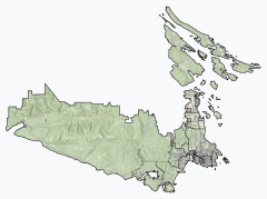
 Location in British Columbia | |
| Country | Canada |
| Province | British Columbia |
| Incorporated[1] | 1966 |
| Administrative office location | Victoria |
| Government | |
| • Body | Board of directors |
| • Chair | Colin Plant (Saanich) |
| • Vice chair | Denise Blackwell (Langford) |
| • Electoral areas |
|
| Area | |
| • Total | 2,340.49 km2 (903.67 sq mi) |
| Population (2016)[3] | |
| • Total | 383,360 |
| • Density | 163.8/km2 (424/sq mi) |
| Time zone | UTC-8 (PST) |
| • Summer (DST) | UTC-7 (PDT) |
| Area code(s) | 250 / 778 |
| Website | crd.bc.ca |
The Capital Regional District (CRD) is a local government administrative district encompassing the southern tip of Vancouver Island and the southern Gulf Islands in the Canadian province of British Columbia. The CRD is one of several regional districts in British Columbia and had an official population of 383,360 as of the Canada 2016 Census.[4]
The CRD encompasses the thirteen municipalities of Greater Victoria and three unincorporated areas: Juan de Fuca Electoral Area on Vancouver Island, Salt Spring Island Electoral Area, and Southern Gulf Islands Electoral Area. The CRD also acts as the local government for most purposes in the Electoral Areas. CRD headquarters is in the City of Victoria, although there are many office and operational facilities throughout the region. The total land area is 2,341.11 km2 (903.91 sq mi).
The CRD was formed in 1966 as a federation of seven municipalities and five electoral areas to provide coordination of regional issues and local government in rural areas in the Greater Victoria region.[5]
Political divisions[]
In 2016, the Capital Regional District had a population of 383,360, a 6.5% increase from 359,991 in 2011.[6] The CRD comprises the 13 municipalities of Greater Victoria, three electoral areas and 10 . The reserves have a relatively small portion of the population with 5,244 participating in the 2016 census. Some reserves did not participate; those that did are included in the population figures of the municipality or electoral area encompassing them, however the CRD regional government and local governments have no jurisdiction over reserves. Saanich and Victoria together have over 50 percent of the region's population.
| Division[7] | Census Subdivision type[8] | Population (2016)[9] | Population (2011) | Change (2011-2016) |
|---|---|---|---|---|
| Saanich | District municipality | 114,148 | 109,752 | 4.0% |
| Victoria | City | 85,792 | 80,017 | 7.2% |
| Langford | City | 35,342 | 29,228 | 20.9% |
| Oak Bay | District municipality | 18,094 | 18,015 | 0.4% |
| Esquimalt | District municipality | 17,655 | 16,209 | 8.9% |
| Colwood | City | 16,859 | 16,093 | 4.8% |
| Central Saanich | District municipality | 16,814 | 15,936 | 5.5% |
| Sooke | District municipality | 13,001 | 11,435 | 13.7% |
| Sidney | Town | 11,672 | 11,178 | 4.4% |
| North Saanich | District municipality | 11,249 | 11,089 | 1.4% |
| View Royal | Town | 10,408 | 9,381 | 10.9% |
| Metchosin | District municipality | 4,708 | 4,803 | -2.0% |
| Highlands | District municipality | 2,225 | 2,120 | 5.0% |
| Salt Spring Island | Regional district electoral area | 10,557 | 10,234 | 3.2% |
| Juan de Fuca | Regional district electoral area | 4,860 | 4,466 | 8.8% |
| Southern Gulf Islands | Regional district electoral area | 4,732 | 4,868 | -2.8% |
| Total Capital Regional District[6] | 383,360 | 359,991 | 6.5% | |
Demographics[]
| Ethnic groups in Capital RD (2016) Source: [1] |
Population | % | |
|---|---|---|---|
| Ethnic group | European | 293,500 | 78.7% |
| Aboriginal | 22,870 | 6.1% | |
| Chinese | 16,460 | 4.4% | |
| South Asian | 10,280 | 2.8% | |
| Filipino | 6,150 | 1.6% | |
| Black | 3,535 | 0.9% | |
| Latin American | 2,675 | 0.7% | |
| Japanese | 2,635 | 0.7% | |
| Southeast Asian | 2,550 | 0.7% | |
| Korean | 2,110 | 0.6% | |
| Arab | 1,480 | 0.4% | |
| West Asian | 1,095 | 0.3% | |
| Multiple minorities | 1,515 | 0.4% | |
| Visible minority, n.i.e. | 495 | 0.1% | |
| Total population | 383,360 | 100% | |
Electoral Areas[]
Salt Spring Island Electoral Area[]
The Salt Spring Island Electoral Area of the Capital Regional District (CRD) of the Canadian province of British Columbia consists of unincorporated areas in the CRD located on Salt Spring Island. It is represented by one director on the CRD.
The major localities encompassed by the electoral area are:
- Ganges
- Fulford Harbour
- Vesuvius Bay
- Long Harbour
According to the Canada 2006 Census:
- Population: 9,640
- % Change (2001-2006): 3.9
- Dwellings: 5,131
- Area (km².): 182.23
- Density (persons per km².): 52.9
Southern Gulf Islands Electoral Area[]

The Southern Gulf Islands Electoral Area of the Capital Regional District (CRD) of the Canadian province of British Columbia consists of unincorporated districts in the CRD located on Galiano, Saturna, Mayne, and North and South Pender Islands, as well as many smaller islands located in the Gulf of Georgia north and east of Victoria. It is previously known as the Outer Gulf Islands Electoral Area. Its population of 5,101 is represented by one director on the CRD.
The major localities encompassed by the electoral area are:
- Bedwell Harbour (South Pender Island)
- (Galiano Island)
- (North Pender Island)
- Saturna (Saturna Island)
- Sturdies Bay (Galiano Island)
- (Mayne Island)
Juan de Fuca Electoral Area[]
(map) The Juan de Fuca Electoral Area is an Electoral Area of the CRD. It consists of the District's unincorporated land on Vancouver Island, including the neighbourhood of on the Saanich Inlet, Malahat, on the western shore of Saanich Inlet, and the Western Communities localities of East Sooke, Jordan River, Otter Point, , Port Renfrew, inclusive of the First Nations reserves of and , which are within its territory. Its population of 4,484 is represented by a single director of the CRD. The total land area is 1,502.24 km² (580.0 sq mi). Population figures do not included residents of Indian Reserves, whether band members or non-indigenous persons.
Administrative role[]
The board of directors are either directly elected officials or are appointed from within the region's elected municipal councils.[5]
The CRD's responsibilities include recycling, operating the regional landfill, building and operating sewage treatment plants, a sewer source control program, regional water supply, funding for non-profit arts groups, regional planning, funding health facilities, and overseeing thirty regional parks, trails, and regional park reserves encompassing over 100 km². The CRD is the sole shareholder of the Capital Region Housing Corporation, which owns and operates over 1200 rental housing units. In certain areas, the CRD can pass bylaws that are binding on a portion of the geographical area or the entire geographical area. These include a "clean air bylaw" smoking ban in all public places and patios in restaurants/pubs.
The CRD assumes responsibilities ordinarily undertaken by municipalities in unincorporated areas of the CRD. These responsibilities include animal control, building inspection, fire protection, and bylaw enforcement. Some of the region's municipalities avail themselves of some of these services in a contractual arrangement with the CRD.
Capital Regional Hospital District[]
The CRHD's primary responsibility is to provide the region's share of capital funding for the region's health facilities and equipment. The region's health care delivery is the responsibility of the Vancouver Island Health Authority (VIHA). The CRHD shares the same Board of Directors with the CRD.[10]
See also[]
- Metro Vancouver Regional District
- Greater Victoria
- Gulf Islands
References[]
- Specific
- ^ "What is CRD". Capital Regional District. Retrieved March 23, 2017.
- ^ "CRD Board of Directors". Retrieved 2019-07-09.
- ^ Jump up to: a b "Census Profile, 2016 Census". 2016 Census. Statistics Canada. February 8, 2017. Retrieved March 23, 2017.
- ^ Profile: Capital Regional District, British Columbia; Statistics Canada. Retrieved 2017-02-20
- ^ Jump up to: a b CRD webpage. Retrieved 2011-10-20
- ^ Jump up to: a b "Capital, Regional district [Census division], British Columbia and Juan de Fuca (Part 1), Regional district electoral area [Census subdivision], British Columbia". Statistics Canada. April 24, 2018. Retrieved August 10, 2018.
- ^ "About the Region". Capital Regional District. Retrieved August 10, 2018.
- ^ "Population and dwelling counts, for Canada, provinces and territories, and census subdivisions (municipalities), 2016 and 2011 censuses – 100% data (British Columbia)". Statistics Canada. February 8, 2018. Retrieved August 10, 2018.
- ^ "Population and dwelling counts, for Canada, provinces and territories, and census subdivisions (municipalities), 2016 and 2011 censuses – 100% data (British Columbia)". Statistics Canada. February 8, 2018. Retrieved August 10, 2018.
- ^ Capital Regional Hospital District webpage Retrieved 2011-10-20
- General
- Community Profile: Capital H (Part 1), Regional District Electoral Area, British Columbia; Statistics Canada
- Community Profile: Capital H (Part 2), Regional District Electoral Area, British Columbia; Statistics Canada
- Interactive map of the Capital Regional District; British Columbia Statistics
External links[]
| Wikimedia Commons has media related to Capital Regional District, British Columbia. |
- Southern Gulf Islands EA website
- Juan de Fuca Electoral Area website
- Salt Spring EA website
- Capital Regional District Website
- "Capital Regional District". BC Geographical Names.
| show Places adjacent to Capital Regional District |
|---|
| show Subdivisions of British Columbia |
|---|

| show Authority control |
|---|
- Capital Regional District
- Regional districts of the British Columbia Coast
- Metropolitan planning organizations