Alberni-Clayoquot Regional District
Alberni–Clayoquot | |
|---|---|
| Alberni–Clayoquot Regional District | |
|
Logo | |
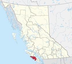 Location in British Columbia | |
| Country | Canada |
| Province | British Columbia |
| Administrative office location | Port Alberni |
| Government | |
| • Body | Board of directors |
| • Chair | John Jack (Huu-ay-aht) |
| • Vice chair | Josie Osborne (Tofino) |
| • Electoral areas |
|
| Area | |
| • Land | 6,589.15 ha (16,282.14 acres) |
| Population (2016)[2] | |
| • Total | 30,981 |
| • Density | 4.7/km2 (12/sq mi) |
| Website | Official website |
The Alberni–Clayoquot Regional District (2016 population 30,981) of British Columbia is located on west central Vancouver Island. Adjacent regional districts it shares borders with are the Strathcona and Comox Valley Regional Districts to the north, and the Nanaimo and Cowichan Valley Regional Districts to the east. The regional district offices are located in Port Alberni.
Communities[]
Cities[]
- Port Alberni - Pop 17,678
Regional District Electoral Areas[]
- Area A (Bamfield)
- Area B (Beaufort)
- Area C (Long Beach)
- Area D (Sproat Lake)
- Sproat Lake
- Area E (Beaver Creek)
- Area F (Cherry Creek)
District Municipalities[]
Indian Reserves[]
NB Indian Reserves are not part of municipal or regional district governance and are outside the regional district's jurisdiction, and also counted separately in the census figures. Population figures here are from the 2006 census:
- pop. 148 [3]
- pop. 5 [4]
- pop. 95 [5]
- pop. 5 [6]
- pop. 27 [7]
- Esowista IR No. 3 pop. 160 [8]
- pop. 10 [9]
- pop. 200 [10]
- Keeshan IR No. 9 Pop. 0 [11]
- pop. 10 [12]
- pop. 19 [13]
- Marktosis IR No. 15 pop. 661 [14]
- pop. 5 [15]
- pop. 0 [16]
- Opitsat IR No. 1 pop. 174 [17]
- pop. 103 [18]
- pop. 0 [19]
- pop. 0 [20]
- pop. 425 [21]
Highways[]
Highways that run through the Alberni–Clayoquot Regional District:
Demographics[]
| Canada census – Alberni-Clayoquot Regional District community profile | |||
|---|---|---|---|
| 2006 | |||
| Population: | 30,664 (1.1% from 2001) | ||
| Land area: | 6,596.58 km2 (2,546.95 sq mi) | ||
| Population density: | 4.6/km2 (12/sq mi) | ||
| Median age: | 43.3 (M: 43.1, F: 43.4) | ||
| Total private dwellings: | |||
| Median household income: | $N/A | ||
| References: 2006[22] earlier[23] | |||
- N/A = Data not available.
See also[]
References[]
- ^ "Alberni-Clayoquot Regional District". Retrieved July 9, 2019.
- ^ a b "Population and dwelling counts, for Canada, provinces and territories, and census divisions, 2016 and 2011 censuses – 100% data (British Columbia)". Statistics Canada. February 8, 2017. Retrieved July 9, 2019.
- ^ Community Profiles, 2006, Ahahswinis 1 (Indian Reserve)
- ^ Community Profiles, Alberni 2 (Indian Reserve)
- ^ Community Profiles, Anacla 12 (Indian Reserve)
- ^ Community Profiles, Clackamus 2 (Indian Reserve)
- ^ Community Profiles "Elhlateese 2 (Indian Reserve)
- ^ Esowista 3 (Indian Reserve)
- ^ Community Profiles, Hesquiat 1 (Indian Reserve)
- ^ Community Profiles Ittatsoo 1 (Indian Reserve)
- ^ Community Profiles, Keeshan 9 (Indian Reserve)
- ^ Community Profiles, Klehkoot 2 (Indian Reserve)
- ^ Community Profiles, Machoa 1 (Indian Reserve)
- ^ Community Profiles, Martosis 15 (Indian Reserve)
- ^ Community Profiles, Numukamis 1 (Indian Reserve)
- ^ Community Profiles, Openit 27 (Indian Reserve)
- ^ Community Profiles
- ^ Community Profiles, Refuge Cove 6 (Indian Reserve)
- ^ Community Profiles, Sachsa 4 (Indian Reserve)
- ^ Community Profiles, Stuart Bay 1 (Indian Reserve)
- ^ Community Profiles, Tsahaheh 1 (Indian Reserve)
- ^ "2006 Community Profiles". 2006 Canadian Census. Statistics Canada. March 30, 2011. Retrieved February 24, 2009.
- ^ "2001 Community Profiles". 2001 Canadian Census. Statistics Canada. February 17, 2012.
External links[]
| Wikimedia Commons has media related to Alberni-Clayoquot Regional District. |
- Alberni–Clayoquot Regional District
- Alberni–Clayoquot R.D., Community Profile, 2006
- "Regional District of Alberni–Clayoquot". BC Geographical Names.
Places adjacent to Alberni-Clayoquot Regional District | ||||||||||||||||
|---|---|---|---|---|---|---|---|---|---|---|---|---|---|---|---|---|
| ||||||||||||||||
Subdivisions of British Columbia | ||
|---|---|---|
| Subdivisions |  | |
| Communities |
| |
| Metro areas and agglomerations |
| |
| Regional districts |
| |
| ||
Coordinates: 49°15′00″N 125°20′00″W / 49.25000°N 125.33333°W

Categories:
- Alberni-Clayoquot Regional District
- Regional districts of the British Columbia Coast
- West Coast of Vancouver Island