North Coast Regional District
North Coast
Skeena–Queen Charlotte Regional District | |
|---|---|
| North Coast Regional District | |
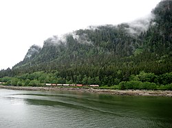 Canadian National train entering Prince Rupert | |
|
Logo | |
Major communities | |
 Location in British Columbia | |
| Country | Canada |
| Province | British Columbia |
| Administrative office location | Prince Rupert |
| Government | |
| • Type | Regional district |
| • Body | Board of Directors |
| • Chair | Barry Pages (Masset) |
| • Vice Chair | Des Nobels (A) |
| • Electoral Areas |
|
| Area | |
| • Land | 19,775.41 km2 (7,635.33 sq mi) |
| Population (2016)[2] | |
| • Total | 18,133 |
| • Density | 0.917/km2 (2.38/sq mi) |
| Website | ncrdbc.com |

The North Coast Regional District (until 2016 known as the Skeena–Queen Charlotte Regional District) is a quasi-municipal administrative area in British Columbia. It is located on British Columbia's west coast and includes Haida Gwaii (formerly the Queen Charlotte Islands), the largest of which are Graham Island and Moresby Island. Its administrative offices are in the City of Prince Rupert.
Description[]
- Area: 19,716.14 km²
- Population (2006): 19,664
Electoral areas[]
- Area A - Skeena North: 29
- Dodge Cove (unincorporated community): 29 (down from 52 in 2011)[3]
- Crippen Cove
- Metlakatla
- Lax Kw'alaams
- Area C - Skeena South: 147
- Porcher Island
- Oona River (unincorporated community): 147 (up from 37 in 2011)[4]
- Humpback Bay
- Hunts Inlet
- Prince Rupert
- Port Edward
- Hartley Bay
- Porcher Island
- Area D - Haida Gwaii North: 524
- Rural Graham Island: 524 (down from 607 in 2006)[5]
- Skidegate
- Old Massett
- Queen Charlotte
- Port Clements
- Area E - Haida Gwaii South: 317
Municipalities[]
- City of Prince Rupert: 12,220
- Village of Queen Charlotte: 948
- Village of Masset: 940
- District of Port Edward: 557
- Village of Port Clements: 440
Demographics[]
| Ethnic groups in Skeena-Queen Charlotte RD (2016) Source: [1] |
Population | % | |
|---|---|---|---|
| Ethnic group | European | 9,360 | 52.3% |
| Aboriginal | 7,610 | 42.5% | |
| Southeast Asian | 450 | 2.5% | |
| South Asian | 420 | 2.3% | |
| Chinese | 250 | 1.4% | |
| Filipino | 250 | 1.4% | |
| Japanese | 95 | 0.5% | |
| Black | 75 | 0.4% | |
| Latin American | 25 | 0.1% | |
| West Asian | 20 | 0.1% | |
| Korean | 10 | 0.1% | |
| Arab | 0 | 0% | |
| Multiple minorities | 40 | 0.2% | |
| Visible minority, n.i.e. | 20 | 0.1% | |
| Total population | 18,133 | 100% | |
Indian reserves[]
In addition to 7,700 aboriginal persons listed in the regional district's community profile at Statistics Canada,[8] there are four separate Indian reserve communities within the regional district whose populations are not included within the regional district's figures, and which are governed separately by their respective band governments. These Indian reserves are:
- Old Massett (Masset Indian Reserve No. 1);
- Skidegate (Skidegate Indian Reserve No. 1);
- Metlakatla; and
- Lax Kw'alaams (Port Simpson Indian Reserve No. 1).
Past naming[]
The Regional District had historically been called the Skeena-Queen Charlotte Regional District, referring to its location on the Skeena River and the Queen Charlotte archipelago. Once the Queen Charlottes were renamed Haidi Gwaii to reflect their Indigenous heritage, discussions began about renaming the Regional District to reflect the update. In September 2016, letters patent were granted renaming it to the North Coast Regional District [9]
References[]
- ^ "Our Board". Retrieved July 9, 2019.
- ^ a b "Population and dwelling counts, for Canada, provinces and territories, and census divisions, 2016 and 2011 censuses – 100% data (British Columbia)". Statistics Canada. February 8, 2017. Retrieved July 9, 2019.
- ^ Census Canada Community Profile, Skeena-Queen Charlotte Electoral Area 'A'
- ^ Census Canada Community Profile, Skeena-Queen Charlotte Electoral Area 'C'
- ^ Census Canada Community Profile, Skeena-Queen Charlotte Electoral Area 'D'
- ^ Census Canada Community Profile, Skeena-Queen Charlotte Electoral Area 'E'
- ^ "Census Profile: Sandspit, UNP, British Columbia (Designated place)". Statistics Canada. January 8, 2014. Retrieved February 28, 2014.
- ^ "2001 Community Profiles: Skeena-Queen Charlotte Regional District, British Columbia (Regional District)". Statistics Canada. August 26, 2013. Retrieved February 27, 2014.
- ^ "News Release: SKEENA-QUEEN CHARLOTTE REGIONAL DISTRICT RENAMING TO THE NORTH COAST REGIONAL DISTRICT" (PDF). Retrieved May 29, 2019.
External links[]
| Wikimedia Commons has media related to North Coast Regional District. |
Places adjacent to North Coast Regional District | ||||||||||||||||
|---|---|---|---|---|---|---|---|---|---|---|---|---|---|---|---|---|
| ||||||||||||||||
Subdivisions of British Columbia | ||
|---|---|---|
| Subdivisions |  | |
| Communities |
| |
| Metro areas and agglomerations |
| |
| Regional districts |
| |
| ||
- North Coast Regional District
- Regional districts of British Columbia