Regional District of Kitimat–Stikine
Kitimat–Stikine | |
|---|---|
| Regional District of Kitimat–Stikine | |
 Terrace townsite | |
|
Logo | |
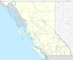
 Location in British Columbia | |
| Country | Canada |
| Province | British Columbia |
| Administrative office location | Terrace |
| Government | |
| • Type | Regional district |
| • Body | Board of directors |
| • Chair | Philip Germuth (Kitimat) |
| • Vice chair | James Cordeiro (Terrace) |
| • Electoral areas |
|
| Area | |
| • Land | 104,464.61 km2 (40,334.01 sq mi) |
| Population (2016)[2] | |
| • Total | 37,367 |
| • Density | 0.358/km2 (0.93/sq mi) |
| Website | rdks.bc.ca |
The Regional District of Kitimat–Stikine is a type of local government administration in northwestern British Columbia, Canada.[3] As of the 2016 Canadian census, it had a population of 37,367 living on a land area of 104,464.61 square kilometres (40,334.01 sq mi). Its administrative offices are in the city of Terrace. The next-largest municipality in the regional district is the District Municipality of Kitimat. The other incorporated municipalities in the regional district are the Village of Hazelton, the District of New Hazelton and the District of Stewart. Unincorporated communities are many, most of them Indian Reserves which are not part of the governmental system of the regional district, which has limited powers relating mostly to municipal-type services. The remote settlement of Dease Lake, formerly in the Stikine Region, was added to the regional district on December 1, 2007.
Municipalities[]
| Municipality | Government Type | Population |
| Terrace | city | 15,723 |
| Kitimat | district municipality | 8,335 |
| New Hazelton | district municipality | 666 |
| Stewart | district municipality | 494 |
| Hazelton | village | 270 |
Demographics[]
| Ethnic groups in Kitimat–Stikine RD (2016) Source: [1] |
Population | % | |
|---|---|---|---|
| Ethnic group | European | 23,125 | 62.6% |
| Aboriginal | 12,915 | 35% | |
| South Asian | 575 | 1.6% | |
| Filipino | 325 | 0.9% | |
| Black | 210 | 0.6% | |
| Chinese | 185 | 0.5% | |
| Latin American | 140 | 0.4% | |
| Korean | 75 | 0.2% | |
| Japanese | 70 | 0.2% | |
| Southeast Asian | 30 | 0.1% | |
| West Asian | 15 | 0% | |
| Arab | 10 | 0% | |
| Multiple minorities | 55 | 0.1% | |
| Visible minority, n.i.e. | 25 | 0.1% | |
| Total population | 37,367 | 100% | |
Population history[]
| Year | Pop. | ±% |
|---|---|---|
| 1996 | 43,618 | — |
| 2001 | 40,876 | −6.3% |
| 2006 | 37,999 | −7.0% |
| 2011 | 37,361 | −1.7% |
| 2016 | 37,367 | +0.0% |
| Source: Statistics Canada | ||
References[]
- ^ "Board of Directors". Retrieved July 9, 2019.
- ^ a b "Population and dwelling counts, for Canada, provinces and territories, and census divisions, 2016 and 2011 censuses – 100% data (British Columbia)". Statistics Canada. February 8, 2017. Retrieved July 9, 2019.
- ^ "Regional District of Kitimat–Stikine". BC Geographical Names.
External links[]
| Wikimedia Commons has media related to Regional District of Kitimat–Stikine. |
- Regional District of Kitimat–Stikine
- Regional districts of British Columbia
- British Columbia Coast geography stubs
