Pottery Addition, Ohio
Pottery Addition, Ohio | |
|---|---|
 on Old State Route 7 | |
 Pottery Addition | |
| Coordinates: 40°24′08″N 80°37′30″W / 40.40222°N 80.62500°WCoordinates: 40°24′08″N 80°37′30″W / 40.40222°N 80.62500°W | |
| Country | United States |
| State | Ohio |
| County | Jefferson |
| Township | Island Creek |
| Area | |
| • Total | 1.093 sq mi (2.83 km2) |
| • Land | 0.908 sq mi (2.35 km2) |
| • Water | 0.185 sq mi (0.48 km2) |
| Elevation | 686 ft (209 m) |
| Population | |
| • Total | 293 |
| • Density | 270/sq mi (100/km2) |
| Time zone | UTC-5 (Eastern (EST)) |
| • Summer (DST) | UTC-4 (EDT) |
| Area code(s) | 740 & 220 |
| GNIS feature ID | 1049104[2] |
| FIPS code | 39-64472 |


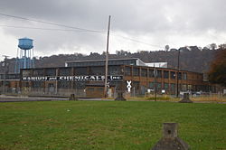
Pottery Addition is a census-designated place (CDP) in Jefferson County, Ohio, United States. Its population was 293 as of the 2010 census.[1] The community is located along the Ohio River and is served by Ohio State Route 7.
Geography[]
Pottery Addition is in eastern Jefferson County, in the southeast corner of Island Creek Township. It is bordered to the east by the Ohio River, which serves as the border between Jefferson County, Ohio, and Hancock County, West Virginia. Weirton, West Virginia, is directly across the river. The southern tip of Pottery Addition touches the border of Steubenville, the Jefferson county seat. State Route 7, a four-lane freeway which runs through the community, leads north (upriver) 5 miles (8 km) to Toronto and south 4 miles (6 km) to the center of Steubenville.
According to the U.S. Census Bureau, the CDP has an area of 1.093 square miles (2.83 km2); 0.908 square miles (2.35 km2) of its area is land, and 0.185 square miles (0.48 km2) is water.[1]
References[]
- ^ a b c d "2010 Census Gazetteer Files - Places: Ohio". U.S. Census Bureau. Retrieved February 25, 2017.
- ^ "Pottery Addition". Geographic Names Information System. United States Geological Survey.
Municipalities and communities of Jefferson County, Ohio, United States | ||
|---|---|---|
| Cities |  | |
| Villages | ||
| Townships | ||
| CDPs | ||
| Other communities |
| |
| Footnotes | ‡This populated place also has portions in an adjacent county or counties | |
| ||
This Jefferson County, Ohio state location article is a stub. You can help Wikipedia by . |
- Census-designated places in Jefferson County, Ohio
- Appalachian Ohio geography stubs