Richmond, Ohio
Richmond, Ohio | |
|---|---|
 Richmond Water Tower | |
 Location of Richmond, Ohio | |
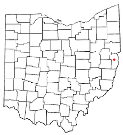
 Location of Richmond in Jefferson County | |
| Coordinates: 40°25′56″N 80°46′21″W / 40.43222°N 80.77250°WCoordinates: 40°25′56″N 80°46′21″W / 40.43222°N 80.77250°W | |
| Country | United States |
| State | Ohio |
| County | Jefferson |
| Township | Salem |
| Area | |
| • Total | 0.55 sq mi (1.43 km2) |
| • Land | 0.55 sq mi (1.43 km2) |
| • Water | 0.00 sq mi (0.00 km2) |
| Elevation | 1,243 ft (379 m) |
| Population | |
| • Total | 481 |
| • Estimate (2019)[4] | 446 |
| • Density | 806.51/sq mi (311.29/km2) |
| Time zone | UTC-5 (Eastern (EST)) |
| • Summer (DST) | UTC-4 (EDT) |
| ZIP code | 43944 |
| Area code(s) | 740 |
| FIPS code | 39-66824[5] |
| GNIS feature ID | 1049120[2] |

Richmond is a village in Jefferson County, Ohio, United States. The population was 481 at the 2010 census. It is part of the Weirton-Steubenville, WV-OH Metropolitan Statistical Area.
History[]
Richmond was laid out in 1815.[6] A post office called Richmond has been in operation since 1817.[7]
During Morgan's Raid of 1863, Confederate Brigadier General John Hunt Morgan traveled through Richmond on his way to defeat at the Battle of Salineville.
Geography[]
Richmond is located at 40°25′56″N 80°46′21″W / 40.43222°N 80.77250°W (40.432178, -80.772436).[8]
According to the United States Census Bureau, the village has a total area of 0.55 square miles (1.42 km2), all land.[9]
Demographics[]
| Historical population | |||
|---|---|---|---|
| Census | Pop. | %± | |
| 1830 | 231 | — | |
| 1850 | 514 | — | |
| 1860 | 692 | 34.6% | |
| 1870 | 405 | −41.5% | |
| 1880 | 491 | 21.2% | |
| 1890 | 444 | −9.6% | |
| 1900 | 332 | −25.2% | |
| 1910 | 203 | −38.9% | |
| 1920 | 358 | 76.4% | |
| 1930 | 388 | 8.4% | |
| 1940 | 458 | 18.0% | |
| 1950 | 579 | 26.4% | |
| 1960 | 728 | 25.7% | |
| 1970 | 777 | 6.7% | |
| 1980 | 624 | −19.7% | |
| 1990 | 446 | −28.5% | |
| 2000 | 471 | 5.6% | |
| 2010 | 481 | 2.1% | |
| 2019 (est.) | 446 | [4] | −7.3% |
| U.S. Decennial Census[10] | |||
2010 census[]
As of the census[3] of 2010, there were 481 people, 213 households, and 136 families living in the village. The population density was 874.5 inhabitants per square mile (337.6/km2). There were 245 housing units at an average density of 445.5 per square mile (172.0/km2). The racial makeup of the village was 98.8% White, 0.6% African American, 0.4% Asian, and 0.2% from two or more races. Hispanic or Latino of any race were 0.8% of the population.
There were 213 households, of which 23.9% had children under the age of 18 living with them, 48.4% were married couples living together, 13.1% had a female householder with no husband present, 2.3% had a male householder with no wife present, and 36.2% were non-families. 31.0% of all households were made up of individuals, and 10.8% had someone living alone who was 65 years of age or older. The average household size was 2.26 and the average family size was 2.83.
The median age in the village was 43.8 years. 18.7% of residents were under the age of 18; 9.5% were between the ages of 18 and 24; 22.8% were from 25 to 44; 33.1% were from 45 to 64; and 16% were 65 years of age or older. The gender makeup of the village was 46.8% male and 53.2% female.
2000 census[]
As of the census[5] of 2000, there were 471 people, 196 households, and 147 families living in the village. The population density was 886.4 people per square mile (343.1/km2). There were 221 housing units at an average density of 415.9 per square mile (161.0/km2). The racial makeup of the village was 98.09% White, 0.21% African American, 1.06% Asian, and 0.64% from two or more races. Hispanic or Latino of any race were 0.21% of the population.
There were 196 households, out of which 27.6% had children under the age of 18 living with them, 59.7% were married couples living together, 10.7% had a female householder with no husband present, and 25.0% were non-families. 24.0% of all households were made up of individuals, and 12.8% had someone living alone who was 65 years of age or older. The average household size was 2.40 and the average family size was 2.82.
In the village, the population was spread out, with 20.6% under the age of 18, 5.5% from 18 to 24, 28.7% from 25 to 44, 25.3% from 45 to 64, and 20.0% who were 65 years of age or older. The median age was 42 years. For every 100 females there were 82.6 males. For every 100 females age 18 and over, there were 79.8 males.
The median income for a household in the village was $29,659, and the median income for a family was $35,500. Males had a median income of $32,969 versus $14,375 for females. The per capita income for the village was $13,764. About 9.5% of families and 11.0% of the population were below the poverty line, including 9.6% of those under age 18 and 6.8% of those age 65 or over.
Education[]
Richmond is served by the Edison Local School District. Campuses serving the village include John Gregg Elementary School and Edison High School.
Notable people[]
- William Milligan Sloane, educator and historian
- Edwin M. Stanton, US Army General 1860–1861, Secretary of War under President Lincoln.
References[]
- ^ "2019 U.S. Gazetteer Files". United States Census Bureau. Retrieved July 28, 2020.
- ^ a b "US Board on Geographic Names". United States Geological Survey. 2007-10-25. Retrieved 2008-01-31.
- ^ a b "U.S. Census website". United States Census Bureau. Retrieved 2013-01-06.
- ^ a b "Population and Housing Unit Estimates". United States Census Bureau. May 24, 2020. Retrieved May 27, 2020.
- ^ a b "U.S. Census website". United States Census Bureau. Retrieved 2008-01-31.
- ^ Doyle, Joseph Beatty (1910). 20th Century History of Steubenville and Jefferson County, Ohio and Representative Citizens. Richmond-Arnold Publishing Company. pp. 517.
- ^ "Jefferson County". Jim Forte Postal History. Retrieved 2 January 2016.
- ^ "US Gazetteer files: 2010, 2000, and 1990". United States Census Bureau. 2011-02-12. Retrieved 2011-04-23.
- ^ "US Gazetteer files 2010". United States Census Bureau. Archived from the original on January 12, 2012. Retrieved 2013-01-06.
- ^ "Census of Population and Housing". Census.gov. Retrieved June 4, 2015.
Municipalities and communities of Jefferson County, Ohio, United States | ||
|---|---|---|
| Cities |  | |
| Villages | ||
| Townships | ||
| CDPs | ||
| Other communities |
| |
| Footnotes | ‡This populated place also has portions in an adjacent county or counties | |
| ||
| Counties |  Map of the Pittsburgh Tri-State with green counties in the metropolitan area and yellow counties in the combined area | |
|---|---|---|
| Major cities | ||
| Cities and towns 15k–50k (in 2010) | ||
| Airports | ||
| Topics |
| |
| ||
- Villages in Jefferson County, Ohio
- Villages in Ohio